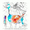
Only made it to 89*F yesterday, but did make it to 90*F today.
-
Hello, please take a minute to check out our awesome content, contributed by the wonderful members of our community. We hope you'll add your own thoughts and opinions by making a free account!
You are using an out of date browser. It may not display this or other websites correctly.
You should upgrade or use an alternative browser.
You should upgrade or use an alternative browser.
Pattern Anaphylactic August
- Thread starter Tarheel1
- Start date
Only made it to 89*F yesterday, but did make it to 90*F today.
85.4*F today, it was actually really nice.
NBAcentel
Member
Wednesday has my attention with energy at H5 diving through on the base of the trough allowing steeper lapse rates and a uptick in deep layer shear (25-35 kts) and low level shear (10-15 kts), soundings are supportive of hail with better lapse rates, and deep layer shear, and damaging winds with high DCAPE, and better organization to storms, if things come together a loosely organized MCS may develop but that’s unlikely 


Brent
Member
Well is about that time of year
Sent from my SM-G975U using Tapatalk
Ah i can feel the disappointments already
Every time you get excited, I get 0 rain!Wednesday has my attention with energy at H5 diving through on the base of the trough allowing steeper lapse rates and a uptick in deep layer shear (25-35 kts) and low level shear (10-15 kts), soundings are supportive of hail with better lapse rates, and deep layer shear, and damaging winds with high DCAPE, and better organization to storms, if things come together a loosely organized MCS may develop but that’s unlikely View attachment 21451View attachment 21452View attachment 21453
NBAcentel
Member
Every time you get excited, I get 0 rain!
And I get rain, every man for himself !!!
NBAcentel
Member
B
Brick Tamland
Guest
Heavy rain is training over me now, I'm under a Flash Flood Warning until 3:15am.
Ready for winter...
Why?Ready for winter...
WHY NOTWhy?
Well is about that time of year
Sent from my SM-G975U using Tapatalk
The firsts are always fun.

Sent from my iPhone using Tapatalk
accu35
Member
Why why why why not? LolWhy why not?
BufordWX
Member
NBAcentel
Member
SPC has placed Central NC user a marginal risk for severe storms for Wednesday.View attachment 21465
Exactly what I was thinking should happen, if 3/6km shear can just be a little stronger maybe a mcs can get going
IF YOU LOVE NO SNOW AND CHASING GFS 300+ HOUR FANTASY SNOW STORMS, GET CRUNK THEN!WHY NOT
B
Brick Tamland
Guest
SPC has placed Central NC user a marginal risk for severe storms for Wednesday.View attachment 21465
Exactly what I was thinking should happen, if 3/6km shear can just be a little stronger maybe a mcs can get going

NAM certainly looks a little better for tomorrow, might even get a slight risk area...Exactly what I was thinking should happen, if 3/6km shear can just be a little stronger maybe a mcs can get going
B
Brick Tamland
Guest
NAM certainly looks a little better for tomorrow, might even get a slight risk area...
Too bad marginal and slight mean the same thing.
NBAcentel
Member
Getting a MCS feeling for tommorow, or at least a strong line of storms that develops along the lee trough, soundings are similar to that MCS back in June 20th, increased amounts of 0-1km/0-3km shear and around 30kts of deep layer shear, there is some hodo curvature aswell from the increase in low level shear, nam likely a little overdone but it’s a solid setup 


Haha lock that ---- upThis should verify considering the N Harnett and S Wake hole... @SD @Rain Cold
View attachment 21466
Sent from my SM-G975U using Tapatalk
Too bad Its 348 hrs outView attachment 21469View attachment 21470
Thank god.
BufordWX
Member
Slight risk for severe weather introduced for Northeast NC in latest day 2 update.

...Carolinas/Mid-Atlantic into New England...
An upper trough will move eastward across the Northeast,
Mid-Atlantic, and Carolinas on Wednesday. A belt of 25-35 kt of
mid-level southwesterly flow will be present ahead of this upper
trough, and will overspread much of these regions through the day.
At the surface, a lee trough should be present to the east of the
Appalachians, and storm development will probably focus along this
trough by the early to mid afternoon. Upper 60s to perhaps mid 70s
surface dewpoints will be present across the warm sector, and
diurnal heating should encourage surface temperatures to warm into
the 80s and perhaps lower 90s. MLCAPE of 1500-3000 J/kg should
develop along/east of the lee trough. Around 25-35 kt of effective
bulk shear will be enough to organize thunderstorm updrafts, with
multicell clusters probably the dominant storm mode. Strong to
damaging winds appear to be the main threat as storms develop
eastward through the early evening.
Probably not a chance of that verifying because it has a bullseye of wet right over the grumpy house in the upstate.?This should verify considering the N Harnett and S Wake hole... @SD @Rain Cold
View attachment 21466
pcbjr
Member
The high today looks to be 93*F.
Webberweather53
Meteorologist
Whoa, this is pretty awesome. weathernerds.org gives you the GOES global lightning mapper (GLM) data overlaid w/ NEXRAD-level II radar data in real-time.
cd2play
Member
just picked up about 0.9" from a thunderstorm that blew through MIddle TN, lots of lightning and thunder.
BufordWX
Member
B
Brick Tamland
Guest
From the RAH discussion this morning. If we get some earlier storms, it might help us keep the second round from being too bad. At least for those east of US 1 in NC. Not sure if that means they think those west of US 1 are still going to get it worse later on or not.
Minor tweaks for the mid morning update this morning to better match
in-situ observations. Also some minor adjustment to the POP forecast
this afternoon, highlighting the two possible primary waves of
convection. The first will likely ignite between 12pm - 2pm across
the central and eastern Piedmont as a shortwave continues east
through the area. The second, likely more potent, will arrive later
tonight, crossing central NC between 6pm - Midnight, which should
have greater coverage and intensity in terms of Tstorms. Some
uncertainty with the second wave, as earlier convection could help
stabilize areas along and east of US-1.
Welp plenty of instability sb capes 2500-4000 over the area with mlcapes of 1500-2500. Starting to get decent CU development out front of the upper level system, let's see what we get over the next 90 minutes
Sent from my SM-G975U using Tapatalk
Sent from my SM-G975U using Tapatalk
Seeing some development.... the HRRR was way off if you ask me (it's been horrible)Welp plenty of instability sb capes 2500-4000 over the area with mlcapes of 1500-2500. Starting to get decent CU development out front of the upper level system, let's see what we get over the next 90 minutes
Sent from my SM-G975U using Tapatalk
B
Brick Tamland
Guest
So, the longer it takes the storms to develop for the first round, the better or worse the storms will be for the expected second round?
BufordWX
Member
Latest update to the day 1 outlook has shifted the slight risk area slightly east in North Carolina.

...Western New England/eastern New York to the Carolinas...
Showers and thunderstorms are forecast to continue developing into this afternoon, largely east of the Appalachian crest, and particularly near/east of a surface trough analyzed from eastern New York south to central North Carolina.
Moderate, deep-layer westerly/southwesterly flow aloft resides across the area, which -- given the very moist/destabilizing airmass near and east of the aforementioned surface trough -- will contribute to weakly organized storms, and some potential for upscale growth into bands of convection. Locally gusty/potentially damaging winds will be the primary risk with the strongest storms through the afternoon, though hail will also be possible. Risk should diminish into the evening hours with the onset of diurnal cooling.


![IMG_0161[1].PNG IMG_0161[1].PNG](https://southernwx.nyc3.digitaloceanspaces.com/data/attachments/21/21462-769580e9b7d259f634e2bcf8e67829aa.jpg)


