• Hello, please take a minute to check out our awesome content, contributed by the wonderful members of our community. We hope you'll add your own thoughts and opinions by making a free account!

Tropical 94L - PTC to be issued later today

NHC 11am discussion

The track models are in good agreement through
72 h, and little change was made to this portion of the NHC track
forecast. This brings the center over the central and northwestern
Bahamas this weekend, moving roughly parallel to but offshore the
east coast of Florida.

The track forecast beyond 72 h is still of low confidence, with a
bifurcation of solutions noted in the various deterministic models
and GFS, ECMWF, and Google DeepMind ensemble members. Much depends
on the future track of Hurricane Humberto, the extent to which it
erodes the steering ridge over the Atlantic, and the strength and
timing of an upper trough expected to dig over the northwestern
Atlantic next week. A majority of the deterministic guidance
suggests that the system will slow down or briefly stall offshore of
the southeast U.S. coast before turning sharply eastward. There
remains considerable uncertainty in how quickly this might occur,
and it must be noted that some ensemble solutions still show the
system reaching the coast. For now, the NHC forecast continues to
show an eastward turn at days 4-5, but at a much slower forward
speed than most of the models.
 
I would be highly surprised to see a major hurricane in that “coffin corner” off the SE coast. Way more often than not storms start to ingest dry air from the continent especially with autumn dewpoints in place. They pretty much need to come barreling in a speed a la Hugo to make it onshore at full song.
 
JB SAYS IT!!!!!!!!!!!!!!!!!!!!!!!!!!!!!!


I think it depends on how established the core of the storm is. He’s smart to point these things out- a lot of our recent RI cases are aided by this look with jet stream dynamics helping. Michael and Ian come to mind. However, since this storm is starting from scratch and will take time for the core to develop, it makes the RI call riskier. But I see and agree with his logic.
 
I would be highly surprised to see a major hurricane in that “coffin corner” off the SE coast. Way more often than not storms start to ingest dry air from the continent especially with autumn dewpoints in place. They pretty much need to come barreling in a speed a la Hugo to make it onshore at full song.
Definitely not Autumn Dewpoints in place today with dews near 70 !
 
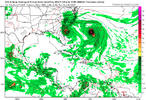
Just like for all runs before, 12Z UK is again staying OTS from US with this run not as close to FL on its closest approach (with it 175 miles offshore) vs last few runs:

TROPICAL DEPRESSION 09L ANALYSED POSITION : 22.0N 77.3W

ATCF IDENTIFIER : AL092025

LEAD CENTRAL MAXIMUM WIND
VERIFYING TIME TIME POSITION PRESSURE (MB) SPEED (KNOTS)
-------------- ---- -------- ------------- -------------
1200UTC 27.09.2025 0 22.0N 77.3W 1007 28
0000UTC 28.09.2025 12 21.3N 77.3W 1006 26
1200UTC 28.09.2025 24 23.4N 77.1W 1005 34
0000UTC 29.09.2025 36 24.7N 77.1W 1003 30
1200UTC 29.09.2025 48 26.2N 77.1W 1003 43
0000UTC 30.09.2025 60 27.5N 77.5W 1000 39
1200UTC 30.09.2025 72 28.3N 76.6W 997 35
0000UTC 01.10.2025 84 28.6N 74.6W 994 39
1200UTC 01.10.2025 96 34.6N 69.7W 977 69
0000UTC 02.10.2025 108 CEASED TRACKING
—————

*Edit: Note the initialization as of 12Z at 22.0N, 77.3W: how is that compared to where it really was at 8AM?

Answer: it was per NHC ~21.7N, ~76W meaning it initialized ~100 miles too far WNW and still recurved pretty easily from US meaning that this bodes well for those chances.
 
Last edited:
1. 12Z CMC stays OTS just like Icon and UK

2. Anyone notice this? Based on the 11AM (15Z) NHC position of 76.2W on a NW heading, it appears to me that the model consensus 12Z initializations are ~35-100 miles too far W with them closer to 76.5-77.3W as of 12Z.

FORECAST POSITIONS AND MAX WINDS

INIT 27/1500Z 22.0N 76.2W 30 KT 35 MPH
 
To me the turn east and how far north that happens is the real threat. Do we get a quick shunt to the east off Charleston or do we get a Dennis 99' late turn.

Things changed in one run yesterday and I guess they can change again although that window is probably closing for major changes
 
12Z GEFS are also initialized W of the implied 12Z position, which was ~76W. The mean 12Z GEFS init. is ~76.5-76.7W meaning that’s ~35-50 miles too far W.
 
To me the turn east and how far north that happens is the real threat. Do we get a quick shunt to the east off Charleston or do we get a Dennis 99' late turn.

Things changed in one run yesterday and I guess they can change again although that window is probably closing for major changes

NHC says "possibly some more changes".....my interpretation.

The track forecast beyond 72 h is still of low confidence, with a
bifurcation of solutions noted in the various deterministic models
and GFS, ECMWF, and Google DeepMind ensemble members. Much depends on the future track of Hurricane Humberto, the extent to which it erodes the steering ridge over the Atlantic, and the strength and timing of an upper trough expected to dig over the northwestern
Atlantic next week.

A majority of the deterministic guidance suggests that the system will slow down or briefly stall offshore of the southeast U.S. coast before turning sharply eastward. There
remains considerable uncertainty in how quickly this might occur,
and it must be noted that some ensemble solutions still show the
system reaching the coast. For now, the NHC forecast continues to
show an eastward turn at days 4-5, but at a much slower forward
speed than most of the models.
 
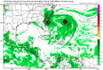
12z hurricane models aren't letting the coast off the hook.
Yeah I think the hurricane models struggle with another system so close and any influence from it, with that said, it shows what will likely happen if Imelda doesn't get influenced by Humberto. Final chapter probably not written on this one yet
 
Back
Top