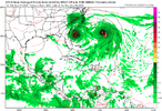
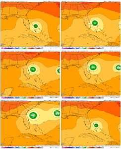
You should be exiled to banter, foreverCooler weather late next week maybe then back to summer right through at least mid October, if not longer. The long range GFS shows this well.
-
Hello, please take a minute to check out our awesome content, contributed by the wonderful members of our community. We hope you'll add your own thoughts and opinions by making a free account!
You are using an out of date browser. It may not display this or other websites correctly.
You should upgrade or use an alternative browser.
You should upgrade or use an alternative browser.
Tropical 94L - PTC to be issued later today
- Thread starter SD
- Start date
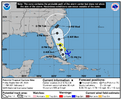
I'm a little worried about the stalling potential of this storm. If the Upper-Level Low is able to tap into this tropical systems moisture it could mean torrential rainfall for much of SC, NC, and VA. The good thing is that rain is needed in much of the SE but the problem in drought conditions is that the rain kind of stands on the ground since it's so hard.
As far as the conditions most of us in Central North Carolina might see, Florence might be a good comparison. 94L may become a slow moving Category 1 hurricane like Florence wherever it comes ashore dumping buckets of rain along its path. Florence broke many rainfall records for NC coastal communities with around 35 inches being recorded in Elizabeth City and 25 in Wilmington. In the KRDU area, rainfall totals ranged anywhere from six to eight inches around Raleigh and up to twelve inches in some locations south of Raleigh.
Elizabeth City did NOT get 35” of rain. I think you mean Elizabethtown in Bladen County.
Yeah this might be the kill shot for landfall chances
Brent
Member
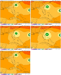
Only about 30 percent of the EPS makes landfall apparently 
 that's kind of embarrassing for some of the hype going around
Stormsfury
Member
I know there’s no correlation between storms but man every hurricane has overperformed this season when it comes to rapid intensification
Interestingly enough, Humberto is also moving south of due west as well.
JHS
Member
And no real effects inland either. This model has led the way with this for sure.0Z Icon is again OTS.
lexxnchloe
Member
ICON is a bit nuts, not that it wont be OTS. It does get a little further west. The nuts part is it deepens it to 937 mb as it goes over the cold wakes left by itself and Hummy0Z Icon is again OTS.
0z GFS even slower with the vorticity through 24. My guess would be it stays offshore again but we will see what happens
910guy
Member
We did, 36 here in Elizabethtown if I remember correctlyElizabeth City did NOT get 35” of rain. I think you mean Elizabethtown in Bladen County.
lexxnchloe
Member
0Z UKMET: once again like the Icon OTS on every run
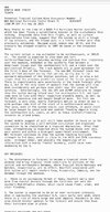
NEW TROPICAL CYCLONE FORECAST TO DEVELOP AFTER 30 HOURS
FORECAST POSITION AT T+ 30 : 23.5N 77.1W
LEAD CENTRAL MAXIMUM WIND
VERIFYING TIME TIME POSITION PRESSURE (MB) SPEED (KNOTS)
-------------- ---- -------- ------------- -------------
1200UTC 28.09.2025 36 23.5N 77.3W 1004 38
0000UTC 29.09.2025 48 25.0N 77.5W 1002 38
1200UTC 29.09.2025 60 26.5N 78.0W 1001 38
0000UTC 30.09.2025 72 28.1N 78.3W 998 43
1200UTC 30.09.2025 84 28.3N 78.5W 995 42
0000UTC 01.10.2025 96 27.6N 76.9W 993 38
1200UTC 01.10.2025 108 27.4N 74.6W 991 45
0000UTC 02.10.2025 120 27.8N 71.6W 989 45
1200UTC 02.10.2025 132 28.3N 68.0W 987 48
0000UTC 03.10.2025 144 28.8N 63.5W 989 66
1200UTC 03.10.2025 156 29.8N 59.3W 994 54
0000UTC 04.10.2025 168 30.3N 56.7W 997 41
Not how the Fujiwara effect works lolI think 94L is going to become strong enough to ignore anything Humberto has going on.
Edit. I guess it’s just going to do whatever Humberto does. Crazy.

