-
Hello, please take a minute to check out our awesome content, contributed by the wonderful members of our community. We hope you'll add your own thoughts and opinions by making a free account!
You are using an out of date browser. It may not display this or other websites correctly.
You should upgrade or use an alternative browser.
You should upgrade or use an alternative browser.
Tropical 94L - PTC to be issued later today
- Thread starter SD
- Start date
ThErE's No LLC YeT.
Never makes it onshore lol. Or even really particularly close
JHS
Member
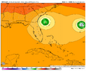
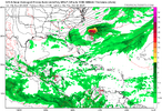
This GFS run is going to keep it out to sea it looks like. A very slow east movement at 108.
Brent
Member
Every year how bad the GFS sucks continues to amaze me
It never ends
lexxnchloe
Member
Its not easy any longer to get a hurricane hit on the East coastThis GFS run is going to keep it out to sea it looks like. A very slow east movement at 108.
lexxnchloe
Member
lexxnchloe
Member
Brent
Member
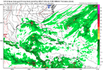
The icon has led the way on the storm not making landfall btw
The GFS and even the Euro have trended towards it
The GFS and even the Euro have trended towards it
That's certainly a firstThe icon has led the way on the storm not making landfall btw
The GFS and even the Euro have trended towards it
lexxnchloe
Member
JB was right!! GFS no longer bullwhips it into the Carolinas
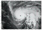
Humberto a major the next few days. Gotta worry about PTC 9 ramping up fast also Monday and Tuesday as MJO goes into phase 2 which has been where all the landfalling majors within 2 days of the coast have ramped up. Likely to crawl or stall in the Carolina coastal waters next week. GFS bullwhip into Carolinas looks to be out of touch. Likely will back off
Humberto a major the next few days. Gotta worry about PTC 9 ramping up fast also Monday and Tuesday as MJO goes into phase 2 which has been where all the landfalling majors within 2 days of the coast have ramped up. Likely to crawl or stall in the Carolina coastal waters next week. GFS bullwhip into Carolinas looks to be out of touch. Likely will back off
Sent from my A600DL using Tapatalk
One would think this setup would cause a massive CAD/upslope situation even with the storm OTS.
GeorgiaGirl
Member
Shaggy
Member
The gfs and euro lose to the icon and cmc. Just wow
18z Euro also looks like it’s going to be a miss
The icon has led the way on the storm not making landfall btw
The GFS and even the Euro have trended towards it
Don’t forget about the UKMET. It has yet to have anything even close to a landfall.
Shaggy
Member
Maybe the plane out there will find a center to actually start analyzing
lexxnchloe
Member
If this is the same storm and we're possibly talking about this a week from now I can imagine the headaches meteorologists will have if they already have one tracking this as it is now
Sent from my SM-S156V using Tapatalk
GeorgiaGirl
Member
There will be. Just not tonightI don't know what to make of PTC9 now. When do y'all think their will be a clearer answer on what exactly will happen here?
Sent from my SM-S156V using Tapatalk
Don't look now, but the euro AI has had an approach to the SC coast followed by stall and turn OTS for several runs now. It hasn't made landfall since the 18z run on Wednesday, but what it has had is varying degrees of closeness to the coastline before heading away. this obviously makes a huge difference on coastal rainfall totals!
Shaggy
Member
Anyone have humberto diving SW in the short term on their bingo card?
Shaggy
Member
Beach erosion will be severe with a 3 day crawling storm producing TS force winds over a long periodDon't look now, but the euro AI has had an approach to the SC coast followed by stall and turn OTS for several runs now. It hasn't made landfall since the 18z run on Wednesday, but what it has had is varying degrees of closeness to the coastline before heading away. this obviously makes a huge difference on coastal rainfall totals!
You are right but this last run actually turns back West after hitting the HP and then makes landfall. Something we also have to watch out for.Don't look now, but the euro AI has had an approach to the SC coast followed by stall and turn OTS for several runs now. It hasn't made landfall since the 18z run on Wednesday, but what it has had is varying degrees of closeness to the coastline before heading away. this obviously makes a huge difference on coastal rainfall totals!
Tokenfreak
Member
Anyone have humberto diving SW in the short term on their bingo card?
I’ve noticed that too. Wonder if it will matter a lot in the lot term track for PTC9?
Sent from my iPhone using Tapatalk
Now PTC 9!
Stormsfury
Member
RECON has multiple swirls with PTC 9. One where its noted on advisory, one closer to the Bahama Island, can't remember what its called.
Shaggy
Member
Might not make a difference but if the low forms 50-100 miles east of advisory it might mean more interaction with humbertoRECON has multiple swirls with PTC 9. One where its noted on advisory, one closer to the Bahama Island, can't remember what its called.
GeorgiaGirl
Member
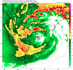
HWRF was the only hurricane model to switch to no landfall. Takes a nice tour just off the SC coast that includes a ride back SE and the rain totals would be pretty gnarly.

