• Hello, please take a minute to check out our awesome content, contributed by the wonderful members of our community. We hope you'll add your own thoughts and opinions by making a free account!

Severe 4/4-4/6 Severe Threat

So south Bama gonna get it rough again?
Maybe, I'd like to see the nam in range, but better placement of 500mb trough and winds for cellular development, 2nd wave may end up being worse in the end but don't really know at this point. Definetly better moisture these two rounds than all the previous ones this season.

500mb winds are almost directly from the west this go around. Probably less height falls than the other events but a good bit of divergence
 
One thing this isn’t lacking is cape. But the other dynamics of this is yet to be ironed out.


Sent from my iPhone using Tapatalk
 
Checking the newest NAM runs indicates a pretty robust environment in south Alabama for day 4.

Sounding from south Alabama for day 4.2022040206_NAM_084_31.8,-87.5_severe_ml.png
 
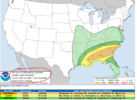
SPC Day 2 Outlook


spc-3.png


spc-4.png


spc-5.png


Day 2 Convective Outlook
NWS Storm Prediction Center Norman OK
1235 AM CDT Sat Apr 02 2022

Valid 031200Z - 041200Z

...THERE IS A SLIGHT RISK OF SEVERE THUNDERSTORMS ACROSS PORTIONS OF
NORTHWEST TEXAS AND SOUTHWEST OKLAHOMA...

...SUMMARY...
Isolated severe thunderstorms are expected across parts of northwest
Texas and southwest Oklahoma Sunday evening. Strong wind gusts and
large hail will be possible with these storms. A couple of strong
storms also are possible across west Texas and the southern Florida
Peninsula.

...OK/TX...

Westerly low-amplitude flow across the western half of the CONUS
will amplify as a midlevel shortwave trough develops east/southeast
to the Upper MS Valley vicinity. A second midlevel trough will pivot
eastward across the southwestern states as well. A weak shortwave
impulse will eject eastward across the southern Rockies into the
southern Plains during the late afternoon/evening ahead of the
western trough. This lead impulse will provide increasing ascent
across western TX into OK by late afternoon/early evening. At the
surface, a cold front is forecast to shift east/southeast across the
central Plains and into northern OK during the afternoon/evening.
This front will stall across northwest OK as a weak surface low is
forecast to develop over eastern NM/western TX. A dryline also will
exist from near the TX Panhandle/western OK border into southwest TX
around 00z.

Increasing southerly low-level flow will result in modest moisture
return to the east of the dryline/south of the cold front, with
dewpoints generally reaching into the mid 50s F to possibly near 60
F. While boundary-layer moisture will be modest, steep midlevel
lapse rates and increasing midlevel moisture will support MLCAPE as
high as 1500 J/kg. A weak capping inversion may preclude convective
initiation until after 00z when a 35-45 kt low level jet is expected
to increase and strong ascent arrives with the shortwave impulse.
Once storms develop, vertically veering wind profiles with 35+ kt
effective bulk shear magnitudes and elongated hodographs will
support supercells capable of large hail. Steep low-level lapse
rates and relatively dry sub-cloud layer air also will support
strong, locally damaging gusts.

The severe threat should diminish/become more conditional with
southward extent given weaker forcing and potentially stronger
capping. However, should convection develop southward along the
dryline across parts of west TX, sporadic strong gusts and hail
could accompany this activity for a few hours during the late
afternoon/early evening.

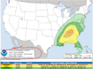
SPC Day 3 Outlook:

https://www.spc.noaa.gov/products/outlook/day3otlk.html

spc-1.png


spc-2.png


SPC AC 020734

Day 3 Convective Outlook
NWS Storm Prediction Center Norman OK
0234 AM CDT Sat Apr 02 2022

Valid 041200Z - 051200Z

...THERE IS A SLIGHT RISK OF SEVERE THUNDERSTORMS FROM CENTRAL TEXAS
INTO THE LOWER MISSISSIPPI VALLEY VICINITY...

...SUMMARY...
A broad area of severe thunderstorm potential will exist Monday
across central/eastern Texas, and spread east into the Lower
Mississippi Valley vicinity through Monday night. Damaging wind
gusts, large hail and tornadoes will all be possible.

...Synopsis...

A neutral to positively tilted upper trough will quickly eject east
from the southwest U.S. to the Ozarks/east Texas on Monday. A large
warm sector ahead of the trough will result in a broad area of
severe potential from central/eastern TX into the Lower MS
Valley/central Gulf Coast vicinity.

A surface low over northern IL will dissipate as it shifts east
across the Midwest, leaving a nearly stationary cold front extending
from the mid-MS Valley into central OK and western TX. As the
western trough shifts east, a weak surface low is forecast to
develop over western TX and track east in the vicinity of north TX
or southern OK. Low-level southerly flow will transport mid 60s to
low 70s surface dewpoints northward into central and eastern TX and
low to mid 60s as far north as the Red River Valley. Steepening
midlevel lapse rates will support moderate destabilization.
Scattered thunderstorms are expected to develop in the vicinity of a
dryline, and also in the warm advection regime in the vicinity of
the quasi-stationary cold front across central/southern OK.
Vertically veering wind profiles, with speeds increasing quickly
with height, will support initial supercells across the warm sector
from central into eastern TX. Large hail, damaging gusts and a few
tornadoes appear possible with this activity through the
afternoon/evening hours. As the low-level jet increases during the
evening, upscale development into an eastward-advancing MCS is
possible across the Sabine Valley vicinity.

During the evening and overnight hours, the southwesterly low-level
jet will increase and spread east across LA and the lower MS Valley
into western AL. A warm front extending from the ArkLaTex vicinity
to southern MS/AL during the evening will lift northward through the
overnight hours to roughly central MS/AL, and will demarcate the
northern extent of at least mid-60s surface dewpoints. Severe
thunderstorms will be possible with any MCS/QLCS that develops
across TX/LA and shifts eastward overnight, as well as with any
semi-discrete convection that may develop. Forecast hodographs
across the region will be quite large given the strength of
low-level flow, and instability will be more than sufficient to
support a risk for damaging gusts a few tornadoes.

..Leitman.. 04/02/2022

CLICK TO GET WUUS03 PTSDY3 PRODUCT

NOTE: THE NEXT DAY 3 OUTLOOK IS SCHEDULED BY 0730Z
CURRENT UTC TIME: 1123Z (6:23AM), RELOAD THIS PAGE TO UPDATE THE TIME
 
Last edited:
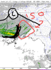
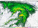
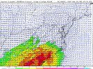
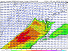
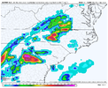
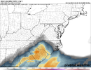
Analysis of Tuesdays threat, looks like a big time event is possible for south Alabama. I know this is no "real" forecasting rule but usually when you see bright pink in the supercell composite for Alabama or Mississippi your looking at a decent chance for some tornadic storms or outbreak. With that being said your pretty darn close to that for south Alabama I imagine once CAMs come into range youll probably get a better idea as to storm mode and relative severity. But your highest Chance is probably going to be on the northern fringe of the highest composite area where the jet splits, with there being no real cold front your probably going to be reliant on peak heating/divergence and some sort of energy moving through possibly confluence bands for ahead of any line that may form. Large hodographs and ample moisture are pretty supportive for severe, the sounding I'm about to show is from around south of Selma Alabama, sounding is showing elevated convection but as you heat up more through the day and more moisture is pumped in you'll more and likely go surface based pretty quick. 3km EHI is pretty dark high. STP 6+ As well.

In other words my highest threat area prediction is probably just south of the warm front along the divergent jet axis.

2022040212_NAM_078_32.27,-86.56_severe_ml.pngScreenshot_20220402-110633-843.pngScreenshot_20220402-110533-701.pngScreenshot_20220402-110501-836.pngScreenshot_20220402-110436-224.png
 
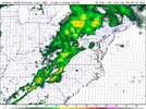
Your going to have some pretty hefty rain totals along that divergent jet axis. 18z still on board with 12z your main severe threat is going to be that south Alabama area mainly along and south of the boundary set up by the rain cooled air mass.

HIGHLY unlikely any instability pumps up north past the MCS draped over central Alabama.

Looks mainly like a south Alabama threat and a pretty good one at that. NAM hints at a possible MCS in the gulf that will limit moisture pull into the south so will see where that goes.

Also of note CAD is limiting the Northeast push of the warm front so again. South Alabama threat, no way this makes it into north or even central Alabama at that.
 
Your going to have some pretty hefty rain totals along that divergent jet axis. 18z still on board with 12z your main severe threat is going to be that south Alabama area mainly along and south of the boundary set up by the rain cooled air mass.

I’m assuming you mean with Wednesday event. But Tuesday a lot of areas will see 1-3 inches of rain. So Wednesday you may see some flooding issues


Sent from my iPhone using Tapatalk
 
I’m assuming you mean with Wednesday event. But Tuesday a lot of areas will see 1-3 inches of rain. So Wednesday you may see some flooding issues


Sent from my iPhone using Tapatalk
Talking about Tuesday with the post above.

Where ever that jet axis sets up and the MCS gets going your going to see some big totals in that area.
 
Tuesday threat reminds me of our last threat with broken up supercells amid a line when it moved across the Mississippi Alabama state line. less wind threat but trades off more flash flooding. Nws of mobile indicates the environment being very ripe Tuesday afternoon and whatever cell gets going all modes of severe weather will be possible. Probably be a case of cells developing on the southern most divergence a little bit ahead of the line and then eventually getting swallowed up as the system moves very slowly to the southeast. STP and EHI are higher than our last threat I'd say you have a bigger threat for significant tornadoes for this event than last one, less chance of QCLS spin ups. No cold front with this one just mesoscale lift factors.
 
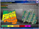
Bham NWS seems to be ramping up the Wednesday threat in their afternoon discussion.


Tuesday through Wednesday.

A low level jet of 40-50 kts will track eastward across Alabama Tuesday
morning. This will pull a surface warm front rapidly northward into
south Alabama Tuesday morning. Before the better forcing exits Alabama
later in the morning, there may be an overlap of lift and instability
across areas along and south of I-85 Tuesday morning. This area would
be favored for any severe storms, with enough helicity and shear for
tornadoes. Tuesday afternoon a little more nebulous for location
of severe storms, with some weak subsidence on the back side of
the exiting low level jet. The models are converging on a zone
of convection developing along the I-20 corridor, where
instability and CAPE increase due to diurnal heating. This may the
position of the surface warm front. Things settle down far
quickly after sunset Tuesday, and expect minimal activity during
the overnight period. Convection will ramp up on Wednesday as a
cold front enters northwest Alabama. Surface based CAPE will likely
exceed 2000 J/kg by early afternoon, possibly reaching 3000 J/kg
across areas south of I-20 in the afternoon. SRH and EHI values
have also increased with the 12Z model runs, and included a threat
for tornadoes on Wednesday, in addition to damaging straight line
winds and large hail. The stronger storms will linger into the
evening as the cold front progresses southeast.

58/rose
 
Can anyone pull the latest GSP discussion? Thank you


Sent from my iPhone using Tapatalk
 
Bham NWS seems to be ramping up the Wednesday threat in their afternoon discussion.


Tuesday through Wednesday.

A low level jet of 40-50 kts will track eastward across Alabama Tuesday
morning. This will pull a surface warm front rapidly northward into
south Alabama Tuesday morning. Before the better forcing exits Alabama
later in the morning, there may be an overlap of lift and instability
across areas along and south of I-85 Tuesday morning. This area would
be favored for any severe storms, with enough helicity and shear for
tornadoes. Tuesday afternoon a little more nebulous for location
of severe storms, with some weak subsidence on the back side of
the exiting low level jet. The models are converging on a zone
of convection developing along the I-20 corridor, where
instability and CAPE increase due to diurnal heating. This may the
position of the surface warm front. Things settle down far
quickly after sunset Tuesday, and expect minimal activity during
the overnight period. Convection will ramp up on Wednesday as a
cold front enters northwest Alabama. Surface based CAPE will likely
exceed 2000 J/kg by early afternoon, possibly reaching 3000 J/kg
across areas south of I-20 in the afternoon. SRH and EHI values
have also increased with the 12Z model runs, and included a threat
for tornadoes on Wednesday, in addition to damaging straight line
winds and large hail. The stronger storms will linger into the
evening as the cold front progresses southeast.

58/rose
Wensday has a lot more potential for our neck of the woods. NAM isn't in range so I haven't really checked that one. Our first real threat with widespread 2000-3000+ cape values. If what the nws is saying in there forecast happens wensday the environment is going to be really conducive for severe storms/ tornadoes. I'm really intrigued highest potential for discrete convection so far this year will be wensday .
 
Can anyone pull the latest GSP discussion? Thank you


Sent from my iPhone using Tapatalk
000
FXUS62 KGSP 021848
AFDGSP

Area Forecast Discussion
National Weather Service Greenville-Spartanburg SC
248 PM EDT Sat Apr 2 2022

.SYNOPSIS...
Dry weather continues through Monday although a weak system may
bring a few sprinkles to the area this evening. Mild high pressure
brings warmer temperatures to start the week. Then, a wet storm
system is expected to arrive Tuesday, with unsettled weather
continuing through the middle of the week.

&&

.NEAR TERM /THROUGH SUNDAY/...
As of 145 PM: Low pressure near Chicago is associated with a sharp
shortwave aloft, which is phased with a weaker wave now over western
KY/TN. Patchy alto/cirrus clouds extend from the Great Lakes to Gulf
Coast as a result of these features. The more southerly wave will
pass the CWA this evening, and as a result a period of cloudiness
is expected. Kept the sprinkle mention added by previous shift,
with ASOS sites reporting spotty trace RA upstream. Max temps
look to be impacted a little bit, and revised aftn temps have been
brought down a tad. RH at obs sites is mostly presently above 25%
and is expected to stay there; land management agencies indicated
fuel moisture readings still appeared high enough for enhanced
fire danger this afternoon.

The passage of the shortwave and sfc low to our north will bring
a relatively weak cold front across the area overnight, with winds
shifting as soon as late evening in the mountains and by daybreak in
the lower Piedmont. Min temps end up around normal. While a few CAMs
spit out light QPF in the NW Flow areas in the wee hours Sunday,
moisture profiles are so shallow that we will mention only a brief
period of sprinkles (possibly flurries in very high elevations).

Skies will be virtually clear at daybreak across the Piedmont,
and clear during the morning in the mountains. Downsloping should
have a big impact on Sunday temps, allowing upper 60s and lower 70s
in the Piedmont. Temps are expected to rise a few degrees above
raw model values, so coaxed winds/gusts toward the high end of
guidance. Please see Fire Wx section below for notes on fire danger.

&&

.SHORT TERM /SUNDAY NIGHT THROUGH TUESDAY/...
As of 130 PM EDT Saturday: Quasi-zonal flow aloft will push
across the CFWA Sunday night into Monday as a surface high riding
underneath slides across the Mid-Atlantic and Carolinas. Mostly
clear skies and light winds will set up decent radiational cooling
conditions Sunday night. Thus, patchy frost will likely develop
across the I-40 corridor. Low RH values may develop Monday afternoon
and elevate fire weather concerns, especially across the NC zones
where wind gusts will be higher. The surface high pushes offshore
Monday afternoon into Monday night, which in turn, allows for
a return flow to enter the CFWA. Moisture and cloud cover will
increase as a result as deep layer southwesterly flow sets up shop
across the southeastern CONUS Monday night and Tuesday, ahead of
an upper level trough to the west. Max temperatures will be at or
slightly above normal for Monday as WAA begins to filter into the
CFWA. Low temperatures Monday night will run slightly above normal
due to increasing cloud coverage.

Southern stream shortwave is shown ejecting across the Southern
Plains Monday night into Tuesday with a low pressure system
developing underneath. Stout 40-50 kt S-SW LLJ will impinge on
the CFWA just ahead of the system as it marches across the Lower
MS Valley and Deep South. PWAT values will surge above 1.00"
across the higher elevations and around 1.50" or higher east of
the mountains by Tuesday as the LLJ pulls in deep moisture from
the Gulf and Atlantic. The timing is still in question as the GFS
is slightly more progressive than other operational model runs as
precip begins in the southwestern zones by mid-morning Tuesday,
while the ECMWF and CMC wait until Tuesday afternoon. The system
will be fast-moving, but strong isentropic lift and upper divergence
to go along with a completely saturated vertical profile from the
top-down will pose the risk for very heavy rainfall rates in a
short period of time. In this case, a hydro threat for flash flood
could develop Tuesday afternoon/evening, especially in the favorable
upslope locations along the southern Blue Ridge Escarpment and in
the far southern zones, where the core of the low pressure system
will cross and destabilization is strongest. QPF amounts at this
time will range from >0.5"-2.0" for most locations with locally
higher amounts in the favorable aforementioned regions. Instability
will be marginal at best Tuesday afternoon, but a few hundred J/kg
of SBCAPE may develop in the southern tier, which could produce
a couple of strong storms in this area, but any severe threat is
low at this time. The low pressure system is expected to lift out
of the CFWA by Tuesday night and provide a lull in precip before
the next system impacts the area during the middle part of next
week. High temperatures on Tuesday will be at or slightly above
normal due to strong WAA.

&&

.LONG TERM /TUESDAY NIGHT THROUGH SATURDAY/...
As of 215 PM EDT Saturday: Deep stacked low will drop into the
north-central CONUS Wednesday as the initial shortwave lifts
offshore. Ongoing deep layer southwesterly flow and WAA regime will
be in store, which will help uptick temperatures into the 70s for
most locations with low 80s becoming a possibility south and east
of the I-85 corridor Wednesday. Model guidance continue to hint at
good SBCAPE values to develop Wednesday afternoon in response, but
global models and even the GEFS continue to slow down the timing
of a cold front that`s associated the the stacked low. As of now,
the cold front`s arrival is expected to be overnight Wednesday,
which would lower any severe threat. With good deep layer shear and
some form of surface instability Wednesday night, expect there to
be a linear segment of convection along the cold front as it pushes
into the CFWA. A lot of uncertainties, but this could produce at
least a low-end severe threat for portions of the CFWA. The threat
could increase if the cold front arrives during peak heating,
but not looking likely at this time. Expect the fropa to occur
some time Thursday morning as a post frontal regime settles in
behind the from later Thursday into the first part of Friday.

The stacked low is expected to move into the Great Lakes region
and stretch across the eastern CONUS Thursday through much of
next weekend. This will lower thicknesses drastically under broad
cyclonic flow aloft. Model guidance continue to produce NW flow
precip across the mountains, with the possibility of some showers
breaking containment east of the mountains later Friday. 850mb
temperatures dip below freezing by Friday as stout CAA filters
into the region and will remain sub-freezing through the end of the
forecast period, especially across the higher elevations. The GFS
and ECMWF keep NW flow precip, especially along the TN border in the
forecast from Thursday night through at least Saturday. Snow will
likely fall in elevations above 3500` during this time frame with
some form of accumulating snow becoming a favorable trend along
the TN border and in the Smokies, but amounts are uncertain at
this point in time. Temperatures will start out well above normal
Wednesday before lowering each day through the end of the medium
range and becoming below normal by Friday into next weekend across
the CFWA.

&&
 
Huntsville is not ruling out tornadoes on Tuesday but it’s conditional. Wednesday looks like more of a damaging wind threat with the dry air aloft.
1648942899357.jpeg
 
Huntsville is not ruling out tornadoes on Tuesday but it’s conditional. Wednesday looks like more of a damaging wind threat with the dry air aloft.
View attachment 116704
Last few model runs of globals have crapped on the wensday threat, more so to a severe thunderstorm threat rather than tornado with the lack of SRH helicity. But I've seen the CAMs revitalize systems that the globals have killed off, best to wait till CAMs get in range for the wensday threat.

Tuesday I'm very hesitant on saying theyre will be much severe threat to the north of the big MCS draped over central Alabama. Almost 99% of the time instability never fully realizes to the north of a MCS. I'd expect the risk area to trim further south with future outlooks.
 
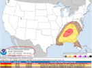
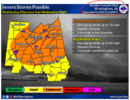
NEW DAY 4

1.png

Day 4-8 Convective Outlook
NWS Storm Prediction Center Norman OK
0337 AM CDT Sun Apr 03 2022

Valid 061200Z - 111200Z

...DISCUSSION...
...Day 4/Wednesday - Central Gulf Coast to the Central
Appalachians...

A strong mid/upper low will be located over the Upper Midwest early
Wednesday. The low and its attendant trough will develop
east/southeast across the MS Valley by Thursday morning. Intense
southwesterly midlevel flow will overspread the region as a surface
cold front surges eastward across the Ohio Valley and into the Deep
South by Wednesday evening. The cold front is expected to continue
east overnight, becoming positioned from the VA/NC Piedmont to the
central Gulf of Mexico by Thursday morning. A moist and unstable
airmass will reside ahead of the front. Strong ascent amid
boundary-parallel deep-layer flow should support linear convection
with an attendant damaging-wind and tornado threat. The northward
extent of severe potential is a bit uncertain at this time, and
severe probabilities may need to shift northward some in future
outlooks depending on forecast trends in the coming days.
 
Back
Top