It’s at 4.72 inchesExcuse me, but what on earth is DVD sized hail?View attachment 117870
-
Hello, please take a minute to check out our awesome content, contributed by the wonderful members of our community. We hope you'll add your own thoughts and opinions by making a free account!
You are using an out of date browser. It may not display this or other websites correctly.
You should upgrade or use an alternative browser.
You should upgrade or use an alternative browser.
Severe 4/12 - (?) Severe Weather
- Thread starter Iceresistance
- Start date
-
- Tags
- severe
NoSnowATL
Member
Wok for softballExcuse me, but what on earth is DVD sized hail?View attachment 117870
HSVweather
Member
HSVweather
Member
HSVweather
Member
HSVweather
Member
Detective WX
Member
Brings back 1991 memories... Ironically 3 days after the 31st anniversary, stranger that both '91 and this one fell on a Friday. Ouch!
Last edited:
HSVweather
Member
Jeff P just got hit with debri as the tornado past him
BufordWX
Member
HSVweather
Member
HSVweather
Member
NoSnowATL
Member
All he does is scream. Damn dude chill. So annoying.
Another video of the Andover, KS tornado:
Another video of the Andover, KS tornado:
That is like the tornado you picture in your head when you think of an Oklahoma/Kansas tornado.
Last edited:
HSVweather
Member
HSVweather
Member
HSVweather
Member
HSVweather
Member
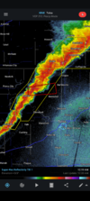
Andover's about to get slammed again by a line of severe storms that has blown up along the cold front.
Severe Weather Statement
National Weather Service Wichita KS
901 PM CDT Fri Apr 29 2022
KSC015-173-300230-
/O.CON.KICT.SV.W.0038.000000T0000Z-220430T0230Z/
Sedgwick KS-Butler KS-
901 PM CDT Fri Apr 29 2022
...A SEVERE THUNDERSTORM WARNING REMAINS IN EFFECT UNTIL 930 PM CDT
FOR NORTHEASTERN SEDGWICK AND WEST CENTRAL BUTLER COUNTIES...
At 900 PM CDT, severe thunderstorms were located along a line
extending from near Potwin to Downtown Wichita, moving east at 40
mph.
HAZARD...70 mph wind gusts and quarter size hail.
SOURCE...Public.
IMPACT...Hail damage to vehicles is expected. Expect considerable
tree damage. Wind damage is also likely to mobile homes,
roofs, and outbuildings.
Locations impacted include...
Wichita, Andover, Park City, Valley Center, Bel Aire, Goddard, Maize,
Benton, Downtown Wichita, Kechi, Eastborough, West Wichita, East
Wichita, Eisenhower National Airport, Northeast Wichita, Mcconnell
Air Force Base, Jabara Airport and Oaklawn.
PRECAUTIONARY/PREPAREDNESS ACTIONS...
A Tornado Watch remains in effect until 1100 PM CDT for south central
Kansas.
For your protection move to an interior room on the lowest floor of a
building.
&&
LAT...LON 3766 9763 3778 9747 3791 9732 3791 9716
3792 9715 3792 9703 3760 9720
TIME...MOT...LOC 0200Z 278DEG 33KT 3789 9707 3769 9734
THUNDERSTORM DAMAGE THREAT...CONSIDERABLE
HAIL THREAT...RADAR INDICATED
MAX HAIL SIZE...1.00 IN
WIND THREAT...RADAR INDICATED
MAX WIND GUST...70 MPH
$$
CUELLAR
Brent
Member
What a tornado. Textbook appearance for sure and damage appears to be on the higher end
Meanwhile we had a tornado watch I'm 3 hours south and it's been sunny all evening lol hasn't been one storm in Oklahoma that I've seen
Meanwhile we had a tornado watch I'm 3 hours south and it's been sunny all evening lol hasn't been one storm in Oklahoma that I've seen
What a tornado
Meanwhile we had a tornado watch I'm 3 hours south and it's been sunny all evening lol hasn't been one storm in Oklahoma that I've seen
The cap was just strong enough to choke off the updrafts that tried to take off (around Lawton). They ended up cancelling the Watch shortly after issuing it.
It was a razor thin close call though. A degree or two difference in temp/dewpoint, or slightly better forcing, and it would probably be a pretty active evening in OK too right now.

Last edited:
Downeastnc
Member
Brent
Member
From what I see yeah that tornado is gonna be on the higher end. We'll see what daylight brings but the initial images are very bad(especially the YMCA)
Downeastnc
Member
From what I see yeah that tornado is gonna be on the higher end. We'll see what daylight brings but the initial images are very bad(especially the YMCA)
Yeah was pretty violent, EF2/3 easy IMO just based on motion....that drone video showed some major vertical motion lifting entire roofs or hell maybe even entire homes well into the air....crazy stuff.
Report on the SPC website shows golf ball sized hail was observed in Andover with the squall line along the cold front (Round 2).
Brent
Member
BufordWX
Member
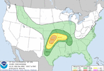
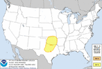
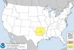
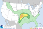
I kinda wish I'm there! I'm currently on I-22 in Western Alabama heading towards BirminghamActive week coming up. 3 out of 4 days with at least a 15% risk of severe weather next week including a day 3 enhanced risk for Monday.View attachment 117889View attachment 117890View attachment 117891
I'm now in Birmingham, ALI kinda wish I'm there! I'm currently on I-22 in Western Alabama heading towards Birmingham
Z
Zander98al
Guest
Thursday/ Friday time frame looks intriguing for Alabama and the southeast. Westerly 500mb winds.
Complex of storms has blown through Birmingham, AL, I'm currently in Columbus, Georgia
BufordWX
Member
Hi-Res models are now looking really chaotic with convection evolution this evening.
Some are even bringing a MCS through the Metroplex, with little activity in OK.
Some are even bringing a MCS through the Metroplex, with little activity in OK.
Brent
Member
Yeah I'm not sure what to expect here. Wouldnt surprise me if Kansas is the bullseye again tomorrow like Friday. Even if storms go out towards OKC it'll probably be after dark before they get here
Wednesday definitely could be the bigger day if the timing lines up
Wednesday definitely could be the bigger day if the timing lines up
Z
Zander98al
Guest
Yup, nice pitter patter and light thunder to wake me up this morning. Always love a good moderate rain.Complex of storms has blown through Birmingham, AL, I'm currently in Columbus, Georgia
Hi-Res models are now looking really chaotic with convection evolution this evening.
Some are even bringing a MCS through the Metroplex, with little activity in OK.
It seems the Hi-Res models are struggling with whether the corfidi vectors or instability gradient will drive storm propagation, provided it does organize into a complex.
The former would support a more NE-ward trajectory, and the latter would support a more SE-ward trajectory.
BufordWX
Member
HSVweather
Member

