There must be a Curse going on there.
-
Hello, please take a minute to check out our awesome content, contributed by the wonderful members of our community. We hope you'll add your own thoughts and opinions by making a free account!
You are using an out of date browser. It may not display this or other websites correctly.
You should upgrade or use an alternative browser.
You should upgrade or use an alternative browser.
Severe 4/12 - (?) Severe Weather
- Thread starter Iceresistance
- Start date
-
- Tags
- severe
Z
Zander98al
Guest
@Zander98al You did say that my area could have severe weather without capping issues, but the models are saying that it's likely the case with this setup.
Z
Zander98al
Guest
Haven't really checked much since the initial post, lots of things can usually change up when 6-7 days out. It's still to early on any type of specifics too be honest@Zander98al You did say that my area could have severe weather without capping issues, but the models are saying that it's likely the case with this setup.
Z
Zander98al
Guest
That bassfield/soso tornado was the closest we've been to a ef5 since Moore Oklahoma. Clocked in at 195mph.
Someone was foolish enough to do this
Z
Zander98al
Guest
Some of these large tornado on the ground reports are complete bogus. I wish storm spotters and such would be completely honest with what there seeing and not exaggerate. The Arkansas tornado emergency was never needed, its bad for the whole industry when people don't give 100% accurate ground truth.Someone was foolish enough to do this
I think the southeast has gotten better at tornado warnings and such over the years but, ground spotters are necessary and the reports of a large tornado when it's actually a funnel cloud is a big difference.
Overall I get too excited when it comes to weather but I'm not reporting to the NWS and such lol, and I always say listen to the official weather offices and stuff. False reports are very dangerous to weather people's creditability
Last edited by a moderator:
- Joined
- Jan 5, 2017
- Messages
- 3,769
- Reaction score
- 5,966
That was going to eventually happen in Dixie Alley, now it's Tornado alley's turn!April is drying out around here, according to the GFS. May starting off with NW flow.
View attachment 117538
I only report if there's no one else has, I did make a legit storm report due to the Surprise Snowstorm of December 2020. I didn't get a reply (As expected), but ~15 minutes after the report was sent, a WWA was issued for up to 1 inch of snow, but I got 1.5 inches! LolSome of these large tornado on the ground reports are complete bogus. I wish storm spotters and such would be completely honest with what there seeing and not exaggerate. The Arkansas tornado emergency was never needed, its bad for the whole industry when people don't give 100% accurate ground truth.
I think the southeast has gotten better at tornado warnings and such over the years but, ground spotters are necessary and the reports of a large tornado when it's actually a funnel cloud is a big difference.
Overall I get too excited when it comes to weather but I'm not reporting to the NWS and such lol, and I always say listen to the official weather offices and stuff. False reports are very dangerous to weather people's creditability
HSVweather
Member
HSVweather
Member
HSVweather
Member
Crazy lightning here
BufordWX
Member
BufordWX
Member
HSVweather
Member
HSVweather
Member
BufordWX
Member
BufordWX
Member
HSVweather
Member
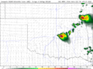
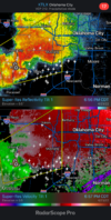
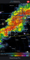
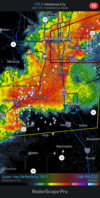
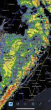
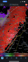
The Norman Supercell was heading my way at first, but at the last minute (It always does that!), it occluded to the North.
It also appears that 1 or 2 minor ingredients for tornadoes was missing, which may be the reason why there were no tornadoes in Oklahoma despite the mean Supercells.
It also appears that 1 or 2 minor ingredients for tornadoes was missing, which may be the reason why there were no tornadoes in Oklahoma despite the mean Supercells.
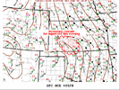
SPC has put the NW half of DFW under the slight risk area in the latest outlook.
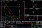
12z HRRR sounding doesn't look too shabby either.
12z HRRR sounding doesn't look too shabby either.
Latest Hi-Res models are all bringing organized convection into DFW (mainly areas north of I-20) this evening.
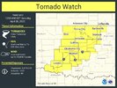
And speak of the devil, now there's a Severe Thunderstorm Watch until 6pm for the northern suburbs of DFW:
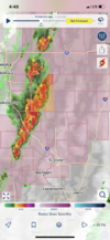
I was a crazy person, out in the open watching a somewhat close Lightning Barrage from the 2nd Supercell last night.
HSVweather
Member
HSVweather
Member
HSVweather
Member
Long live this severe thread lol
Z
Zander98al
Guest
Long live this severe thread lol
It's been very active but also somewhat unsubstantial which is a good thing. Hopefully it doesn't change though
I don't know when this sequence is going to end at all, it's now going into May.
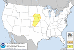
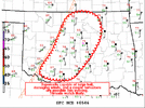
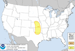
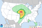
I'm surprised that no one is noticing the Enhanced risk in place for Oklahoma and Kansas on Tomorrow.
HSVweather
Member
HSVweather
Member
BufordWX
Member

