Yup its PDS tornado emergencyconfirmed tornado near Chattanooga, TN
View attachment 39342
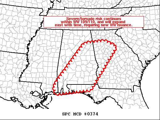
-
Hello, please take a minute to check out our awesome content, contributed by the wonderful members of our community. We hope you'll add your own thoughts and opinions by making a free account!
You are using an out of date browser. It may not display this or other websites correctly.
You should upgrade or use an alternative browser.
You should upgrade or use an alternative browser.
4/11/20 - 4/13/20 Severe Weather Outbreak
- Thread starter Webberweather53
- Start date
-
- Tags
- severe weather tornadoes
Dawgdaze22
Member
Are these storms that strong that the thunder we are hearing near Atlanta is from them? The radar shows rain headed my way ( Lawrenceville, east of Atlanta) and its sprinkling and feels like I'm at the beach when I step out. I hope everyone stays safe tonight!
THIS? There’s no storms on radar that should be making this much noise
Sent from my iPhone using Tapatalk
Are these storms that strong that the thunder we are hearing near Atlanta is from them? The radar shows rain headed my way ( Lawrenceville, east of Atlanta) and its sprinkling and feels like I'm at the beach when I step out. I hope everyone stays safe tonight!
They aren't that strong yet. It's mainly the insane instability out there.
bingcrosbyb
Member
Tornado Emergency just east of Chattanooga
bingcrosbyb
Member
Huge TDS near Chattanooga 
iGrey_X
Member
Well that didn’t take long. You can see cells forming out a head of it quickly.
6"-7" rainfall rates moving through Chattanooga right now ?
TOR for Bradley County now
campamy
Member
What an interestingly shaped tornado polygon.View attachment 39338
Going to pass close to me and my husband's fire hall if it stays together.TOR for Bradley County now
- Joined
- Jan 5, 2017
- Messages
- 3,810
- Reaction score
- 6,066
I guess it is from the outflow from the main line? Not sure why we are hearing thunder.Are these storms that strong that the thunder we are hearing near Atlanta is from them? The radar shows rain headed my way ( Lawrenceville, east of Atlanta) and its sprinkling and feels like I'm at the beach when I step out. I hope everyone stays safe tonight!
CJ is saying "classic hook"??? He must be seeing something I'm not
Flooding was downplayed in the news and social media even tho Moderate Risk was issued. Evacuations in Tennessee will occur tomorrow based on latest river forecasts near Chattanooga. I feel this is going to expand over much of the Appalachians.
Interesting watching the main line as it passes half way thru Alabama it appears that some storm growth occuring out in front of main line north to south this is troubling if those storms continue to grow.
Impressively enough, the temp climbed up to 79*F before the rain moved back in.
Channel 7 saying it looks extremely weak and will not be extendedCJ is saying "classic hook"??? He must be seeing something I'm not
Warning dropped for the SC storm.
ChattaVOL
Member
It’s bad here. East Brainerd took a direct hit.
Another warning for Chattooga County, GA:

Is the HRRR too slow with this storm? Looks to be behind the current radar, I heard it was dragging its feet earlier but didn’t know if it corrected..?
It’s bad here. East Brainerd took a direct hit.
Looks like South Cleveland is getting a direct hit now.
Temp still rising here, Dp has plateaued for now. 74/66 Definitely feel the mugginess and humidity when I was outside a few minutes ago. Just got home from work.
NBAcentel
Member
VWP hodo from GSP and Columbia, quite impressive large low level hodos with lots of SRH already and somewhat decent critical angles, also note how the whole hodo from The surface to 3km and 3-10km is literally cyclonic
GSP

CAE
GSP
CAE
Watch out Mount Airy NC that storm appears to be growing again after leaving Wilkes. Going to need another warning
Lostnthaweather85
Member
 Moving my way at 85 mph!
BufordWX
Member

That Tornado way out ahead of the main line had my fiancé shook. We have a Clayton Home so we came across the farmstead to stay at my dad’s tonight?
Snow_chaser
Member
I know it’s been mentioned that this setup wasn’t necessarily favorable for large hail, but has there been any reports of hail in Alabama and East? I seen the pics earlier of the hail further west
I know it’s been mentioned that this setup wasn’t necessarily favorable for large hail, but has there been any reports of hail in Alabama and East? I seen the pics earlier of the hail further west
I don't see any hail reports east of MS.
EDIT: There were a couple reports several hours ago in AL. Blount/Etowah Counties.
Cadi40
Member
Starting to become a little concerned with the individual storms quite a ways ahead of the main line...
Snow_chaser
Member
Just got severe thunderstorm warning here
campamy
Member
Power out here, missed us thankfully.
Feels like this is transitioning into a more linear situation and straight-line winds may be the main concern in ATL metro coming up. Hope I'm right...
Correct me if I'm wrong, but isn't this 1H HRRR sounding showing a cap?

Yes.
Snow_chaser
Member
W
what does cap mean?Yes.
Darklordsuperstorm
Member
Hats off to everyone at SPC! This one was definitely a challenge to forecast. At the end of the day they had a tough decision to make in regards to moderate vs high. At the end of the day I feel like they nailed it and made the right call.
W
what does cap mean?
Capping inversion, which can inhibit convection.
That said, it's not a strong cap and the forcing from the upcoming front is overcoming it.
GeorgiaGirl
Member
It's now 77 with a heat index of 79. Pretty unreal.
Still kind of debating setting an alarm for way earlier than normal for me just to check on the progress of these storms.
Edit: Think I'm gonna gamble a little here and just sleep, like I said elsewhere (what I normally do even on nights like this). Maybe I'll sleep through a heavy storm or be woken up, who knows?
Last edited: