HRRR gonna suck me in for the Carolinas. Not bad. @metwannabe could be the spot today, or a bit south of him
-
Hello, please take a minute to check out our awesome content, contributed by the wonderful members of our community. We hope you'll add your own thoughts and opinions by making a free account!
You are using an out of date browser. It may not display this or other websites correctly.
You should upgrade or use an alternative browser.
You should upgrade or use an alternative browser.
Severe 3/30-4/2 Severe Weather
- Thread starter SD
- Start date
Metwannabe specials aren't just for winter weather lol. Yeah models have been showing some of the better parameters for action N/NE NC for last day or so, we shall see. Still messy setupHRRR gonna suck me in for the Carolinas. Not bad. @metwannabe could be the spot today, or a bit south of him
HRRR is tor soundings and SRH for days. I wish somebody would turn that model off so I don't end up chasing and wasting gasMetwannabe specials aren't just for winter weather lol. Yeah models have been showing some of the better parameters for action N/NE NC for last day or so, we shall see. Still messy setup
There've already been some 40 mph gust this morning around the Triad, surprised NWS has issued a wind advisory....... this it the old brick logic right here, issue advisories and nothing burger, no advisories and it materializes lol
Z
Zander98al
Guest
- Joined
- Jan 23, 2021
- Messages
- 4,603
- Reaction score
- 15,199
- Location
- Lebanon Township, Durham County NC

Valid for the Hillsborough/Efland area
NAM is pretty dry by then.
Stormsfury
Member
Charleston SC sustained winds 32 mph gusts to 51 mph... 11am.. LLJ screaming despite no sun
Shaggy
Member
Blowing dust and pollen a problem today. Lost resolution on the upload but the freshly plowed field at the end of my neighborhood is a bignole blowing dust machine
Tornado warning in north central SC
? 
These cells look like they’re trying to get going .. still got some time to cook even before the main line gets here .. interesting to say the least .. next three hours parameters should be spiking
SREF had the STP up to 60% in the CarolinasThese cells look like they’re trying to get going .. still got some time to cook even before the main line gets here .. interesting to say the least .. next three hours parameters should be spiking
Okay this event starting to look more like 
A something burger! Severe warned now 
It keeps popping some high reflectivity probably a hail core trying to get going. I'm home for lunch and about to take it dead centerA something burger! Severe warned now View attachment 116591
Bannerdude
Member

Nice little cell about to move right over the house


Wedge! 
Shaggy
Member
Gonna see our first tornado warning near Fuquay-Varina in minute?
Last edited:
Nice structure well defined rain shaft with a lowered cloud base just to the SE. No obvious rotation but a good amount of scud
bingcrosbyb
Member
Was the storm that produced damage in Chelsea, AL warned?
New SPC .. lil bump up 


Bannerdude
Member
Tornado warned storm now near I-95 SE of Fayetteville and a cell further north moving towards downtown Clayton appears to be getting better organized......
Tornado Warning
Tornado WarningNCC051-101-163-311745-
/O.NEW.KRAH.TO.W.0003.220331T1722Z-220331T1745Z/
BULLETIN - EAS ACTIVATION REQUESTED
Tornado Warning
National Weather Service Raleigh NC
122 PM EDT Thu Mar 31 2022
The National Weather Service in Raleigh has issued a
* Tornado Warning for...
Northwestern Sampson County in central North Carolina...
Eastern Cumberland County in central North Carolina...
South central Johnston County in central North Carolina...
* Until 145 PM EDT.
* At 122 PM EDT, a severe thunderstorm capable of producing a tornado
was located 10 miles north of Jerome, or 12 miles southeast of
Fayetteville, moving northeast at 55 mph.
HAZARD...Tornado.
SOURCE...Radar indicated rotation.
IMPACT...Flying debris will be dangerous to those caught without
shelter. Mobile homes will be damaged or destroyed.
Damage to roofs, windows, and vehicles will occur. Tree
damage is likely.
* This tornadic thunderstorm will remain over mainly rural areas of
northwestern Sampson, eastern Cumberland and south central Johnston
Counties, including the following locations... Vander, Spivey`s
Corner, Cedar Creek, Falcon and Autryville.
The tornado warnings are popping up like popcorn
Yea this one just popped up too along VA/NC border
^^^Hope RAH pings Wakefield on that one. Not sure how often those offices coordinate with each other. lol
Downeastnc
Member
Nasty couplet headed towards Richmond VA
Yeah I'm definitely keeping an eye on that one, set to pass right over the homestead..... of course I'm at work so I'll miss it
It's small but little notch looking semi interesting

Shaggy
Member
Suspect shorter lived fast spin ups to be the rule of the day
Tornado watch issued.
Anothet tornado for DFW.
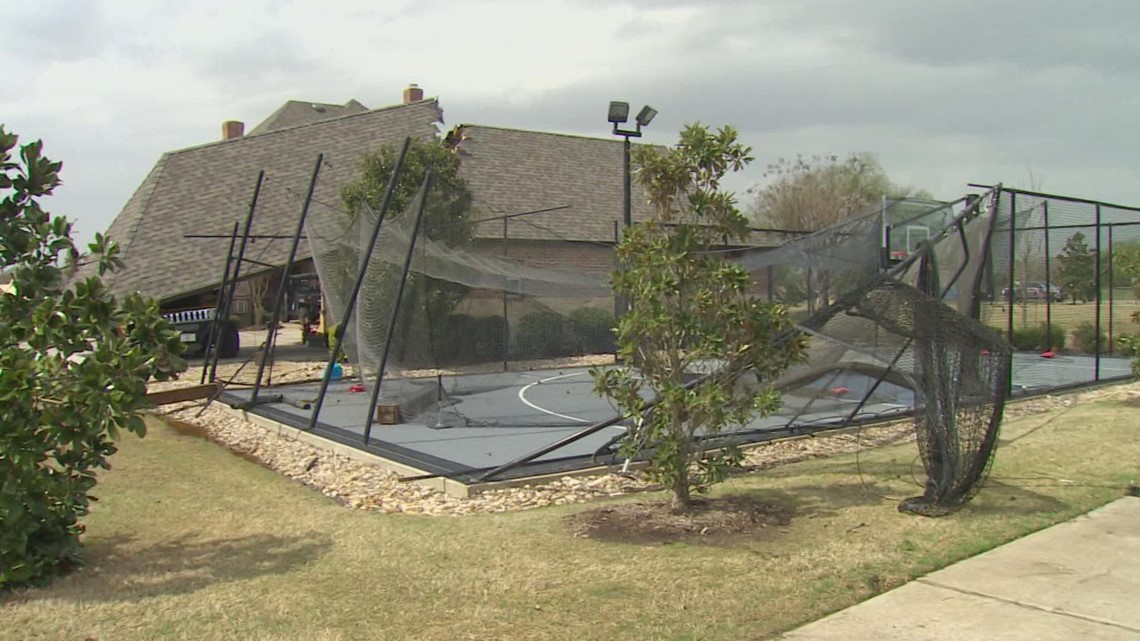
 www.wfaa.com
Why radar didn't pick up an EF-1 tornado in North Texas this week
Our area was under a tornado watch for most of the morning, but no tornado warnings were issued.
www.wfaa.com
blueheronNC
Member
Hmm

Here’s the threat 