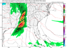
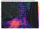
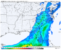
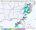
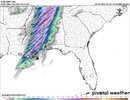
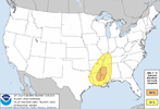
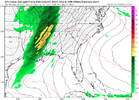
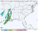
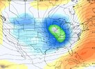
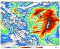
This one has some potential for higher quality moisture return with more aerial coverage.
-
Hello, please take a minute to check out our awesome content, contributed by the wonderful members of our community. We hope you'll add your own thoughts and opinions by making a free account!
You are using an out of date browser. It may not display this or other websites correctly.
You should upgrade or use an alternative browser.
You should upgrade or use an alternative browser.
Severe 3/30-4/2 Severe Weather
- Thread starter SD
- Start date
accu35
Member
NoSnowATL
Member
Gulf coast gonna steal this one with that look.
Brent
Member
Z
Zander98al
Guest
500mb placement a bit better for discreet convection than the last threat it looks like.
HSVweather
Member
Brent
Member
Z
Zander98al
Guest
Don't hold your breath but looks like this threat may be a 2 wave system like we had recently.
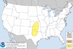
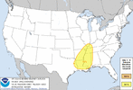
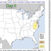
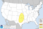
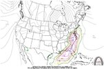
Yeah typical carolina split look here, forcing going north, cape chasing remnant qlcs going south.Day 5 and 6 severe probs added by the SPC. also notes D7 potential in the Carolinas but uncertainty with buoyancy and forcing (shocker)
View attachment 116227View attachment 116228
Looking back over it I will say the 0z euro looked pretty ominous for us vs the gfs
Yeah I was impressed by the shear from the euro. Would have loved to have soundingsYeah typical carolina split look here, forcing going north, cape chasing remnant qlcs going south.
Looking back over it I will say the 0z euro looked pretty ominous for us vs the gfs
Z
Zander98al
Guest
Convection looks a good bit more broken up, from previous runs for Alabama and Mississippi. Overall a bit better placment for discrete stuff
NWMSGuy
Member
Looking at timing from the GFS, Memphis looks to get into storm mode right around peak heating. 
NWMSGuy
Member
Anyone have any thoughts on the EURO run for this system?
Get the camera ready @Myfrotho704_
tennessee storm
Member
Look
Anyone have any thoughts on the EURO run for this system
tennessee storm
Member
Wind fields look really impressive with this system … large warm sector out ahead of a potent negative titled trough spells trouble … with impressive low level shear showing concerning for discrete activity out ahead main line … also not on 12z euro , system appears slowed down tad, so timing as now for Memphis area thinking early evening maybe now. But all modes severe hazard are on the table thus far . Plenty time watch for changes also meso stuff be more clearer… edit. I do think spc will pull trigger N show higher probs severe weather by end weekend , if things hold
Last edited:
(First Post)
I'm going to have some Severe Weather action on March 30th, it appears linear for my area, but there's a chance that the models will shift into a more discrete mode & a slower storm system, the SPC has a Slight Risk for my area on D5 & the Mississippi River Valley from Illinois to Louisiana & Mississippi on D6
EDIT: It looks like that the bulk of the Severe Weather on D5 is along & west of US-69
Last edited:
Z
Zander98al
Guest
That's about as high of a look for discreet convection you'll get with the euro lol. Veering of winds are better this go around from last event.Euro definitely did choose violence View attachment 116255
Z
Zander98al
Guest
Timing will change with this setup some, always does. as stupid as it sounds you will probably see a shift more east for higher threat area. Like clockwork it always happens lol. Checked some soundings for multiple areas, pretty good veering with winds. Better placement of 500mb winds like arcc said you'd rather have them coming more from west/southwest which they are.Wind fields look really impressive with this system … large warm sector out ahead of a potent negative titled trough spells trouble … with impressive low level shear showing concerning for discrete activity out ahead main line … also not on 12z euro , system appears slowed down tad, so timing as now for Memphis area thinking early evening maybe now. But all modes severe hazard are on the table thus far . Plenty time watch for changes also meso stuff be more clearer… edit. I do think spc will pull trigger N show higher probs severe weather by end weekend , if things hold
Z
Zander98al
Guest
BHS1975
Member
Hey look at us go ! View attachment 116268
That's a lot for day 6.
Sent from my iPhone using Tapatalk
It will be long gone by then.That's a lot for day 6.
Sent from my iPhone using Tapatalk
Z
Zander98al
Guest
Z
Zander98al
Guest

S Central MS.
Z
Zander98al
Guest
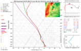
7.3 ehi on a global OOF.
S Central MS.
Not much of a dry layer anywhere in that sounding.
NBAcentel
Member
Slightly less SW flow with this system in Dixie, higher ceiling for supercells, still leaning on the side of a QLCS with pinwheeling vorticity maximums/SWs embedded in the H5 trough
NoSnowATL
Member
WhatSlightly less SW flow with this system in Dixie, higher ceiling for supercells, still leaning on the side of a QLCS with pinwheeling vorticity maximums/SWs embedded in the H5 trough
NWMSGuy
Member
Looks like a crazy day for the Mississippi River Valley, also with Supercells in the Enhanced risk area, I'm not going to be surprised at yet another Moderate Risk for Mississippi, Climo favors Dixie Alley for Severe Storms until at least April/May
Last edited:
HSVweather
Member

