-
Hello, please take a minute to check out our awesome content, contributed by the wonderful members of our community. We hope you'll add your own thoughts and opinions by making a free account!
You are using an out of date browser. It may not display this or other websites correctly.
You should upgrade or use an alternative browser.
You should upgrade or use an alternative browser.
Severe 3/3-6 2025 Severe
- Thread starter SD
- Start date
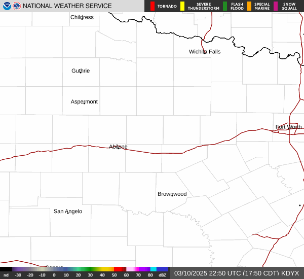
Hatched area added

Darklordsuperstorm
Member

A little breezy
Lots of models with widespread 55-65mph gusts. Even if this really means 40-50mph that’s gonna do some damage


Shaggy
Member
Wilmington is saying we could gust 40-50 outside of the showers Wednesday before the storms even arrive. Quite the LLJ overhead.
A dynamic low level jet with wind
speeds up to 60 knots below 2k ft AGL will have little
resistance mixing to the surface in stronger embedded showers.
Gusts up in excess of 40 or 50 mph could be possible outside of
showers on Wednesday morning.
A dynamic low level jet with wind
speeds up to 60 knots below 2k ft AGL will have little
resistance mixing to the surface in stronger embedded showers.
Gusts up in excess of 40 or 50 mph could be possible outside of
showers on Wednesday morning.


Even without the enhanced chance for severe weather that NWS Raleigh mentioned in their forecast and taking into account these wind maps are probably overdone, these wind maps show that things are going to get rough for some folks on Wednesday.
Today has really uptrended over OK
NBAcentel
Member
Hmm 


BufordWX
Member
Today has really uptrended over OK
Im not looking forward to this. Went 10% tornado as well and its a middle of the night event as well.

Darklordsuperstorm
Member
This looks so close to a carbon copy of the last system. The dynamics with this system are super impressive. If we had sufficient instability over a broad area tomorrow would be a completely different story. With that said we all saw what happened a couple weeks ago. It won't take much instability tomorrow/tomorrow night to cause issues with damaging winds.
LukeBarrette
im north of 90% of people on here so yeah
Meteorology Student
Member
2024 Supporter
2017-2023 Supporter
We said the same thing LMAO
"Hmmmm"
LukeBarrette
im north of 90% of people on here so yeah
Meteorology Student
Member
2024 Supporter
2017-2023 Supporter
Really hoping this trends better so I can chase the afternoon (I have a physical meteorology exam at 9 am on Wednesday). Need it to trend slower for better afternoon destabilization.
Things have sped up from a couple days ago. It's a good thing instability is meager, because this would be a major severe outbreak otherwise.Really hoping this trends better so I can chase the afternoon (I have a physical meteorology exam at 9 am on Wednesday). Need it to trend slower for better afternoon destabilization.
LukeBarrette
im north of 90% of people on here so yeah
Meteorology Student
Member
2024 Supporter
2017-2023 Supporter

Need that cell in south-central VA like white women need starbucks
BufordWX
Member
BufordWX
Member
Lot of updraft potential showing up on the HRRR for tonight. Its gonna be interesting to see how things play out.
BufordWX
Member
The line is not wasting any time in forming.
BufordWX
Member
And there is the tornado watch…
BufordWX
Member
Things ramping up now.
Darklordsuperstorm
Member
He is sounding the alarm big time for this wind threat 

Brent
Member
He is sounding the alarm big time for this wind threat
Yeah there is a lot of wind with this thing. No doubt about that
Like the wind threat doesn't even really end with the line at 5am here
Pretty much unanimous agreement of widespread 40-50mph wind gusts with possibly 60+. Another thing that I believe could make this more impactful- we’re looking at several hours of high winds versus your typical squall line where high winds last 10 minutes.

Quick check of NWS forecasts and man they seem to really be lowballing the potential winds. FFC and BMX saying max gusts to 35-40mph whereas models are well into the 50’s and low 60’s. I know the models are likely overdone some but sheesh feels like some High Wind Warnings might be necessary in spots.
Brent
Member
Enhanced is a big bust here
Belle Lechat
Member
- Joined
- Aug 29, 2021
- Messages
- 1,547
- Reaction score
- 1,224
Texas
Belle Lechat
Member
- Joined
- Aug 29, 2021
- Messages
- 1,547
- Reaction score
- 1,224
Belle Lechat
Member
- Joined
- Aug 29, 2021
- Messages
- 1,547
- Reaction score
- 1,224
Belle Lechat
Member
- Joined
- Aug 29, 2021
- Messages
- 1,547
- Reaction score
- 1,224

Belle Lechat
Member
- Joined
- Aug 29, 2021
- Messages
- 1,547
- Reaction score
- 1,224

Belle Lechat
Member
- Joined
- Aug 29, 2021
- Messages
- 1,547
- Reaction score
- 1,224


Belle Lechat
Member
- Joined
- Aug 29, 2021
- Messages
- 1,547
- Reaction score
- 1,224
Belle Lechat
Member
- Joined
- Aug 29, 2021
- Messages
- 1,547
- Reaction score
- 1,224
North Central Texas. This warning is unlike other recent ones in that it says
THIS STORM IS CURRENTLY PRODUCING 70 MPH WINDS AND
WIND DAMAGE NEAR DECATUR IN WISE COUNTY!
EXPECT CONSIDERABLE TREE DAMAGE.
THUNDERSTORM DAMAGE THREAT...CONSIDERABLE
WIND THREAT...OBSERVED
442 AM CST TUE MAR 4 2025
THE NATIONAL WEATHER SERVICE IN FORT WORTH HAS ISSUED A
* SEVERE THUNDERSTORM WARNING FOR...
WISE COUNTY IN NORTH CENTRAL TEXAS...
DENTON COUNTY IN NORTH CENTRAL TEXAS...
EASTERN PARKER COUNTY IN NORTH CENTRAL TEXAS...
TARRANT COUNTY IN NORTH CENTRAL TEXAS...
WESTERN DALLAS COUNTY IN NORTH CENTRAL TEXAS...
Belle Lechat
Member
- Joined
- Aug 29, 2021
- Messages
- 1,547
- Reaction score
- 1,224
That's some intense looking tornadic area. And the lightning map in another post, it's the first time I've seen a blue concentration, same area.
Belle Lechat
Member
- Joined
- Aug 29, 2021
- Messages
- 1,547
- Reaction score
- 1,224
Texas. According to 300k customers, each customer can be a family, without power in DFW area.


Love Field had a gust of 68 kts.
90 mph winds were approaching Collin County Regional Airport, but the anemometer there is no longer giving wind readings.
Love Field had a gust of 68 kts.
90 mph winds were approaching Collin County Regional Airport, but the anemometer there is no longer giving wind readings.
Last edited:
Belle Lechat
Member
- Joined
- Aug 29, 2021
- Messages
- 1,547
- Reaction score
- 1,224
604 AM CST TUE MAR 4 2025
THE NATIONAL WEATHER SERVICE IN NORMAN HAS ISSUED A
* TORNADO WARNING FOR...
CENTRAL ATOKA COUNTY IN SOUTHEASTERN OKLAHOMA...
THE NATIONAL WEATHER SERVICE IN NORMAN HAS ISSUED A
* TORNADO WARNING FOR...
CENTRAL ATOKA COUNTY IN SOUTHEASTERN OKLAHOMA...
Belle Lechat
Member
- Joined
- Aug 29, 2021
- Messages
- 1,547
- Reaction score
- 1,224
North of Austin. I was going to go outside, but then nope.
Belle Lechat
Member
- Joined
- Aug 29, 2021
- Messages
- 1,547
- Reaction score
- 1,224
612 AM CST TUE MAR 4 2025
THE NATIONAL WEATHER SERVICE IN NORMAN HAS ISSUED A
* TORNADO WARNING FOR...
NORTH CENTRAL ATOKA COUNTY IN SOUTHEASTERN OKLAHOMA...
613 AM CST TUE MAR 4 2025
THE NATIONAL WEATHER SERVICE IN TULSA HAS ISSUED A
* TORNADO WARNING FOR...
WESTERN MCINTOSH COUNTY IN SOUTHEASTERN OKLAHOMA...
SOUTHEASTERN OKMULGEE COUNTY IN NORTHEASTERN OKLAHOMA...