-
Hello, please take a minute to check out our awesome content, contributed by the wonderful members of our community. We hope you'll add your own thoughts and opinions by making a free account!
You are using an out of date browser. It may not display this or other websites correctly.
You should upgrade or use an alternative browser.
You should upgrade or use an alternative browser.
Severe 3/23-26 Severe Weather
- Thread starter SD
- Start date
Shaggy
Member
Suspicious look to it. Hate night time severe
Claycochaser
Member
Appears to be right over the wild animal safari park attm
Claycochaser
Member
Now crossing Hamilton rd/Hwy 27. Modestly populated area.
Just checked on my Aunt in LaGrange, GA. She's in the closet and ready to move. 4 close calls this year and she's done! Yall all be safe!!!
Out and about this morning and found the current location of the surface boundary across central Talladega county. Temp dropped six degrees in six miles or so.
Last edited:
gawxnative
Member
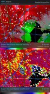
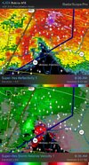
Media Reports of structural damage in Pine Mountain, White Sulphur Springs, and Warm Springs...
gawxnative
Member
Scanner traffic "multiple entrapments" Numerous Injuries" in West Point Area, (Area of Kia Plant) ....Media Reports of structural damage in Pine Mountain, White Sulphur Springs, and Warm Springs...
Shaggy
Member
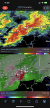
Yeah that's gonna be a tornado pretty soon if it's not already on the groundStorm west of Milledgeville trying to spin something up.View attachment 134566
Not gonna pretend, if we get the same supercell dominated storm mode this evening we are gonna have big issues.
gawxnative
Member
Additional Scanner: Person "entraped/blocked in their house but ok-Reporting "All the houses next to him are leveled/gone" (Near Troup/Harris County Line/Pine Mountain)Scanner traffic "multiple entrapments" Numerous Injuries" in West Point Area, (Area of Kia Plant) ....
There's a tiger missing from the Pine Mountain area where the wildlife safari is! I hope it's found soon and that the people trapped are rescued safely!
Current radar and warnings
View attachment 032623.mp4
Current watches
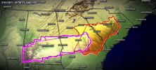
SPC D1
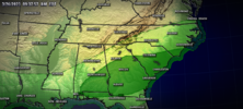
12z HRRR reflectivity
View attachment 032623.mp4
Current MCDs
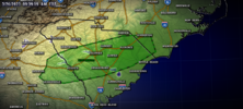
View attachment 032623.mp4
Current watches

SPC D1

12z HRRR reflectivity
View attachment 032623.mp4
Current MCDs

Shaggy
Member
Those training cells would be of concern if they can get clean air in front of them. They have that look
Getting some decent structures in S AL
Those training cells would be of concern if they can get clean air in front of them. They have that look
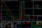
Really right now the only thing stopping them is lack of low level shear which will increase as the day goes by and especially into the evening. However, definitely still dominantly supercell storm mode.
The ARW shows how this even will bust if it does. While westerly wind vectors at 500mb are a check mark for supercells across the SE most of the time; this time it also parallels the surface boundary. It won’t take much to congeal into a convective junk pile.

