For the Carolinas, the timing differences are hilarious at this range. HRRR gets some spin going in a big rainy mass for central SC tomorrow afternoon, while the NAM3k has a wee hours Thu morning threat for coastal plain and eastern piedmont of NC. Wind field/shear looks pretty impressive generally but as has been noted by the NWS's and SPC mechanism for actually getting stuff going could be lacking
-
Hello, please take a minute to check out our awesome content, contributed by the wonderful members of our community. We hope you'll add your own thoughts and opinions by making a free account!
You are using an out of date browser. It may not display this or other websites correctly.
You should upgrade or use an alternative browser.
You should upgrade or use an alternative browser.
Severe 3/21-3/24 Severe Weather
- Thread starter SD
- Start date
Shaggy
Member
3k nam fires off plenty of storms for SC/NC so if that trend continues all storm threats from hail to tornados would still be on the table.For the Carolinas, the timing differences are hilarious at this range. HRRR gets some spin going in a big rainy mass for central SC tomorrow afternoon, while the NAM3k has a wee hours Thu morning threat for coastal plain and eastern piedmont of NC. Wind field/shear looks pretty impressive generally but as has been noted by the NWS's and SPC mechanism for actually getting stuff going could be lacking
Shaggy
Member
These drone videos really show the way the winds are working around the tornado. You can see little inflow streaks and at 30 seconds or so you can see a quick vortices spin up in the field to the left of the main tornado.
HSVweather
Member
Z
Zander98al
Guest
Nws is pretty confident on violent tornado potential in the Jackson watch area. I'm wondering if they're thinking a boundary will setup somewhere in the delta, localizing strong tornado potential
Also, just before that little vortex spins up, in that same field there is a pile of bushes or debris or something that get pulled into the tor almost one by one in a straight line, laying out the inflow nicely. Unreal video to watch over and overThese drone videos really show the way the winds are working around the tornado. You can see little inflow streaks and at 30 seconds or so you can see a quick vortices spin up in the field to the left of the main tornado.
12z HRRR more aggressive on severe prospects for central and even upstate SC tomorrow afternoon, continuing up into NC
Nothing high end but impressive wind field and here's the UH swaths.png")
NBAcentel
Member
Yeah that hrrr run opens eyes a bit, 

Lots of low level instability and just enough venting aloft favorable for maintenance of supercells and winds near the SFC are backed

Lots of low level instability and just enough venting aloft favorable for maintenance of supercells and winds near the SFC are backed
Z
Zander98al
Guest
My exact thinking ?
Z
Zander98al
Guest
WOW!
Z
Zander98al
Guest
New HRRR run has a tornadic cell spawning on the LA/MS border south border* and staying intact all the way to north Alabama/ north Mississippi border. Along with many other cells
NBAcentel
Member
Damn the QLCS was slower then modeled. Really changed the setup
Fountainguy97
Member
Atmosphere is already primed for storm activity. We will be tracking cells by 1pm.
Z
Zander98al
Guest

Z
Zander98al
Guest
Earlier than that 11 o'clock you'll start seeing some probably.Atmosphere is already primed for storm activity. We will be tracking cells by 1pm.
Fountainguy97
Member
wouldn't surprise me. Those HRRR cells popping up in LA by lunch will spin up quickly. Could be a day where a few cells get TOR warned 20 minutes after they fire. Days like this they are basically rotating from the start.Earlier than that 11 o'clock you'll start seeing some probably.
HSVweather
Member
Is this the start of those isolated cells, North of NO and around Hattiesburg?

Z
Zander98al
Guest
Yes more and likely, probably take it awhile to get going though, going to be a real sloppy afternoon but with those sloppy conditions you'll have some cells really flourish
HSVweather
Member
There are a few breaks in NE MS but not many

Z
Zander98al
Guest
You might get a high risk for that south central Mississippi area soon, your probably going to see a few long track stronger tornadoes there just based off of looking at guidance, mesolow is currently sitting over northwest Mississippi. It's about to be a dangerous afternoon over Mississippi and west Alabama I'm afraid.
Id probably expect your first PDS watch of the year for that area.
Id probably expect your first PDS watch of the year for that area.
EMTime
Member
It may not matter but here in Monroe County ms, the sun is out big time.
Temps are rising fast. Winds are howling out of the south.
Temps are rising fast. Winds are howling out of the south.
Z
Zander98al
Guest
Tornado warning north of lake Charles!
EMTime
Member

KatrinaRuns
Member
Sun is out in Tuscaloosa/Northport
HSVweather
Member
Tornado warning north of lake Charles!

HSVweather
Member
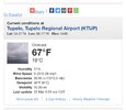
What’s the dewpoint there?
HSVweather
Member
It looks like the 60+ dewpoints are from demoplis to meridian but shouldBeing surging north.

Z
Zander98al
Guest
Looks like this cell in south Mississippi is about to take off, if it can distinguish itself from the pack. 
Z
Zander98al
Guest
If the QCLS is slowing down expect a bit more coverage north of severe weather than previously thought more moisture will build in into north MS.It looks like the 60+ dewpoints are from demoplis to meridian but shouldBeing surging north.
View attachment 116045
Z
Zander98al
Guest
TDS with the north of lake Charles tornado.
Now it's gone* quick one
Now it's gone* quick one
Usmeagle2005
Member
At 10 am in Tupelo it was still only 48 for the dew point.It looks like the 60+ dewpoints are from demoplis to meridian but shouldBeing surging north.
View attachment 116045
Attachments
EMTime
Member
52 atmWhat’s the dewpoint there?
HSVweather
Member
Z
Zander98al
Guest
It's a bit wonky right now but it's a mesocyclone now, 

HSVweather
Member
Z
Zander98al
Guest

Z
Zander98al
Guest
Current 3km ehi. .gif")
Z
Zander98al
Guest
Tight rotation within the line heading to near Vicksburg.
Z
Zander98al
Guest
Surprised at the no warning. 