• Hello, please take a minute to check out our awesome content, contributed by the wonderful members of our community. We hope you'll add your own thoughts and opinions by making a free account!

Tropical 2025 Tropical Thread

This year's hurricane season has been frustrating and hard to predict for forecasters and casual weather watchers. The latest disturbance that is being watched is typical for an untypical season like the one we are having. If that system stalls out over Hispaniola as the models are suggesting it will be ripped to shreds by the mountainous terrain and will pose no threat anywhere else as a tropical system.
 
The 0Z UKMET once again has just a rather weak low (not even a TC on the textual output; it has yet to show TCG in the Caribbean on this output though it awhile back had several runs with TCG east of the Lesser Antilles) and again into Nicaragua. The last 5 runs have shown a weak low either hitting Nicaragua (0Z 10/19, 12Z 10/18), barely E of Nic. but heading into it (0Z 10/18, 12Z 10/17), or still 200 miles E of Nic. but likely headed into it (0Z 10/17).

Looking at the H5 vorticity, it appears that as the AOI on the TWO comes into the E Car that a portion of it turns sharply right like the GFS but unlike that model it never develops. Then what looks like a split from this, possibly incorporating additional vorticity coming off northern S America, causes the weak low to move into the SW Caribbean, which then goes into Nicaragua.

So, the UKMET remains a SW outlier. I should add that yesterday’s 12Z JMA is similar and it has been similar all of the way back to the 12Z 10/15 run. So, the JMA has had 4 12Z runs in a row with just a weak low into Nicaragua or just offshore headed there.

Thus the UKMET and JMA have a good chance to both either fail badly or end up doing the best of the major operationals with this.

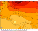
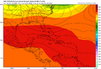
0Z 10/19 UKMET 156:
IMG_4902.png

12Z 10/18 JMA 168:
IMG_4901.png
 
Last edited:
Of course, I always look for a prominent "starter" event like a deep trough or combination with a western Atlantic Basin hurricane. There is good support for a major system affecting the Greater Antilles in the longer term, then accelerating north and possibly merging or phasing with a big cold trough complex close to the East Coast. It is very early in the game, but the waters are very warm and the cPk air mass will likely head toward Texas and Mexico before pushing through Dixie. If a gap is present, the big cyclonic circulation may track due north or possibly undergo a jog toward Virginia, the Mid-Atlantic or New England. For all of this to happen, we must see a strong Rex or Omega block in Nunavut AR. And should this cyclonic path occur, we can finally start to get rid of the "Indian Summer In Overdrive" pattern.


Prepared by Meteorologist LARRY COSGROVE
 
The 0Z UKMET once again has just a rather weak low (not even a TC on the textual output; it has yet to show TCG in the Caribbean on this output though it awhile back had several runs with TCG east of the Lesser Antilles) and again into Nicaragua. The last 5 runs have shown a weak low either hitting Nicaragua (0Z 10/19, 12Z 10/18), barely E of Nic. but heading into it (0Z 10/18, 12Z 10/17), or still 200 miles E of Nic. but likely headed into it (0Z 10/17).

Looking at the H5 vorticity, it appears that as the AOI on the TWO comes into the E Car that a portion of it turns sharply right like the GFS but unlike that model it never develops. Then what looks like a split from this, possibly incorporating additional vorticity coming off northern S America, causes the weak low to move into the SW Caribbean, which then goes into Nicaragua.

So, the UKMET remains a SW outlier. I should add that yesterday’s 12Z JMA is similar and it has been similar all of the way back to the 12Z 10/15 run. So, the JMA has had 4 12Z runs in a row with just a weak low into Nicaragua or just offshore headed there.

Thus the UKMET and JMA have a good chance to both either fail badly or end up doing the best of the major operationals with this.

0Z 10/19 UKMET 156:
View attachment 175572

12Z 10/18 JMA 168:
View attachment 175573

Followup from yesterday:
-12Z UKMET was still another headed into Nicaragua with a weak low

-12Z JMA: after four 12z runs in a row of weak low into Nicaragua, yesterday’s was a bit stronger (1004-5 mb) and slightly further N with a Mitch-like track that skimmed the N coast of Honduras
 
There remains the 3rd main model option for 98L (other 2 options being either like GFS of sharp turn right or Euro/Icon slower development allowing it to get to W Car and develop there) that of many UKMET runs in a row (including today’s 0Z) that never get it much more organized than it is now due to a splitting off of the main H5 vorticity, which turns sharply north in the E Car leaving behind just a weak surface low. That weak low then continues westward in the S Caribbean with the run then ending (168) with just a 1007 low that’s likely about to dissipate near the Nicaragua coast underneath a pretty solid ridge.

The JMA had been similar though the latest run (yesterday’s 12Z that I just posted) developed it into a 1004-5 TD to possibly low end TS that skims the N coast of Honduras to S Belize at 192 (end).

Interestingly, the 0Z CMC was kind of similar to the 12Z JMA though it survives Honduras and then turns NE as a TS over WC Cuba and then the NW Bahamas.

We’ll see whether or not this is one of those cases of the UKMET being genesis shy/too weak due to the splitting of energy. It (along with the JMA for the most part) has a good chance to either bust badly or score a coup.
 
With Melissa headed to ~27.25 ACE as of 0Z this evening, it will then be only 5 lower than Erin. I see very little chance (5%) that it won’t get an additional >5 ACE the next 96 hours before extratropical transition. Thus I feel quite confident that Melissa’s ACE will exceed Erin’s 32.2.

We’re now at 123.81 season to date with low 130s+ highly likely through Melissa.
 
You know for all the talk of models sucking this year they really nailed this

Except the GFS that insisted it would go to Hispanola

I’d argue that the UKMET was even worse than the GFS. Remember those runs taking it into Nicaragua and then only slowly correcting northeast? A lot of the blame has to be on it having too weak a system thus causing it to prog a lower mean level of steering, which took it too far SW.

The UKMET is a strange model because it is so hit or miss. It was absolutely stellar with Imelda (even a bit better than the very good Icon) with it never even coming close to landfalling on the SE US. It was also the best with Ian (again Icon was 2nd best) for BOTH US hits: it turned right into SW FL on every run within 4 days out vs others that were too far N until later on and it had the 2nd hit on mid or upper SC on every run within 4 days vs others that took longer to have their first run with a mid to upper SC hit. They were hitting NE FL, GA, and lower SC for a number of runs while UK was CHS north. In other words, the UKMET was furthest right and won.

And then there are others for which UKMET was the worst. When the UKMET is the worst, it’s usually too far left (like for Melissa).

I think I know the formula that might work best. When UKMET is a left outlier, bet against it. But when it is a right outlier, bet on it.

Oh yeah I distinctly remember the ukmet not even showing a storm

But yes I also remember it being like way left with Laura famously... It kept hitting Texas
 
Sep 17th through Nov 3rd highest ACE back to 1851 based on tracks on record and my ACE calculations/estimates:

1878: ~105-110
1894: ~100-110
2025: 94
1893: ~89
2017: 88
2024: 86
2016: 85
2005: 85


So, 2025 had the highest Sept 17th-Nov 3rd ACE since 1895 and the 3rd highest on record!


Sept 17th-Nov 3rd ACE 2025-2010:

2025: 94
2024: 86
2023: 42
2022: 58
2021: 64
2020: 70
2019: 58
2018: 45
2017: 88
2016: 85
2015: 32
2014: 36
2013: 7
2012: 44
2011: 45
2010: 51

—————
Edit: As we move forward through the rest of the season and look at Sept. 17th+ ACE, these seasons would overtake 2025 if it has no more ACE: 1932, 2005, 2020, and 2024 with 1893, 1896, and 1961 coming very close.
 
Last edited:
That’s why ACE is dumb data. Helps nothing and means nothing.

That’s because you’re looking for a strictly impact related index. ACE is quite meaningful and is a great way of counting how much activity there’s been compared to other seasons. It’s a great way to measure the amount of energy being converted from potential to kinetic by the oceans. Impact is irrelevant to it as we know. Actually, an impact usually reduces ACE potential of a particular storm vs if it were to stay OTS.
 
That’s because you’re looking for a strictly impact related index. ACE is quite meaningful and is a great way of counting how much activity there’s been compared to other seasons. It’s a great way to measure the amount of energy being converted from potential to kinetic by the oceans. Impact is irrelevant to it as we know. Actually, an impact usually reduces ACE potential of a particular storm vs if it were to stay OTS.
I don't know, if it doesn't hit land then why would the strength of the season matter. It should be impact driven like tornado ratings.
 
I just where a University of Miami study ranked the Google Deep Mind AI model as the best performing model during this year's hurricane season up to this point. That might be something to pay more attention compared to the traditional models many of us look at. The worst performing model is the GFS.
 
Last edited:
I don't know, if it doesn't hit land then why would the strength of the season matter. It should be impact driven like tornado ratings.
I’m far from knowledgeable on the subject but it would seem to me that the ACE would drive weather patterns down the road that are not directly associated with land impacts. Weather patterns and such later down the road that would direct affect land masses.
 
Back
Top