• Hello, please take a minute to check out our awesome content, contributed by the wonderful members of our community. We hope you'll add your own thoughts and opinions by making a free account!

Tropical 2025 Tropical Thread

Since the season is over I’d give this past year a F+. Zero storms to track, Gulf was dead.

Not so fast!

1. This won’t come anywhere close to the western basin but it may add some ACE:

Tropical Weather Outlook
NWS National Hurricane Center Miami FL
800 PM EDT Sun Oct 12 2025

For the North Atlantic...Caribbean Sea and the Gulf of America:

Central Tropical Atlantic (AL97):
Showers and thunderstorms have increased in association with a
small area of low pressure located about 900 miles west-southwest of
the Cabo Verde Islands. Environmental conditions are forecast to
become more favorable for further development of this system during
the next few days, and a tropical depression is likely to form by
the middle part of this week while it moves to the west-northwest
then northwest at 15 to 20 mph across the central tropical Atlantic.
* Formation chance through 48 hours...medium...60 percent.
* Formation chance through 7 days...high...70 percent.

$$
Forecaster Blake

2. Of more importance landfall potential-wise, a followup AEW has been forecasted by a number of runs of various models and ensemble members to develop close to the Lesser Antilles in ~a week. The 18Z GFS and Icon have it, for example.
 
The 0Z UKMET is the first run with the aforementioned followup MDR AEW as a TD with it going just N of due W at a rather brisk pace through the middle of the Lesser Antilles on Sunday (10/19): keep in mind that this is a top tier model that is sometimes genesis shy

NEW TROPICAL CYCLONE FORECAST TO DEVELOP AFTER 150 HOURS
FORECAST POSITION AT T+150 : 13.5N 57.7W

LEAD CENTRAL MAXIMUM WIND
VERIFYING TIME TIME POSITION PRESSURE (MB) SPEED (KNOTS)
-------------- ---- -------- ------------- -------------
1200UTC 19.10.2025 156 13.8N 59.5W 1010 32
0000UTC 20.10.2025 168 14.1N 62.8W 1009 34
——————

Also, the Icon (0Z) has it yet again.
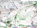
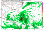
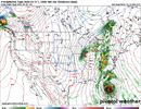
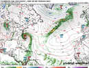
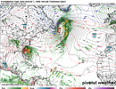
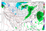
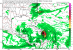
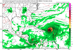
Euro and GFS both agree

EURO
1760353029234.png

GFS


1760353063552.png
 
We got Lorenzo btw

BULLETIN
Tropical Storm Lorenzo Advisory Number 1
NWS National Hurricane Center Miami FL AL122025
500 AM AST Mon Oct 13 2025

...TROPICAL STORM LORENZO FORMS OUT IN THE CENTRAL TROPICAL
ATLANTIC...


SUMMARY OF 500 AM AST...0900 UTC...INFORMATION
----------------------------------------------
LOCATION...14.2N 40.3W
ABOUT 1095 MI...1760 KM W OF THE CABO VERDE ISLANDS
MAXIMUM SUSTAINED WINDS...45 MPH...75 KM/H
PRESENT MOVEMENT...NW OR 305 DEGREES AT 17 MPH...28 KM/H
MINIMUM CENTRAL PRESSURE...1006 MB...29.71 INCHES
——————-


FORECAST POSITIONS AND MAX WINDS

INIT 13/0900Z 14.2N 40.3W 40 KT 45 MPH
12H 13/1800Z 15.0N 41.7W 40 KT 45 MPH
24H 14/0600Z 16.2N 43.4W 40 KT 45 MPH
36H 14/1800Z 18.0N 44.4W 45 KT 50 MPH
48H 15/0600Z 20.1N 44.7W 50 KT 60 MPH
60H 15/1800Z 22.4N 44.2W 55 KT 65 MPH
72H 16/0600Z 25.1N 42.6W 60 KT 70 MPH
96H 17/0600Z 30.9N 36.9W 55 KT 65 MPH
120H 18/0600Z 33.2N 29.6W 45 KT 50 MPH

$$
Forecaster Papin
 
The 0Z UKMET is the first run with the aforementioned followup MDR AEW as a TD with it going just N of due W at a rather brisk pace through the middle of the Lesser Antilles on Sunday (10/19): keep in mind that this is a top tier model that is sometimes genesis shy

NEW TROPICAL CYCLONE FORECAST TO DEVELOP AFTER 150 HOURS
FORECAST POSITION AT T+150 : 13.5N 57.7W

LEAD CENTRAL MAXIMUM WIND
VERIFYING TIME TIME POSITION PRESSURE (MB) SPEED (KNOTS)
-------------- ---- -------- ------------- -------------
1200UTC 19.10.2025 156 13.8N 59.5W 1010 32
0000UTC 20.10.2025 168 14.1N 62.8W 1009 34
——————

Also, the Icon (0Z) has it yet again.

This will likely need its own thread at some point:

Consistent with the 0Z, the 12Z UKMET has the followup MDR system moving WNW through the central Lesser Antilles on 10/19 and then into the far E Caribbean:


NEW TROPICAL CYCLONE FORECAST TO DEVELOP AFTER 138 HOURS
FORECAST POSITION AT T+138 : 13.9N 57.2W

LEAD CENTRAL MAXIMUM WIND
VERIFYING TIME TIME POSITION PRESSURE (MB) SPEED (KNOTS)
-------------- ---- -------- ------------- -------------
1200UTC 19.10.2025 144 14.2N 59.0W 1010 33
0000UTC 20.10.2025 156 14.6N 61.9W 1010 34
1200UTC 20.10.2025 168 15.1N 64.9W 1009 35
 
All 12Z ops (except CMC’s near Leewards) have shifted TCG from the prior favored E of Car to the C Car, which matches favored climo. TCG there would be ~10/20-10/23.
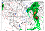
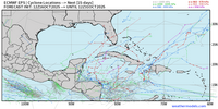
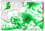
Check out the 12Z EPS, which has a whopping 18 H (36%) with 11 in the dangerous W Car and 7 recurving in SW ATL:
IMG_4872.png
 
All 12Z ops (except CMC’s near Leewards) have shifted TCG from the prior favored E of Car to the C Car, which matches favored climo. TCG there would be ~10/20-10/23.
Check out the 12Z EPS, which has a whopping 18 H (36%) with 11 in the dangerous W Car and 7 recurving in SW ATL:
View attachment 175505
It’s hard to imagine we get the through the season without the western Caribbean and Gulf getting threatened. With nothing in the Gulf this year so far to those SST’s are like bath water
 
I'm just not sure I buy anything in the Gulf at this point given it's mid October now and will be late October by then. It's getting very late for that. It's not even about water temps at this point any front will deflect it

I could see a sharp recurve over Cuba and the Bahamas maybe

Or it never goes north and goes into Mexico
 
And from that spot it’s moving NE OTS.

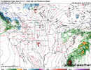
Yup I'm thinking it misses the US unless something crazy happens I mean look at the trough over the Plains. If that's there it has no chance

The best hope for something interesting is like Michelle 2001 where it goes across Cuba and then the Bahamas probably as a big hurricane

And it's almost November by then the season is shutting down quickly from west to east
You would need a more due north exit to run the coast or an occlusion like Sandy.
 
Regarding the E MDR AEW, here are the 12Z operational runs:

Icon joining the consensus turning it sharply right as it goes into DR after forming in E Caribbean; also very weak entire run

CMC once again is the only model with a TCG E of the Lesser Antilles; TS goes through Windwards; it like the Icon joins the consensus turning it sharply right as it, too, goes N over DR. Then the weakened main part moves NE toward Bermuda

GFS forms in E Caribbean and then moves N over PR followed by turn to NE/OTS

UKMET text again shows no TCG through day 7 but again a sfc low is there (1007 mb) that’s further S than 0Z with it 300 miles S of Jamaica moving slowly W at 168; so this not turning right by 168 is exception so far of 12Z operationals

JMA only out to 72 so far (inconclusive)

Euro is next
 
This MDR AEW just made the TWO for the first time (0/20):

Tropical Weather Outlook
NWS National Hurricane Center Miami FL
200 PM EDT Thu Oct 16 2025

For the North Atlantic...Caribbean Sea and the Gulf of America:

1. Caribbean Sea:
A tropical wave located over the tropical central Atlantic is
expected to move westward at 15 to 20 mph during the next several
days. Some slow development of this system is possible when
it reaches the central portion of the Caribbean Sea by the middle
part of next week.
* Formation chance through 48 hours...low...near 0 percent.
* Formation chance through 7 days...low...20 percent.
 
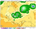
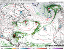
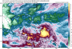
Fwiw due to it being way out in fantasyland, the 12Z Euro has Mitch-like/Eta-like/Iota-like flooding in N Honduras as it stalls just to the N of Honduras for a few days and intensifies followed by E and then ENE/NE movement to W of Jamaica headed toward C Cuba at the end as a trough picks it up.
 
Last edited:
Fwiw due to it being way out in fantasyland, the 12Z Euro has Mitch-like/Eta-like/Iota-like flooding in N Honduras as it stalls just to the N of Honduras for a few days and intensifies followed by E and then ENE/NE movement to W of Jamaica headed toward C Cuba at the end as a trough picks it up.
1760639582745.png
 
This has been one weird season, usually a cool Neutral ENSO means an active season for landfalling storms in the US. But I think the high activity in the EPAC so close to MX kept sinking diverging winds over the Caribbean/southern gulf despite below average shear.
On AUG 01 the pattern flipped to an east coast trof and it hasnt changed
 
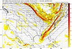
Could be the season finale on anything close to the US View attachment 175533

Ensembles as well as this time of year climo/history suggest that E NC has almost as much of a chance at getting hit directly by this as S or C FL, including a scenario where both get hit. I’m not saying either is favored to get hit though. Right now neither is at high risk but a nontrivial risk is there.
 
In a big change from prior runs, the 12Z CMC hits Nicaragua on 10/24-5 with a strong TS!

12Z UKMET: still no actual TCG shown in textual output but 1007 mb low is E of Nicaragua headed slowly in the direction of Nicaragua. Don’t know yet if it will landfall there though. Run not finished.
Edit: looks like it.
 
This last gasp of the 2025 hurricane season would be the first system to develop in the Caribbean this year. Conditions there are more favorable than they have been with little wind shear and warm water temperatures to inhibit development. It looks like the NHS thinking is that this disturbance tracks almost due west into Central America for now. It is still something for the East Coast to keep an eye on as the track and potential intensity of anything that might develop is still up in the air.
 
Back
Top