• Hello, please take a minute to check out our awesome content, contributed by the wonderful members of our community. We hope you'll add your own thoughts and opinions by making a free account!

Tropical 2025 Tropical Thread

Atlantic may get marginally favorable in a few days and last through about day 7. Pattern looks to still favor passing development west if it doesn't find the weakness in the far east Atlantic. Its still not a classic well west into the US pattern look with no ridging over SE Canada but we could see a coastal scraper
 
Per Joe Bastardi yesterday in the free video, this is and will likely end up being the quietest Labor Day weekend for the globe as a whole tropically (not Atlantic specifically as 2024, for one, was equally quiet) of most of our lifetimes. There was just an Invest in the EPAC and the remnants of a TD in SE Asia. That was it, which is fascinating!
 
Per Joe Bastardi yesterday in the free video, this is and will likely end up being the quietest Labor Day weekend for the globe as a whole tropically (not Atlantic specifically as 2024, for one, was equally quiet) of most of our lifetimes. There was just an Invest in the EPAC and the remnants of a TD in SE Asia. That was it, which is fascinating!

Followup: As a result of newly formed TS Kiko in the EPAC, 2025 is no longer the quietest Labor Day weekend tropically globally of Joe Bastardi’s lifetime. Why? Going back to 1950:

-1980: no TC in EPAC, WPAC, or N Indian. The only TC was TD7 forming 8PM Sun in the NATL and lasting through Mon. Thus, 2025 now having a TS already beats 1980 globally.

-1991 is debatable:
-no TC in EPAC or N Indian
-WPAC had a dissipating Harry, probably down to only a TD, on Sat, and a new TD on Mon
-NATL: TD 5 dissipated on Sat
-So, unlike 2025, 1991 had no TS+ but there were 3 TDs during the weekend.
 

Thanks, lexx. The 12Z models today are much more active for the E MDR lemon than the runs from 24 hours ago.

12Z models for the E MDR lemon:

-Euro has a MH hit Bermuda on 9/14 (fwiw)

-GFS has a H pass 250 miles E of Bermuda on 9/13 (fwiw)

-Icon that Lexx posted at 168: has a minimal TS moving ~due W at 180 hours near 16N, 45W. That would be far enough S when also considering its near due W movement and a 600 dam H5 high to its N to be a potential concern for at least the NE Caribbean.

-CMC has a TD that later dissipates.

-UKMET has two separate weak lows and no TC. I’m throwing this weird solution out since it’s a clear outlier.

-JMA has a TD the furthest S of any major model with a TC. It’s at 14N, 45W, and moving WSW (unlike any other model with a TC) at end of its run (192). If that were to be real, it could be a legit concern at least for the Lesser Antilles. But all others are up at 16-19N then. And this is the JMA. An outlier JMA, especially to the left, is usually wrong. But we’ll see.
 
Last edited:
Fwiw, here are 12Z op. models not yet mentioned
-Euro: H recurves 250 miles SE of Bermuda

-CMC easily strongest run yet with 992 mb at ~17N, 47W moving WNW but then weakening back to 1005 mb and likely about to recurve E of Bermuda per H5/climo

-UKMET like last few runs no TC but still has organized LLC moving WNW to 22N,60W at 192; per H5 and climo, this is likely about to recurve probably meaning a miss of the US but even if so, could threaten Bermuda had this run gone out further

-JMA not as threatening as yesterday’s run when it had a TD moving WSW at 14N, 45W at 192; today’s is further N and moving WNW at ~17N, 45W at 192 as a TD; per H5 and climo likely not US threat from there with Bermuda needing to watch it more
 
Get that system father SW in the atlantic and slower that pattern is going right into a US hit lookView attachment 174664
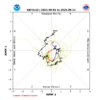
Just look at how much further west Erin made it than first progs and there's no reason to write anything off the table. Looks like anything that forms would safely recurve but a couple minor changes like you said change things alot
 
There’s an unusually large disagreement between GEFS and EPS regarding the MJO as they almost couldn’t be further apart!

1. GEFS heads for less threatening MC/W Pac (at low amp) pretty quickly and is on phase 6/7 border on 9/15 (supported by CMC):
IMG_4492.png

2. Euro ens stuck mainly in phase 2, the most dangerous phase for Conus H hits in JAS (supported by JMA):
IMG_4493.png


I may be forgetting but I can’t recall ever seeing this degree of disagreement between these two! I don’t have a good feel for which will verify more closely but of course it could end up between the two.
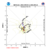
 
For the first time in a couple of days, the UKMET (0Z) has TCG for this. However, after moving WNW, then WSW for a short time, and then back to WNW, it dissipates at 16.4N, 48.3W:

NEW TROPICAL CYCLONE FORECAST TO DEVELOP AFTER 72 HOURS
FORECAST POSITION AT T+ 72 : 15.0N 35.4W

LEAD CENTRAL MAXIMUM WIND
VERIFYING TIME TIME POSITION PRESSURE (MB) SPEED (KNOTS)
-------------- ---- -------- ------------- -------------
0000UTC 05.09.2025 72 15.0N 35.4W 1011 28
1200UTC 05.09.2025 84 15.6N 37.0W 1012 26
0000UTC 06.09.2025 96 15.9N 39.8W 1012 28
1200UTC 06.09.2025 108 16.4N 42.7W 1012 32
0000UTC 07.09.2025 120 16.0N 45.7W 1013 29
1200UTC 07.09.2025 132 16.4N 48.3W 1013 29
0000UTC 08.09.2025 144 CEASED TRACKING
 
There’s an unusually large disagreement between GEFS and EPS regarding the MJO as they almost couldn’t be further apart!

1. GEFS heads for less threatening MC/W Pac (at low amp) pretty quickly and is on phase 6/7 border on 9/15 (supported by CMC):
View attachment 174665

2. Euro ens stuck mainly in phase 2, the most dangerous phase for Conus H hits in JAS (supported by JMA):
View attachment 174666


I may be forgetting but I can’t recall ever seeing this degree of disagreement between these two! I don’t have a good feel for which will verify more closely but of course it could end up between the two.

Followup:
Wow, what a massive fold by GEFS to EPS in today’s MJO forecast! Whereas the EPS is similar to yesterday’s idea of not going to the right side (MC), GEFS abandoned the typical counterclockwise path that it had yesterday through MC and then to 6/7. Today, it remains in 2 through 9/11 and then crawls “backwards” up to 1 followed by 8 as of 9/16 (all mainly inside the circle, i.e., low amp). The EPS is very similar:

Today’s (9/2) GEFS prog:
IMG_4495.png

Compare today’s GEFS to yesterday’s (9/1) GEFS prog showing the huge change:
IMG_4492.png

Thus, 9/2 EPS, which is very similar to 9/1 EPS, is very similar to 9/2 GEFS as it also ends up in low amp 8:
IMG_4496.png
 
The E MDR AOI is now red. This from Michael Lowry is a bit concerning at least for the E Caribbean:

Models all over the map

Forecast models generally agree on development, but the timing of and placement of development vary wildly, which of course affect the future track.

On the one hand the American GFS is quick to develop the system this week along the northern lobe of the tropical wave and as a result move it farther north and turn it quickly into the Atlantic for next week, missing the islands to the north.

On the other hand, the European model and Google DeepMind’s newest machine learning-based model that performed well during Hurricane Erin, take some time to develop the wave and do so on the southern side, which not surprisingly favors a track farther south and west and toward the eastern Caribbean for the middle part of next week.


—————————————
My concern is that the aforementioned Google Deepmind ensembles, which I know little about, did best with Erin per Lowry. As you can see on the Lowry image, its 0Z 9/2 run has 6 of its members from the E MDR AEW in a very dangerous location. What I don’t know is how many total members it has. Lowry’s diagram makes it look like most members go toward the Caribbean, but there are only 6 that actually get there by hour 210. Many are slower (still well E) and 4 of them are turning WNW to NW (at the top of his yellow circle) and we can’t see where they go after hour 210. But regardless, this ensemble’s average trajectory does look more dangerous than the EPS and is totally different from the GEFS.
 
Regarding the MDR 30/70, the 12Z ICON is much weaker than and S of the 0Z run and has WSW motion to 15N, 49W at 168 well below a 600 dm H5 high at a steady state 1003 mb/TS.
 
For the first time in a couple of days, the UKMET (0Z) has TCG for this. However, after moving WNW, then WSW for a short time, and then back to WNW, it dissipates at 16.4N, 48.3W:

NEW TROPICAL CYCLONE FORECAST TO DEVELOP AFTER 72 HOURS
FORECAST POSITION AT T+ 72 : 15.0N 35.4W

LEAD CENTRAL MAXIMUM WIND
VERIFYING TIME TIME POSITION PRESSURE (MB) SPEED (KNOTS)
-------------- ---- -------- ------------- -------------
0000UTC 05.09.2025 72 15.0N 35.4W 1011 28
1200UTC 05.09.2025 84 15.6N 37.0W 1012 26
0000UTC 06.09.2025 96 15.9N 39.8W 1012 28
1200UTC 06.09.2025 108 16.4N 42.7W 1012 32
0000UTC 07.09.2025 120 16.0N 45.7W 1013 29
1200UTC 07.09.2025 132 16.4N 48.3W 1013 29
0000UTC 08.09.2025 144 CEASED TRACKING

12Z UKMET, after having it for the first run in a couple of days as a TD on the 0Z run (though it later weakened), is back to having the low too weak to be classified as a TC.
 
The 12Z EPS has a notable signal near midmonth for a TC formation (~25%) in the S Gulf with them moving mainly N to WNW and then hitting or threatening to hit from NE MX through TX/LA. But this could be mainly gone on the 0Z for all we know since this run looks much different vs earlier runs and its way out in the unreliable late week 2.
 
I've been saying this, which makes sense if we get a ridge in the Atlantic further west, the US will be hit most likely but don't look like that will happen. We can be happy about that with ridge further east imo
 
0Z UKMET for the 30/70 AOI:
This run is back to a TD. Once formed, it remains the same strength. It is significantly further S than the prior run with a TD (24 hrs ago). At 168, it’s on a trajectory toward the Leewards only 150 miles away:

NEW TROPICAL CYCLONE FORECAST TO DEVELOP AFTER 132 HOURS
FORECAST POSITION AT T+132 : 13.3N 51.7W

LEAD CENTRAL MAXIMUM WIND
VERIFYING TIME TIME POSITION PRESSURE (MB) SPEED (KNOTS)
-------------- ---- -------- ------------- -------------
1200UTC 08.09.2025 132 13.3N 51.7W 1011 27
0000UTC 09.09.2025 144 14.1N 54.6W 1010 29
1200UTC 09.09.2025 156 15.0N 57.4W 1011 31
0000UTC 10.09.2025 168 16.0N 59.5W 1010 31
 
Back
Top