• Hello, please take a minute to check out our awesome content, contributed by the wonderful members of our community. We hope you'll add your own thoughts and opinions by making a free account!

Tropical 2025 Tropical Thread

NHC definitely seems concerned

A large area of disorganized showers and thunderstorms over the
eastern tropical Atlantic is associated with a tropical wave.
Environmental conditions appear conducive for gradual development
of this system, and a tropical depression could form during the
latter part of the week
while moving westward to west-northwestward
at about 20 mph across the central tropical Atlantic, possibly
approaching the vicinity of the Leeward Islands on Friday.

* Formation chance through 48 hours...low...near 0 percent.
* Formation chance through 7 days...medium...50 percent.
All models are now a recurve and it looks dead going into Sept. CFS does show an active Sept with no threats to the US.
 
Wouldn’t be surprised to see this follow a very similar path to Erin
View attachment 174385
Yeah I've been leaning that way. Erin is just too big for it to probably be like nevermind and go more west

Also the eastern trough is becoming a persistent thing I'm seeing. Most of our threats may come from further west like Helene and Milton last year

I mean to be totally fair most African storms recurve anyway. That's just facts
 
Last edited:


The good news for dead season lovers is if and when it does get active sometime in Sept the CFS shows a deep Eastern trof


Last year our biggest storms were homegrown anyway I'm not really that worried about it. Most of the 2020 season was homegrown too

Id much rather not be 100 degrees in September this year like we have been 😜
 
It's worth noting that the 6z GEFS has both the OTS solutions (at least for the US, apparently they all landfall on Atlantic Canada) and a cluster around Florida, though it does seem to have dropped the "get in the Gulf and track further west" idea.

0z EPS shifted west too.
 
Last year our biggest storms were homegrown anyway I'm not really that worried about it. Most of the 2020 season was homegrown too

Id much rather not be 100 degrees in September this year like we have been 😜
I can agree with that. Sept should be well below normal temp wise
 
Yeah, the end result of the 12z GFS is a shift back west with two hurricane landfalls, one in south FL and the second kind of in the middle of SC.

It's worth noting that these models may all not be initializing correctly as it looks like the southern lobe will win out.
 
12Z UKMET: aiming for Bermuda and weak (only a TD this run)

NEW TROPICAL CYCLONE FORECAST TO DEVELOP AFTER 96 HOURS
FORECAST POSITION AT T+ 96 : 18.7N 59.7W

LEAD CENTRAL MAXIMUM WIND
VERIFYING TIME TIME POSITION PRESSURE (MB) SPEED (KNOTS)
-------------- ---- -------- ------------- -------------
1200UTC 22.08.2025 96 18.7N 59.7W 1010 28
0000UTC 23.08.2025 108 19.7N 62.4W 1009 28
1200UTC 23.08.2025 120 21.0N 65.2W 1010 28
0000UTC 24.08.2025 132 22.5N 67.0W 1011 26
1200UTC 24.08.2025 144 24.0N 68.0W 1013 29
0000UTC 25.08.2025 156 26.8N 67.7W 1013 29
1200UTC 25.08.2025 168 29.5N 66.1W 1014 29

IMG_4391.png
 
12Z JMA fwiw also has it very weak but disagrees on the track with it near Cuba at 192:IMG_4393.png
 
This hasn't finished playing, but my personal readthrough of this ensemble suite at least is=if we get Fernand, the US EC has probably used up the last of its luck with Erin being a just miss:

1755558410291.png


Edit: Nvm, that readthrough appears to be wrong. Think most of these will end up being fish storms.
 
Last edited:
NATL ACE has risen to 23.6, which is suddenly the 16th highest of the last 75 for the date.

Based on the latest NHC prog, ACE would be ~42 as of late Aug 23. If that verifies, 2025 would move up to 9th or 10th of the last 75. It would also move up to ~19th or 20th of the last 175 years (~89th percentile).

The only ones higher than 2025 as of Aug 23rd would be these:
2024, 2008, near tie with 2007, 2005, 1995, 1980, 1969, 1955, 1951, 1950, 1933, 1926, 1916, 1899, 1893, 1887, 1886, 1880, and 1871.
2025 would be just ahead of 2004, 1966, and 1915.
 
Last edited:
Latest UKMET (0Z) still pretty weak and a little west of 12Z though still not far W of Bermuda:

NEW TROPICAL CYCLONE FORECAST TO DEVELOP AFTER 102 HOURS
FORECAST POSITION AT T+102 : 20.6N 64.4W

LEAD CENTRAL MAXIMUM WIND
VERIFYING TIME TIME POSITION PRESSURE (MB) SPEED (KNOTS)
-------------- ---- -------- ------------- -------------
1200UTC 23.08.2025 108 21.3N 65.7W 1010 28
0000UTC 24.08.2025 120 22.9N 67.2W 1011 30
1200UTC 24.08.2025 132 24.5N 68.2W 1011 35
0000UTC 25.08.2025 144 26.9N 68.9W 1011 35
1200UTC 25.08.2025 156 29.9N 68.4W 1012 35
0000UTC 26.08.2025 168 33.3N 67.2W 1011 31
 
The E MDR AOI (the lemon, not the further west orange) is now Invest 99L:

AL, 99, 2025081906, , BEST, 0, 125N, 201W, 30, 1010, DB, 34, NEQ, 0, 0, 0, 0, 1013, 120, 30, 0, 0, L, 0, , 0, 0, INVEST, S, 0, , 0, 0, 0, 0, genesis-num, 019, SPAWNINVEST, al792025 to al992025,
 
Well, I’ll give credit to the models, while the lower lobe looked better, it is looking as if the northern part is blowing up now, and you’ll probably end up seeing that end take over some…
 
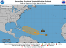
1. Near the Leeward Islands in the Tropical Atlantic:
A tropical wave located over the central tropical Atlantic continues
to produce a broad area of disorganized showers and thunderstorms.
Environmental conditions appear conducive for gradual development of
this system, and a tropical depression could form toward the end of
the week or weekend. This system should move westward to
west-northwestward at about 20 mph across the central tropical
Atlantic and approach the vicinity of the Leeward Islands on Friday.
* Formation chance through 48 hours...low...10 percent.
* Formation chance through 7 days...medium...60 percent.

two_atl_7d1.png
 
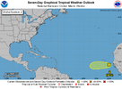
. Eastern Tropical Atlantic:
A tropical wave located a few hundred miles to the southeast of the
Cabo Verde Islands continues to produce a concentrated area of
showers and thunderstorms. Environmental conditions appear generally
favorable for additional development over the next couple of days as
the system moves westward at around 15 mph. Towards the end of this
week, this system could encounter a less favorable environment,
limiting its development chances after that time.
* Formation chance through 48 hours...low...30 percent.
* Formation chance through 7 days...low...30 percent.

two_atl_7d2.png
 
I’m not sure but am thinking this 12Z UKMET new TC might be for 99L: E of Bermuda moving NNE at the end:

NEW TROPICAL CYCLONE FORECAST TO DEVELOP AFTER 114 HOURS
FORECAST POSITION AT T+114 : 25.7N 64.2W

LEAD CENTRAL MAXIMUM WIND
VERIFYING TIME TIME POSITION PRESSURE (MB) SPEED (KNOTS)
-------------- ---- -------- ------------- -------------
1200UTC 24.08.2025 120 26.9N 63.9W 1012 34
0000UTC 25.08.2025 132 29.9N 63.3W 1012 30
1200UTC 25.08.2025 144 32.0N 62.6W 1012 28
0000UTC 26.08.2025 156 34.8N 61.8W 1013 28
1200UTC 26.08.2025 168 37.5N 60.9W 1013 29
 

The Atlantic SST configuration has turned quite favorable-looking (for TC development) over the last couple weeks, in large part driven by reduced trades over the Caribbean.In fact, 2025 now ranks #7 in terms of MDR SST anomaly (with the tropics mean anomaly removed to bias correct for climate trends).2010 0.996250992023 0.749654292024 0.64659561995 0.621191562005 0.594340621998 0.518180192025 0.49122003 0.4752881999 0.410415562017 0.35969672All the other years in the Top 10 on this date reached "hyperactive" activity levels in terms of ACE (Accumulated Cyclone Energy). The Atlantic definitely has done some catching up after a slow start (thanks to #Erin), but TBD what the back half of the season holds after a potentially quiet couple weeks ahead.
 
Back
Top