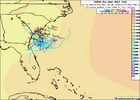
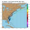
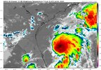
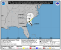
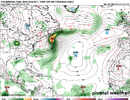
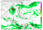
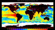
The NHS has the seven day development chances for the tropical disturbance off of the southeast coast at 60 percent now. Development will be slow to occur however this system will be at least a rainmaker for coastal areas during one of the busiest weekends of the year at the beach as it slowly moves up the coastline.
-
Hello, please take a minute to check out our awesome content, contributed by the wonderful members of our community. We hope you'll add your own thoughts and opinions by making a free account!
You are using an out of date browser. It may not display this or other websites correctly.
You should upgrade or use an alternative browser.
You should upgrade or use an alternative browser.
Tropical 2025 Tropical Thread
- Thread starter SD
- Start date
Brent
Member
Stormsfury
Member
Ngl, haven't had much rain locally here in the last 2 weeks. Storms have practically bounced off a dome. Wouldn't mind having a couple inches of rain this weekend.Most of them are extremely weak but still View attachment 173331
snowc
Member
Tropical Storm Vince Gill update (with apologies to @GaWx )
TROPICAL CYCLONE DEVELOPED IN THE MODEL ANALYSIS AT POSITION : 30.3N 114.7W
LEAD CENTRAL MAXIMUM WIND
VERIFYING TIME TIME POSITION PRESSURE (MB) SPEED (KNOTS)
-------------- ---- -------- ------------- -------------
1200UTC 03.07.2025 0 30.3N 114.7W 1006 27
0000UTC 04.07.2025 12 CEASED TRACKING
Last edited:
Those coordinatesChantal update (with apologies to @GaWx )
AT POSITION : 30.3N 114.7W
are in the Gulf of California.
snowc
Member
OOps, sorry.Those coordinates
AT POSITION : 30.3N 114.7W
are in the Gulf of California.
Going to be some decent rain along the coast this weekend. Will probably work inland early next week.
Shaggy
Member
Even trying to get some winds along the coast Saturday might be worth a drive down to playGoing to be some decent rain along the coast this weekend. Will probably work inland early next week.
Brent
Member
Stormsfury
Member
Shaggy
Member
3k nam.was a bit aggressive this morningdidn't have this on my bucket list until now.. invest 92L already looks better than the previous 2 "named" storms already.
(Sure as hell didn't have a potential tropical cyclone impact on my birthday this upcoming weekend)
View attachment 173341
Brent
Member
Showers and thunderstorms have increased in association with an area
of low pressure located about 100 miles off the northeast Florida
coast. Environmental conditions are forecast to be marginally
conducive for further development, and a short-lived tropical or
subtropical depression could form late today or on Saturday while
the system drifts northward. This low is expected to move inland
over the southeastern U.S. Saturday night or early Sunday.
Regardless of development, heavy rainfall is possible across
portions of west-central and southwestern Florida through early
Saturday, and across coastal sections of the Carolinas beginning
later on Saturday. An Air Force Reserve Hurricane Hunter aircraft is
scheduled to investigate the system later today.
Dedicated thread for this may be warranted shortly.
Recon will take off at noon EDT and get into it during the early afternoon:
SUSPECT AREA (OFF SOUTHEAST U.S. COAST)
FLIGHT ONE - TEAL 71
A. 04/1800Z
B. AFXXX 01BBA INVEST
C. 04/1600Z
D. 30.5N 79.5W
E. 04/1730Z TO 04/2100Z
F. SFC TO 10,000 FT
G. LOW-LEVEL INVEST
H. WRA ACTIVATION
Recon will take off at noon EDT and get into it during the early afternoon:
SUSPECT AREA (OFF SOUTHEAST U.S. COAST)
FLIGHT ONE - TEAL 71
A. 04/1800Z
B. AFXXX 01BBA INVEST
C. 04/1600Z
D. 30.5N 79.5W
E. 04/1730Z TO 04/2100Z
F. SFC TO 10,000 FT
G. LOW-LEVEL INVEST
H. WRA ACTIVATION
snowc
Member
snowc
Member
GLOBAL MODEL DATA TIME 1200UTC 04.07.2025
TROPICAL DEPRESSION 92L ANALYSED POSITION : 30.6N 79.2W
ATCF IDENTIFIER : AL922025
LEAD CENTRAL MAXIMUM WIND
VERIFYING TIME TIME POSITION PRESSURE (MB) SPEED (KNOTS)
-------------- ---- -------- ------------- -------------
1200UTC 04.07.2025 0 30.6N 79.2W 1014 23
0000UTC 05.07.2025 12 CEASED TRACKING
snowc
Member
lexxnchloe
Member
lexxnchloe
Member
Evidently, the extreme TX flooding is being connected to the remnants of what peaked as just an innocent looking minimal TS Barry:
“The tropical moisture from the remnants of Tropical Storm Barry, combined with a stationary storm complex (which provided the lift) that was already sitting over Texas, resulted in slow-moving heavy downpours that produced prolific rainfall totals over a short period of time.”

How remnants of Tropical Storm Barry are to blame for Texas floods
Texas experienced devastating floods over the weekend, and the cause was remnants of a tropical storm.
lexxnchloe
Member
I would hope not. Barry wasnt even a storm IMO and in any case the same moisture was there whether it got a name or not.Is there a chance that the name Barry will be retired as a result of its very high level of moisture leading to the TX floods?
Opinions?
Ha noIs there a chance that the name Barry will be retired as a result of its very high level of moisture leading to the TX floods?
Opinions?
accu35
Member
Next week looks interesting in the gulf
Time for some 1970's into early 1980's quiet Atlantic Hurricane seasons and Stellar SE winters. Cycle we are headed for imo. The Solar cycle we are rolling into, probably has a lot to do with it. My "not an expert" opinion.
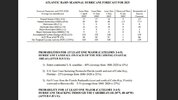
This is from the 7/9/25 CSU update. Note that this isn’t anywhere close to saying “season cancel” as it’s merely a slight decrease to still slightly above activity vs the recent active era: ACE dropped from last month’s forecast’s 155 to 140, which is still 18 greater than 1991-2020 avg:
CSU July 9 update
We have decreased our forecast slightly and now call for a slightly above-normal 2025 Atlantic basin hurricane season. The primary reason for the slight decrease in the outlook is both observed and predicted high levels of Caribbean shear. High levels of Caribbean shear in June/July are typically associated with less active hurricane seasons. However, we also anticipate the tropical Pacific to be characterized by ENSO neutral conditions. Sea surface temperatures across the eastern and central Atlantic are slightly warmer than normal, but not as warm as they were last year at this time. A warmer-than-normal tropical Atlantic combined with likely ENSO neutral conditions typically provides a more conducive dynamic and thermodynamic environment for hurricane formation and intensification. We anticipate a slightly above-average probability for major hurricanes making landfall along the continental United States coastline and in the Caribbean. As with all hurricane seasons, coastal residents are reminded that it only takes one hurricane making landfall to make it an active season. Thorough preparations should be made every season, regardless of predicted activity.
Analog years for 2025 with the associated hurricane activity listed for each year.
Year NS NSD H HD MH MHD ACE NTC
2001 15 68.75 9 25.50 4 4.25 110.1 135.3
2008 16 88.25 8 30.50 5 7.50 145.7 162.3
2011 19 89.75 7 26.00 4 4.50 126.3 144.9
2021 21 79.75 7 27.75 4 12.75 145.6 173.7
Average 17.8 81.6 7.8 27.4 4.3 7.3 131.9 154.0
2025 Forecast 16 80 8 30 3 8 140 145

Shaggy
Member
The
More concerning part is that they expect a slightly higher hit rate along coastlines. Number of storms is important but impacts could still.be badThis is from the 7/9/25 CSU update. Note that this isn’t anywhere close to saying “season cancel” as it’s merely a slight decrease to still slightly above activity vs the recent active era: ACE dropped from last month’s forecast’s 155 to 140, which is still 18 greater than 1991-2020 avg:
CSU July 9 update
We have decreased our forecast slightly and now call for a slightly above-normal 2025 Atlantic basin hurricane season. The primary reason for the slight decrease in the outlook is both observed and predicted high levels of Caribbean shear. High levels of Caribbean shear in June/July are typically associated with less active hurricane seasons. However, we also anticipate the tropical Pacific to be characterized by ENSO neutral conditions. Sea surface temperatures across the eastern and central Atlantic are slightly warmer than normal, but not as warm as they were last year at this time. A warmer-than-normal tropical Atlantic combined with likely ENSO neutral conditions typically provides a more conducive dynamic and thermodynamic environment for hurricane formation and intensification. We anticipate a slightly above-average probability for major hurricanes making landfall along the continental United States coastline and in the Caribbean. As with all hurricane seasons, coastal residents are reminded that it only takes one hurricane making landfall to make it an active season. Thorough preparations should be made every season, regardless of predicted activity.
Analog years for 2025 with the associated hurricane activity listed for each year.
Year NS NSD H HD MH MHD ACE NTC
2001 15 68.75 9 25.50 4 4.25 110.1 135.3
2008 16 88.25 8 30.50 5 7.50 145.7 162.3
2011 19 89.75 7 26.00 4 4.50 126.3 144.9
2021 21 79.75 7 27.75 4 12.75 145.6 173.7
Average 17.8 81.6 7.8 27.4 4.3 7.3 131.9 154.0
2025 Forecast 16 80 8 30 3 8 140 145
View attachment 173415
Brent
Member
Honestly with the way people are acting with this Texas flood maybe we don't need any hurricanes this year 


Good grief. I have no words
Good grief. I have no words
Last edited:
Last edited:
Summary of latest model progs for Nino 3.4: coolest month (these don’t take into account RONI type of adjustments downward)
BoM (Australian): -0.2 (in August)(too warm overall in prior 2 years; last July was slightly too warm with -0.17 for OND vs actual of ~-0.4)
Euro: ~-0.2 (almost always has been too warm…July forecast last year was only down to -0.11 for NDJ vs actual of ~-0.5)
JMA: ~-0.9 (Nov)(did well 2 years ago but too cool last year as July forecast had -0.87 for OND vs actual of ~-0.4)
MetFrance: ~-0.6 (Dec)(July outlook too warm 2 years ago but did fairly well last year with it actually slightly too cool with -0.61 OND vs actual of ~-0.4)
CFS: -0.5 (Nov)(last July much too cold with -1.32 for OND!)
UKMET: -0.76 (Oct) (this is from June as I don’t see July outlook yet)(last July much too cool with -0.95 in OND)
————
So, my latest guess based on last year’s errors and current forecasts (all listed above) is for ONI low point this fall/winter of ~-0.4. That would likely mean RONI low of a somewhat ominous (from hit risk standpoint for the NE Caribbean to SE US on avg) -0.6 to -0.9.
But -0.6 to -0.9 RONI being “somewhat ominous” for those areas on avg doesn’t mean it will necessarily be a bad season for them as that’s just based on averages and there’s lots of variance from year to year. Actually, the Euro’s last few forecasts have had it near to slightly quieter than the 1993-2015 avg for those regions as a whole unlike what it showed for that area last year at this time.
You know it's dead when the GFS can't even conjure up a system.
According To AI:
AI Overview

Wind shear in the Atlantic basin is expected to remain strong for the next week or so, potentially suppressing tropical development, before potentially weakening and becoming more conducive for storms in the 11-15 day timeframe, according to Tropical Tidbits. The shift towards a more favorable pattern for tropical cyclone development is linked to a weakening of a tropical upper-tropospheric trough and a potential trend towards a La Niña weather pattern.
Here's a more detailed breakdown:
AI Overview

Wind shear in the Atlantic basin is expected to remain strong for the next week or so, potentially suppressing tropical development, before potentially weakening and becoming more conducive for storms in the 11-15 day timeframe, according to Tropical Tidbits. The shift towards a more favorable pattern for tropical cyclone development is linked to a weakening of a tropical upper-tropospheric trough and a potential trend towards a La Niña weather pattern.
Here's a more detailed breakdown:
- Current Conditions:
Strong wind shear, particularly in the western Gulf and Caribbean, is currently inhibiting tropical development.
- Short-term Outlook:
The shear is expected to remain strong for the next 10 days, potentially suppressing storm formation.
- Longer-term Outlook:
After the next 10 days, the wind shear is forecast to weaken and become more conducive for tropical cyclone formation, according to Tropical Tidbits.
- Influence of La Niña:
A potential shift towards a La Niña pattern could also contribute to reduced wind shear, further favoring storm development.
- AI Overview
ENSO-neutral conditions are most likely for the rest of 2025 and early 2026. While ENSO-neutral is favored, there's a chance of La Niña developing in late 2025 and early 2026, though it's not the dominant forecast. El Niño conditions are less likely to develop during this period.
Downeastnc
Member
The Gulf would be the spot to watch for that to happen in the next couple of weeks. I don't have my Pivotal Subscription at work but I've seen model runs from the GFS during the past couple of days hinting that a weak low might develop in the Gulf from time to time.
lexxnchloe
Member
lexxnchloe
Member

