-
Hello, please take a minute to check out our awesome content, contributed by the wonderful members of our community. We hope you'll add your own thoughts and opinions by making a free account!
You are using an out of date browser. It may not display this or other websites correctly.
You should upgrade or use an alternative browser.
You should upgrade or use an alternative browser.
Tropical 2025 Tropical Thread
- Thread starter SD
- Start date
NoSnowATL
Member
Not bad either. Many ways to skin a cat these days. About time we cut waste. More is needed.
Surely, finally this time there will be probs that we have been hearing for 6 months.Not bad either. Many ways to skin a cat these days. About time we cut waste. More is needed.
Last edited:
lexxnchloe
Member
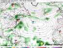
Posting models a month out is about as responsible as saying hurricane season is over in July. I get weather patterns being slow but this is just ridiculous!
Soooooo are we going to talk about the front getting stuck this week?
Brent
Member
Soooooo are we going to talk about the front getting stuck this week?
I've seen some people on Facebook talking about it
There's an orange in the BOC too that may steal a name too although it doesn't have long
I'm not sure anything in the gulf can close off in time but stalled fronts are always a problemI've seen some people on Facebook talking about it
There's an orange in the BOC too that may steal a name too although it doesn't have long
Brent
Member
I'm not sure anything in the gulf can close off in time but stalled fronts are always a problem
Yeah I haven't seen an obvious signal either but it is that time of year of course
NoSnowATL
Member
My forecast has been jumping from heatwave to flooding every model run for this coming week.Yeah I haven't seen an obvious signal either but it is that time of year of course
Brent
Member
My forecast has been jumping from heatwave to flooding every model run for this coming week.
Yeah I'm not surprised I've seen so many people talking about how inconsistent the models are. The storm chasers not sure where to go
So I wouldn't rule anything out yet
Well this isn’t good
Insane how when we cast votes certain ways, certain outcomes are bound to happen
NoSnowATL
Member
Good ones. I agree.Insane how when we cast votes certain ways, certain outcomes are bound to happen
Brent
Member
Brent
Member
NHC mentioning it now
Southeastern U.S. Coastline:
Towards the end of this week into next weekend, an area of low
pressure could develop from a remnant frontal boundary near or along
the southeastern U.S. Atlantic and or Gulf coasts. Some gradual
tropical or subtropical development could occur thereafter as it
drifts slowly just off the U.S. coastline.
* Formation chance through 48 hours...low...near 0 percent.
* Formation chance through 7 days...low...20
percent.
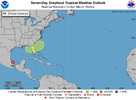

TD 2 will probably become Barry and remain a weak tropical storm going into Mexico. The only impact for us will be taking another name off of the National Hurricane Center list of names. The Gulf of Mexico does bear watching but with westerly shear ripping and the Saharan dust cloud extending across the Atlantic things will remain quiet for the near future.
lexxnchloe
Member
Has to be the 2 weakest supposed storms to start a season ever.TD 2 will probably become Barry and remain a weak tropical storm going into Mexico. The only impact for us will be taking another name off of the National Hurricane Center list of names. The Gulf of Mexico does bear watching but with westerly shear ripping and the Saharan dust cloud extending across the Atlantic things will remain quiet for the near future.
lexxnchloe
Member
NoSnowATL
Member
Maybe the NHC needs to be replaced.
Up to 0.64 ACE for season to date
Storm Active Winds Pressure ACE
Tropical Storm ANDREA 18z Jun 21 to 12z Jun 25 35kt 1014mb 0.24
Tropical Storm BARRY 00z Jun 27 to 00z Jun 30 40kt 1006mb 0.4
Season Total 18z Jun 21 to 00z Jun 30 40kt 1006mb 0.64
Storm Active Winds Pressure ACE
Tropical Storm ANDREA 18z Jun 21 to 12z Jun 25 35kt 1014mb 0.24
Tropical Storm BARRY 00z Jun 27 to 00z Jun 30 40kt 1006mb 0.4
Season Total 18z Jun 21 to 00z Jun 30 40kt 1006mb 0.64
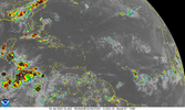
That wave around 26west has been holding convection pretty good past day or so. zero spin, but WV shows a moist path out in front
Brent
Member
NoSnowATL
Member
Gotta get that bonus…..
Per JB this morning for the N Hem this June:
“In the Northern Hemisphere, we have had the average number of named storms. But now look at the ACE statistic. We are less than 1/3. Never have we had an average ACE of only 2/storm in June The average in June is 6.5. It's boggling what is going on in the WPAC, where we are at 10% of average with over 10% of their ace done.”

——————
and for the Atlantic basin specifically, he said this:
“The Atlantic naming were a complete joke. Isla Lobos where the so called center of Barry crossed had a half inch of rain and a gust to 22. Tampico had gusts to 31 and over 2 inches of rain and the center crossed close to them Andrea was a stratocu swirl But in a way I am glad they got named. the .6 between the 2 of them have established the all time record for weakest back to back storms at only .3 per storm”
“In the Northern Hemisphere, we have had the average number of named storms. But now look at the ACE statistic. We are less than 1/3. Never have we had an average ACE of only 2/storm in June The average in June is 6.5. It's boggling what is going on in the WPAC, where we are at 10% of average with over 10% of their ace done.”

——————
and for the Atlantic basin specifically, he said this:
“The Atlantic naming were a complete joke. Isla Lobos where the so called center of Barry crossed had a half inch of rain and a gust to 22. Tampico had gusts to 31 and over 2 inches of rain and the center crossed close to them Andrea was a stratocu swirl But in a way I am glad they got named. the .6 between the 2 of them have established the all time record for weakest back to back storms at only .3 per storm”
Last edited:
lexxnchloe
Member
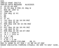
Ah, that very dangerous 1009mb eyewall.
lexxnchloe
Member
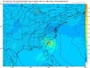
That tweet was good timing. The RDU forecast discussion mentioned that the Euro and GFS were both hinting at some possible tropical low pressure development along an old frontal boundary off of the southeast coast towards the end of the forecast period. RDU didn't seem too excited about it at this time but they did mention it at least.
Brent
Member
Going to be interesting to see which if either end of the trough takes over and tries to consolidate.
lexxnchloe
Member
lexxnchloe
Member
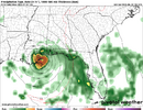
Crazy we've gone from west across the gulf to possibly missing the entire EC
Crazy we've gone from west across the gulf to possibly missing the entire EC
The area from the NE GOM to off the SE US coast is currently at 40% odds for TCG through 7 days per the last few TWOs.
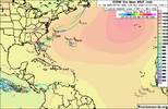
Isn't this an image of the product that we are going to lose soon?
Isn't this an image of the product that we are going to lose soon?
I believe "Independent" forecasters will pick up the Slack, Like Dr. Levi Cowan? & other Indie Forecasters???
Nope. Not much money in the private side and too much liability. I legally cannot use any source other than NOAA/NWS for site safety to give you an idea. There is some private data available in that spectrum but the issue comes when you have multiple storms or a storm nearing landfall requiring 100% uptime and not fighting for access at surge pricing levels.I believe "Independent" forecasters will pick up the Slack, Like Dr. Levi Cowan? & other Indie Forecasters???
Are they planning to launch their own independantly owned satellites? Not being a smart-a, this is not going to end well.I believe "Independent" forecasters will pick up the Slack, Like Dr. Levi Cowan? & other Indie Forecasters???

