Brent
Member
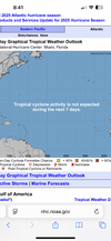
Still nothing in the outlook
Of course the exact track changes every run, but it has now been there for a while now and is up to a day 10 threat now. I think we will either see other models pick it up, or the GFS lose it by Sunday at 12z. My money is on the GFS losing it by then.Gfs is awfully consistent with it though
All I'm saying is if the last 3 or 4 years of may GFS runs where archived somewhere i bet 60%+ have the same hurricane past D10 in May and early June. They said the gulf/Caribbean should get interesting over the next weekGfs is awfully consistent with it though
A few euro ensembles have something in the GOM around the same time frame so that period might squeak out a weak TS if the models keep this thing alive for a few more runsAll I'm saying is if the last 3 or 4 years of may GFS runs where archived somewhere i bet 60%+ have the same hurricane past D10 in May and early June. They said the gulf/Caribbean should get interesting over the next week
Gfs is awfully consistent with it though

Yeah that doesnt seem likely. Climatology doesn't offer much hope for a full blown cane.But yeah some of these people on Facebook seem to think we're gonna have some full blown amazing hurricane and I just don't buy it
Maybe in a couple months
.jpeg")
Reposting the names since it's the official start todayView attachment 173001
Name number five is gonna be a bad one, I can feel it.

Nah it will just meander and be a pain in the ass.Ha im ready for Karen to act like Karen
It's always been lame. The 2013 version holds a record for one of the few storms to die in the Gulf
But not before speaking to the manager.If we get a Karen, it will threaten this whole board and then drive away in a suburban.
American models are way left of everything else with the disturbance this week.
Not enough time to get goingThe late may early June lopsided sloppy system seems about as close to a slam dunk as you can get in tropical season this year
Not enough time to get going


The good Ol GFS which spins up a tc everyday with its feedback issues! I guess if it didn’t Hurricane season would be over already.