Brent
Member
Invest tomorrowCode Red
A broad area of low pressure located over the southwestern Gulf of
Mexico is producing disorganized showers and thunderstorms.
Gradual development of this system is expected, and a tropical or
subtropical depression or storm is likely to form late this weekend
or early next week while the system moves eastward or northeastward
across the Gulf of Mexico. Interests in the Florida Peninsula and
the Florida Keys should monitor the progress of this system.
Regardless of tropical or subtropical development, locally heavy
rains could occur over portions of Mexico during the next day or
two, and over much of Florida late this weekend through the middle
of next week.
* Formation chance through 48 hours...low...30 percent.
* Formation chance through 7 days...high...
70 percent.
Invest tomorrow
Dang....I'm goodOr now apparently
``AL, 92, 2024100500, , BEST, 0, 220N, 955W, 25, 0, DB, 0, , 0, 0, 0, 0, 1011, 180, 60, 0, 0, L, 0, , 0, 0, GENESIS028, , 0, , 0, 0, 0, 0, genesis-num, 028, SPAWNINVEST, al712024 to al922024,``
Dang....I'm good
You ever see a name like this? On Tropical tidbits....
92L GENESIS028
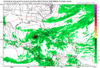
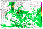
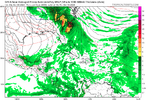
6z still has itGo back to my post for both set of ensembles on Friday. Oct 17 was a big day on the GFS ensemble. So not really surprised that the operational has something then. Ensembles are a bit delayed from the operational now, but its there.
This is the third run of the GPS with a third storm.
View attachment 152671
View attachment 152672


Yep....let's keep up with how many runs in a row. So 4 now.
