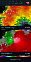
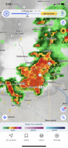
Tornado warning for Scotland Neck now.
-
Hello, please take a minute to check out our awesome content, contributed by the wonderful members of our community. We hope you'll add your own thoughts and opinions by making a free account!
You are using an out of date browser. It may not display this or other websites correctly.
You should upgrade or use an alternative browser.
You should upgrade or use an alternative browser.
Severe 2024 Severe Discussion
- Thread starter RBR71
- Start date
Downeastnc
Member
The wind is really picking up here but it's still sunny.
Wow, already canceled the tornado watch here. That has to be a record for the quickest a watch has been canceled. Once again no storm for me when under a watch but had some last night and this morning. I am going to start keeping a file of everytime I am under a severe thunderstorm or tornado watch and if I actually get a storm or not. See if I am really right when I say 9 out of 10 times I don't get a storm when under a watch.
Last edited:
Windergawx
Member
hopefully you catch the next one and it blows your house overWow, already canceled the tornado watch here. That has to be a record for the quickest a watch has been canceled. Once again no storm for me when under a watch but had some last night and this morning. I am going to start keeping a file of everytime I am under a severe thunderstorm or tornado watch and if I actually get a storm or not. See if I am really right when I say 9 out of 10 times I don't get a storm when under a watch.
Really? That's a bit much.hopefully you catch the next one and it blows your house over
Windergawx
Member
You want severe? Get the full experienceReally? That's a bit much.
You know ppl lose everything in a blink of an eye right?
Where did I say anything about wanting severe? I said the majority of time I am under a watch I do not get any storms at all. I never said anything about wanting severe weather. Reading is fundamental.You want severe? Get the full experience
You know ppl lose everything in a blink of an eye right?
Had pretty bad flooding today around here! A storm came through this morning and dropped about an inch, this afternoon’s severe storms dropped over 4” in spots! Cars stranded in flood waters and stuff! Pretty unusual. Got a chance at more severe tomorrow, then calm for 5-6 days
Avalanche
Member
I’m not sure how anyone reading your posts could argue that your statements mean you want severe.Where did I say anything about wanting severe? I said the majority of time I am under a watch I do not get any storms at all. I never said anything about wanting severe weather. Reading is fundamental.
As I read it my understanding concludes that you have an issue with how often severe is called for by meteorologists that never come to fruition, thus leaving the reader thinking that maybe severe weather predictions might not be that accurate. That’s what I get out of it anyway.
Windergawx
Member
maybe I'm just tired of reading the complaints every time I visit. With how many post I read from OP? I really cant remember the last one I seen with anything logical.I’m not sure how anyone reading your posts could argue that your statements mean you want severe.
As I read it my understanding concludes that you have an issue with how often severe is called for by meteorologists that never come to fruition, thus leaving the reader thinking that maybe severe weather predictions might not be that accurate. That’s what I get out of it anyway.
Montgomery County, MD has been hit by a tornado.
Harford County, MD also hit.
SPC has a level 1 threat for storms here today. Maybe we'll actually have some storms at all around here.
Dead unless we find some sun in the next 90 minutes.SPC has a level 1 threat for storms here today. Maybe we'll actually have some storms at all around here.
Last edited:
Avalanche
Member
Severe looking limited now. Heck even the development of storms in general look minor. Can’t afford a dry-less front with a dry week ahead.
And no storms again. Can't get any storms at all, nevermind anything severe.
Well, maybe there's a chance. Saw this posted on Facebook from WRAL met Mike Maze.
Heads up to Wake County, a thunderstorm is moving through Chatham County right now and should hold together and dump some heavy rain along with frequent lightning.
Heads up to Wake County, a thunderstorm is moving through Chatham County right now and should hold together and dump some heavy rain along with frequent lightning.
Well, I'll be a monkey's uncle. The storm made it here.
Shaggy
Member
I get we don't have storms like we use to but to judge NC storms on your backyard is a bit crazy. There were plenty of severe thunderstorm warnings yesterday for a level 2 riskWell, I'll be a monkey's uncle. The storm made it here.
Lol 2 decades of trying....I admire the effort, though!I get we don't have storms like we use to but to judge NC storms on your backyard is a bit crazy. There were plenty of severe thunderstorm warnings yesterday for a level 2 risk
I didn't say there wasn't. Just saying for me personally I don't get a storm the majority of time when under a watch or when the SPC puts out a risk. And the tornado watch they put out last week only to cancel it 2 hours later was horrible. Maybe predicting storms in the Triangl is just as hard as predicting snow now.I get we don't have storms like we use to but to judge NC storms on your backyard is a bit crazy. There were plenty of severe thunderstorm warnings yesterday for a level 2 risk
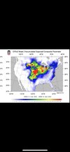
Not worth itAnybody ever look at this? How accurate is it and what is it? View attachment 147935
Impressive summer supercells over north AL this evening.
Downeastnc
Member
dont see this everyday....
dont see this everyday....
Nope! It's been a weird weather day for the New England states! I live way far form the storms headed into western Maine in a little while but still checking the radar. There was a nice thunderstorm with a good amount of rain around 3pm. I hope everyone stays safe and cool as ya'll can!
The fact that it was caught on film both hand held and drone was incredible. I was watching his stream when the windmill was wrecked and toppled. Just incredible.
Shaggy
Member
This storm was in the middle of nowhere in Nebraska and was unwarned originally. Maybe one of the more spectacular tornado videos of the year despite it not being a close intercept. Just amazing.
Under a level 2 threat tomorrow for severe storms. Hope we at least get some rain.
Up here in Maine, we got a slight risk for severe weather, again! Hopefully it will just be some thunderstorms and that's it. I moved north partly to get away from the severe weather other than nor'easters! Ya'll all be safe and cross your fingers for safe weather!
Might have had a tornado up above me in Haynesville, Maine. The severe line has diminished and looks like a good thunderstorm might be almost here! Pretty rare for a tornado up here!

