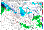
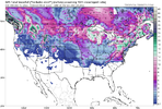
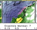
Huh? LolThe SER is back on the 0z NAM
-
Hello, please take a minute to check out our awesome content, contributed by the wonderful members of our community. We hope you'll add your own thoughts and opinions by making a free account!
You are using an out of date browser. It may not display this or other websites correctly.
You should upgrade or use an alternative browser.
You should upgrade or use an alternative browser.
Misc 2022-23 Fall/Winter Whamby Thread
- Thread starter Drizzle Snizzle
- Start date
- Status
- Not open for further replies.
You got early access or you talking about the first 6 hours of the 32k?The SER is back on the 0z NAM
severestorm
Member
lol I'm just messing around before the runs beginning. Just being facetiousYou got early access or you talking about the first 6 hours of the 32k?
He stole Bouncycorns models! ?Huh? Lol
NAM only goes out to 84hrs anywaylol I'm just messing around before the runs beginning. Just being facetious
Does anyone here remember this storm and the aftermath? I wonder if something like this could happen if the cold wave verifies.
This was huge ice/sleet storm for the NC Piedmont and SC upstate. It came in on a Friday and there was freezing rain the entire day with temperatures in the 30-31 degree range… then in the evening the temperature dropped back quick in the low 20s as a period of very heavy sleet came through and put down a quick 1-2” of sleet… the temperatures dropped so quickly that puddles in my parents yard literally flash froze even as sleet was piling up. Then the rest of the weekend temperatures stayed pretty much in the teens with periods of light snow
rambleon
Member
Seems like the threat of this intense cold shot is growing… I have some personal concerns about extreme cold temps and long duration. How are you folks interpreting the models as far as possible surface temps for central nc with this coming intrusion of frigid air? Thanks!
buckinbronco
Member
Any of y’all worrying about the apocalyptic cold outbreak coming up: they surprisingly use heat pumps up here for heating and it’s gets below zero every winter! Y’all suck it up and stock up on bread and milk
Yes! Milk sammiches for Christmas!Any of y’all worrying about the apocalyptic cold outbreak coming up: they surprisingly use heat pumps up here for heating and it’s gets below zero every winter! Y’all suck it up and stock up on bread and milk
Keep hope alive! !Cold is ALWAYS the most important ingredient! Let us never forget! SMDHView attachment 126450
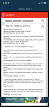
Also another key note in there, to help with the age old debate! Rates overcome ground temps, all day everyday! This has been a PSA! Thank youKeep hope alive! ! View attachment 126451
Grits & Shrimp,, here..Yes! Milk sammiches for Christmas!
SimeonNC
Member
The 00z party is about to begin. I legit feel anxious.
70 likes! New record?Well, no matter what happens tonight, I think we can safely say that it has been one of the most satisfying days of model-watching in a long, long time top to bottom. It's what we wait all year for, and it's good to enjoy the moment.
- Joined
- Jan 2, 2017
- Messages
- 1,566
- Reaction score
- 4,279
Bout to be some 0Z goodness
- Joined
- Jan 5, 2017
- Messages
- 3,769
- Reaction score
- 5,966
Large differences between the GFS 0z and 12z. Let's see where this goes...
- Joined
- Jan 2, 2017
- Messages
- 1,566
- Reaction score
- 4,279
Gfs going to have the Icon clipper as well??
- Joined
- Jan 2, 2017
- Messages
- 1,566
- Reaction score
- 4,279
buckinbronco
Member
NC peeps should like this run
LukeBarrette
im north of 90% of people on here so yeah
Meteorology Student
Member
2024 Supporter
2017-2023 Supporter

LOCK IT TF IN
- Joined
- Jan 2, 2017
- Messages
- 1,566
- Reaction score
- 4,279
South Carolina Snub...we toss
I wouldn't sleep on this behavior just yetSouth Carolina Snub...we toss
- Joined
- Jan 2, 2017
- Messages
- 1,566
- Reaction score
- 4,279
SimeonNC
Member
I don't think I've ever seen the 540 line in fricking Florida lol.There she is!! Woof woof hahaView attachment 126487
I have a sneaking suspicion we are gonna take a big L on this pattern when all around us will score. Just part of the game I guess.South Carolina Snub...we toss
no
Brent
Member
Low of 5 on TV and he said that might be "too warm" ?
LukeBarrette
im north of 90% of people on here so yeah
Meteorology Student
Member
2024 Supporter
2017-2023 Supporter
Logan would be happy to see this but he’s banned…This is RIDICULOUSLY good .. +PNA is the real deal for us being able to score and it’s coming in a big way View attachment 126488
At 60:1 ratios, I should get an inch or two from this!
It’s not a real threat until ? logs in and tells us the trends are trending
LukeBarrette
im north of 90% of people on here so yeah
Meteorology Student
Member
2024 Supporter
2017-2023 Supporter
Things are looking great in the 7 to 10 day range. i think we could see a storm pop up on the models within the next 7 days.
- Status
- Not open for further replies.

