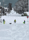
Why you always trying to take it to the streets??I can confirm this is fake news. My 7 inches of snow last winter says otherwise. Your a bigger warm weenie then me, you can’t see me in these snowy* streets
-
Hello, please take a minute to check out our awesome content, contributed by the wonderful members of our community. We hope you'll add your own thoughts and opinions by making a free account!
You are using an out of date browser. It may not display this or other websites correctly.
You should upgrade or use an alternative browser.
You should upgrade or use an alternative browser.
Misc 2022-23 Fall/Winter Whamby Thread
- Thread starter Drizzle Snizzle
- Start date
- Status
- Not open for further replies.
Carolina Sky
Member
SASQUATCH
2-Time Defending SouthernWX Fantasy Football Champ
Member
2024 Supporter
2017-2023 Supporter
Well, the wifey has COVID; the dog is walking on 3 legs; yard man is lost in the woods...something is going on here.
Oconeexman
Member
- Joined
- Jan 2, 2017
- Messages
- 919
- Reaction score
- 2,356
Honestly we have a 3 or 4 week window after Jan 10th ish and after that put a fork in this winter. Sux we waisted this block pattern but thats how we roll these daysIf there becomes a legit threat around the 27th is it more than likely just a North Carolina threat? It’s hard to tell when most posters are from NC.
Your joking right? We have until March 15th to see like a HUGE storm anywhere in the SE... and it has snowed in early April in CLT of all places... like 5ish yrs ago.... jus sayinHonestly we have a 3 or 4 week window after Jan 10th ish and after that put a fork in this winter. Sux we waisted this block pattern but thats how we roll these days
I have to agree with him. Seems like all we get anymore is a northern wave diving and a Miller B evolution with a CAD component. I know Dec 2018 was like that at last I'm pretty sure last Jan was too. That's the only 2 big storms we've had. Seems like the winters of 16-17 and 17-18 only featured northern stream energy diving. I can't remember the last time a southern wave cruised across from TX to the Carolina's with snow on the northern edge. We've seen rainstorms do it sure. But haven't seen a southern slider be cold enough for snow since what? Jan 2014 or maybe Feb 2014?I can confirm this is fake news. My 7 inches of snow last winter says otherwise. Your a bigger warm weenie then me, you can’t see me in these snowy* streets
I haven't seen a big snowstorm in Feb, or March in the Carolina's in what seems like a decade. If you count novelty events where you get a dusting to an inch then sure. But the big storms that used to be common in Feb or early March haven't been happening lately.Your joking right? We have until March 15th to see like a HUGE storm anywhere in the SE... and it has snowed in early April in CLT of all places... like 5ish yrs ago.... jus sayin
It very much so is. I live a mile below that EVIL I-85 and it's even too much fore to ask.... but I err on the hopeful side. Didn't SC get a nice storm a decade or so ago? Like even between CHS and CAE saw good snow right???I just want to watch a big dog storm start forming out around texas and grow as it comes across and plows into the Carolinas. And I want the 540 line to be around Columbia sc. is that too much to ask?
Drizzle Snizzle
Member
Oh please, nobody cares about snow after Feb 15. Late Feb and March snow usually melts within a day. Anybody who loves snow would prefer snow before Feb 15.Your joking right? We have until March 15th to see like a HUGE storm anywhere in the SE... and it has snowed in early April in CLT of all places... like 5ish yrs ago.... jus sayin
SASQUATCH
2-Time Defending SouthernWX Fantasy Football Champ
Member
2024 Supporter
2017-2023 Supporter
Easy there, DeweyOh please, nobody cares about snow after Feb 15. Late Feb and March snow usually melts within a day. Anybody who loves snow would prefer snow before Feb 15.
Your so right... your 110% right and I'm such an idiot.. hehe... hang in there!!Oh please, nobody cares about snow after Feb 15. Late Feb and March snow usually melts within a day. Anybody who loves snow would prefer snow before Feb 15.
Drizzle Snizzle
Member
It's you're not your.Your so right... your 110% right and I'm such an idiot.. hehe... hang in there!!
Hasn’t quite been a decade… the last good February for us in the Carolinas was back in 2015. I wouldn’t dismiss February this just based on Niña climo. The Niña is steadily weakening and honestly the behavior we’re seeing from is more in line with a neutral ENSO. Also there’s such a small sample of 3rd year Niñas it’s hard to say how it will behave as we progressI haven't seen a big snowstorm in Feb, or March in the Carolina's in what seems like a decade. If you count novelty events where you get a dusting to an inch then sure. But the big storms that used to be common in Feb or early March haven't been happening lately.
Your right againIt's you're not your.
.. good grief I'm an idiot AND dumb... hang in there!
I’m that type of person man, I’m gonna take any storm I can get. Miller B, A, slider, anything. I just know My 7 inches of snow Last winter was my best snow winter since 2014 and my first AN winter since 2018. I mean 3 events 3 weekends in a row is unheard of around here. I do agree though, that evolutions have been on the sloppy side lately (Miller Bs) and progressive northern stream. but it’s because as of late we score with pacific driven stuff (-EPO). It’s like we can’t get a -NAO related Miller A anymoreI have to agree with him. Seems like all we get anymore is a northern wave diving and a Miller B evolution with a CAD component. I know Dec 2018 was like that at last I'm pretty sure last Jan was too. That's the only 2 big storms we've had. Seems like the winters of 16-17 and 17-18 only featured northern stream energy diving. I can't remember the last time a southern wave cruised across from TX to the Carolina's with snow on the northern edge. We've seen rainstorms do it sure. But haven't seen a southern slider be cold enough for snow since what? Jan 2014 or maybe Feb 2014?
Oh absolutely me too. I don't care how I get it. But those southern sliders where we all cash in from TX to NC have been mia. Who knows if they'll return anytime soon.I’m that type of person man, I’m gonna take any storm I can get. Miller B, A, slider, anything. I just know My 7 inches of snow Last winter was my best snow winter since 2014 and my first AN winter since 2018. I mean 3 events 3 weekends in a row is unheard of around here. I do agree though, that revolutions have been on the sloppy side lately (Miller Bs) but it’s because as of late we score with pacific driven stuff. It’s like we can’t get a -NAO related Miller A anymore
I feel like we get the looks on modeling often, but as they get closer wavelengths just want to be shortened, and that acts to amplify the pattern favoring more SW to NW oriented stuff. I don’t know anymoreOh absolutely me too. I don't care how I get it. But those southern sliders where we all cash in from TX to NC have been mia. Who knows if they'll return anytime soon.
Coldest airmass in December in decades and we won't even get a single flake out of it
Why do all of your posting reincarnations suck? Seems like blind luck would allow for you to get it right at least once.It's you're not your.
- Status
- Not open for further replies.


