Rising heights over Eastern Canada and lowering over the deep South in the prime of hurricane season? Yippie
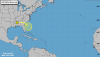
Feels like destiny at this point that a hurricane strikes NC!View attachment 86895
Rising heights over Eastern Canada and lowering over the deep South in the prime of hurricane season? Yippie

Yeah, NC is most likely as always, but this screams of building a set up that could bring one into lower SC or perhaps, even as rare as it is, into GA.Feels like destiny at this point that a hurricane strikes NC!
HugoView attachment 86895
Rising heights over Eastern Canada and lowering over the deep South in the prime of hurricane season? Yippie
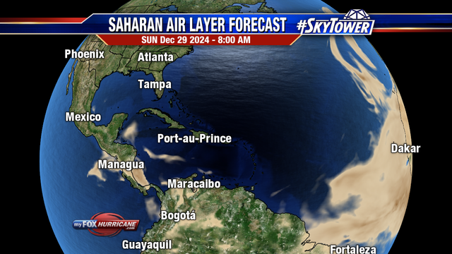
One actually moved off the other day but has since dissipated. We’re about a week to 10 days until the activity over Africa really starts to ramp up which will coincide with the Saharan dust moving on from the tropical Atlantic. I think 2 weeks from now, things will be starting to get busyI know its early, but usually don't we see waves off of Cape Verde by this time?
I know its early, but usually don't we see waves off of Cape Verde by this time?
SD You said several days ago to watch tail end of this front when it got off coast.


We better if we want to hit those Projections. It’s going to have to be a busy August September October November.Yeah I'm about ready to flip the switch
We better if we want to hit those Projections. It’s going to have to be a busy August September October November.

Welcome back, Henry!
Thanks Ollie....good to see you!Welcome back, Henry!


No! Go home we here in eastern NC are waiting our overdue major hurricane . We don’t need your gulf breezy drizzles !That track does me no good.
Next.
Yeah it's not a ton of support but with the mjo getting into p1-2 there's a little support. The mjo cycle is similar to where we saw Elsa form last month just a little less amplitudeThe GEFS has one big member, and that’s it.
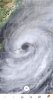
View attachment 87443
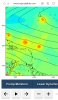
The Euro has much more than 12zView attachment 87445
Doesn’t mean much but it’s interesting the only member with anything wants to threaten the Carolina coast . I mean it’s nuts to me everything is literally aligned as bad / good as possible for the highest possible chances you can get for a hurricane strike on the Carolina coast / SE . 1999 to the end I guess ! Perhaps means a Jan 2000?Yeah it's not a ton of support but with the mjo getting into p1-2 there's a little support. The mjo cycle is similar to where we saw Elsa form last month just a little less amplitude
You know a winter like ‘99-‘00 would most of us in the Carolinas very happy. We all got in on a 10-15 day stretch of cold and multiple winter weather hits and the warm weather fans still get to end up with a winter that’s predominantly mild.Doesn’t mean much but it’s interesting the only member with anything wants to threaten the Carolina coast . I mean it’s nuts to me everything is literally aligned as bad / good as possible for the highest possible chances you can get for a hurricane strike on the Carolina coast / SE . 1999 to the end I guess ! Perhaps means a Jan 2000?