-
Hello, please take a minute to check out our awesome content, contributed by the wonderful members of our community. We hope you'll add your own thoughts and opinions by making a free account!
You are using an out of date browser. It may not display this or other websites correctly.
You should upgrade or use an alternative browser.
You should upgrade or use an alternative browser.
Wintry 1/9-12 Winter Potential Great Dane or Yorkie
- Thread starter SD
- Start date
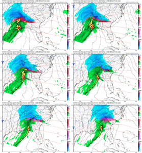
GFS should be a tick colder here in a minute. Less ridging over the Ohio Valley compared to 12z
NBAcentel
Member
More + tilt on the GFS. More then likely flatter then previous runs
ForsythSnow
Moderator
Less ice more snow on the GFS across the board.
WXinCanton
Member
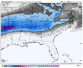
18z GFS


SnowNiner
Member
RGEM keeps me all snow basically 3.4 inches. Ai euro shows about .4 qpf that I’m assuming is also all snow. That would match up pretty well imby. If that actually verifies, I get 3-4 inches and the rest of the dry as a bone runs are incorrect I’ll take that as a win. I will consult the euro ai only from now on and ignore all others lol.
WXinCanton
Member
Lots of IP for N GA
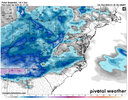
WTH the snow disappear when it hit SC?RGEM on the front end looks good to meView attachment 161474
NCHighCountryWX
Member
- Joined
- Dec 28, 2016
- Messages
- 679
- Reaction score
- 1,861
cold dry air. The thing we need and the thing we hateWTH the snow disappear when it hit SC?
The trend back up on the snowfall totals seems to be starting for those further north and to the east. Hopefully we continue to see that trend away from the warm nose for all. The purples are creeping back into the maps.
Chattownsnow
Member
Like seeing the increase in snow output on subsequent runs of the GFS, though I know these snow maps are flawed. Curious to see if that can continue translating east. The best forcing is out west towards western Tennessee and Arkansas but I have seen QPF up in the 12-36hr time range multiple times in gulf lows like this. 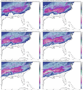

Webberweather53
Meteorologist
RGEM keeps me all snow basically 3.4 inches. Ai euro shows about .4 qpf that I’m assuming is also all snow. That would match up pretty well imby. If that actually verifies, I get 3-4 inches and the rest of the dry as a bone runs are incorrect I’ll take that as a win. I will consult the euro ai only from now on and ignore all others lol.
Even if you end up getting all sleet from that 0.4” QPF, you end up with 1-1.3” or so of sleet. 2” ish is probably realistic
rburrel2
Member
Graf ain’t budging
MichaelJ
Member
I like the RGEM presentation for our region and want to wait until the HRDPS2.5km comes into range before making a guess about accumulation amounts. From GSO West, I think the vast majority of QPF will be snow with some sleet late. As you move East from there, I see some snow then sleet and ending as zr. Ga peeps are going to be a little snow sleet and a moderate amount of ZR. Extreme upstate SC will get a good front end thump of snow and end as some IP and zr, moving east from there will be ip. zr and a little snow. Alabama, Mississippi and a small part of NGa will see nice accumulations in there extreme North sections with a sharp cutoff not far away. The TN area and mountains (northern) of NC will have the best numbers for sn. A lot depends on the next 12-18 hours as we get more data from the short range high resolution models and a consensus of what to expect for individual areas,
tennessee storm
Member
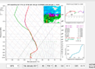
Problem is storm is still someIf the GFS is to be believed... the problem layer for the upstate Friday evening is right at 700mb. Seems crazy high up warm nose for a weak'ish storm.
View attachment 161479
Amped
That sure isn't much of a 'warm nose'. Saturation is all the way up to 300 Mb, and a large DGZ looks more like a fatty sounding than IP to me.If the GFS is to be believed... the problem layer for the upstate Friday evening is right at 700mb. Seems crazy high up warm nose for a weak'ish storm.
View attachment 161479
packfan98
Moderator
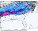
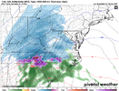
18z ukmet looks great! @Metwannabe or someone with pivotal, can you post the kuchera map please?
View attachment 161481


Wow I mean you could draw I-20 on that Georgia map and it fits the cutoff perfectly
ITUSETOSNOW
Member
That makes no sense at all...
CNCsnwfan1210
Member
18z ukmet looks great! @Metwannabe or someone with pivotal, can you post the kuchera map please?
View attachment 161481
Keep bringing the good stuff pack, that’s a nice run
Sent from my iPhone using Tapatalk
rusrius
Member
Graf ain’t budging
That thing hasn't budged all day.
ChattaVOL
Member

Sent from my iPhone using Tapatalk
NBAcentel
Member
Has no in situ cad either. lol. Probably a sign of a sucky 00z hrrr. But not concerned about this solution at all
Drizzle Snizzle
Member
That's how you know the map is probably accurate. I-20 is usually the dividing line.Wow I mean you could draw I-20 on that Georgia map and it fits the cutoff perfectly
LickWx
Member
Exactly, if the low is all the way there we would be getting a warm rain not snow!That makes no sense at all...
So we have some with hardly enough precip and super weak low and the rap with an apps runner. I mean it’s a scenario but I highly doubt we see anything like this. Definitely wouldn’t put much in the RAP I believe it did well with a system or two over the years but definitely not at this range
The thing with the RAP is that it runs 24 times a day so you're going to get some weird solutions. It's also outside it's useful range, I'd argue.
Wow, the 18z UKMET looks pretty great to me. Big improvement on the 18z GFS for RDU peeps, too (though I'm glad to be in Orange County and not Wake).
Wow, the 18z UKMET looks pretty great to me. Big improvement on the 18z GFS for RDU peeps, too (though I'm glad to be in Orange County and not Wake).
Nerman
Member
The UKMET has been pretty consistent too
albertwilsonjr
Member
Whatever your snow total accumulation is you probably want to add a inch on top of that because everything will stick
Sent from my iPhone using Tapatalk
Sent from my iPhone using Tapatalk
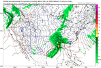
Coming back to 850mb again...
These are kind of crude maps on SV, but the tell the story
The GFS is running a stronger 850mb low / wave from SW Louisiana into W North Carolina if you look at it closely. The Euro is running a weaker 850mb wave from SW Louisiana to south of Cape Hatteras (it's the west to east southern slider look). It's a big difference.
The GFS is going to bring more forcing for ascent (warm advection / overrunning and frontogenesis) - so more of the front end snow thump potential, but it's also bringing more of the warm nose aloft of course. Note also that there are other models that use the GFS boundary conditions (the HRRR for one from what I'm reading - not sure about the NAM and RAP - but those are NOAA / NCEP models)
Me, I would have more faith that the Euro has this correct, but not total faith. Say 60% Euro / 40% GFS


Drizzle Snizzle
Member
I really hope ratios are better than 6 to 1, which is what FFC is using in their forecast.

