-
Hello, please take a minute to check out our awesome content, contributed by the wonderful members of our community. We hope you'll add your own thoughts and opinions by making a free account!
You are using an out of date browser. It may not display this or other websites correctly.
You should upgrade or use an alternative browser.
You should upgrade or use an alternative browser.
Wintry 1/9-12 Winter Potential Great Dane or Yorkie
- Thread starter SD
- Start date
ChattaVOL
Member
albertwilsonjr
Member
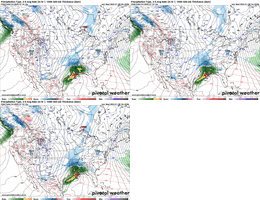
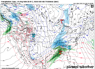
ICON with snow deep in southern GA...it's too bad the NAM is showing us these globals are just too cold.
View attachment 161453
The nam did terrible predicting the storm in north east Monday
Sent from my iPhone using Tapatalk
Forevertothee
Member
It has been LOCKED in for DAYS. Hoping it is correct.
NWMSGuy
Member
Definitely, need the HRRR to verify. Would make for a great winter storm across the Mid-South.HRRR has 6.5 inches on ground noon Friday and still snowing hard at the end of run
NWS Atlanta afternoon disco
.LONG TERM...
(Friday morning through next Tuesday)
Issued at 345 PM EST Wed Jan 8 2025
Key Messages:
- Primary impact continues to be winter weather on Friday into
Friday night. Greatest probability of impactful wx will be in
northern Georgia through metro Atlanta. Areas south of I-20
continue to remain a bit more uncertain.
- Snow looks to be primary precip time in northern Georgia and the
mountains as of this forecast package. Amounts look to be in the
3-6" range. Can`t rule out some mixing in of sleet or freezing
rain that could limit accumulations a bit in some locations.
- Precip type continues to look primarily frozen in the metro and
points east. Snow would be the onset precip type that could
accumulate and impact morning commute. A switch to sleet and/or
freezing rain would during the afternoon. Can`t rule out a brief
transition to rain.
- South of I-20, uncertain if we can remain below freezing during
the day on Friday. We will likely start during the morning hours
with snow, but this would quickly transition to rain.
Forecast:
Not too much change in the overall forecast with the update to this
forecast package. Starting to get access to some of the higher
resolution guidance, and it is painting a similar picture to what
the forecast has been thus far. Snow expected in the north, a
transition area in the metro and points east, including Athens,
and then for central Georgia an initial period of snow before a
quick transition to a cold rain.
Synoptic setup is as follows - cold air mass continues to linger in
the area during the day on Thursday. We will see another wave pass
by the area on Thursday aloft that will be dry, but will push a
reinforcing shot of cold air in on Thursday into Thursday night.
This will set the stage for winter precipitation on Friday, allowing
our surface air mass to be cold enough for some sort of frozen
precip. Two significant upper level features, a cut off low over the
desert southwest, and another shortwave quickly moving within the
polar jet, will phase together and eject into the southeast on
Friday into Saturday. Wave will interact with significant
baroclinicity in place across the Gulf coast with cold air settled
in place and generate strong surface low within region of PVA ahead
of it. This will bring precip and the potential for winter weather
across wide swath of the south, including our CWA.
Confidence remains high in seeing impactful snow accumulations
across northern Georgia. Ensemble guidance has come down a little
bit in totals in these areas, and this forecast package reflects
that a bit. A few things going on here - the biggest being models
seeming to be a bit warmer at the surface, as well as some models
seeming to better resolve a warm nose. Precip would likely start
during the morning hours, around or a bit after sunrise, and remain
snow for a good bit of the day, if not the entire day. Current
forecast amounts would be between 3-6" inches in this area. A
huge caution with looking at 10:1 ratio forecast maps - current
SLRs used in this package are closer to 5 and 6 to 1. Sounding
profiles are near isothermal for a good chunk of low levels and
approaching mid levels. This is likely to be a wet, heavy snow.
There is a chance that would could see some sleet or freezing rain
mix in, especially if some of the more aggressive guidance with
the warm nose occurs, which would act to limit accumulations to
the lower end of projections.
In metro Atlanta and points eastward, including Athens, we are
expecting to see several different phases of precipitation. The
initial onset during the morning hours looks like it should be
snow. Hi res models show significant drying in the low levels just
off the surface that will likely quickly adjust thermal profiles
to be below freezing in the entire column as initial snowfall
sublimates while falling. From there, a transition to sleet and
possibly freezing rain is expected to happen moving into the
afternoon. Big model discrepancy as to how quickly this transition
will happen. Latest HRRR (18Z), for instance, has come in with an
impressive solution that would likely pile up an inch or two of
snow in these areas before transitioning in the late afternoon as
the warm nose pushes into the area. Other models have even earlier
transition (for instance, 12Z 3km NAM) as warm nose in these push
in even faster. Right now, forecast expectations are 1-3 inches
of snow and/or sleet with the potential for a tenth to 2 tenths of
ice. Really want to emphasize an important point here - if models
which show earlier transition are right, there is absolutely
potential for a decent ice storm, with decrease in snow totals and
increase in ice totals. Please stay tuned to this portion of the
forecast.
Other bit of uncertainty is on surface temperatures in the metro and
areas east (and really south into central GA). We will need to find
a way to offset the latent heat release required to freeze liquid
water to objects for any significant ice storm. Signs of in-situ
wedge being able to form is noted in a lot of the model guidance.
This could certainly be a way for us to "hang on" to even colder
surface temps than many of the models have shown. Dynamic cooling
may also be possible, especially if models showing substantial 925
mb-850mb drying in lead up to storm are accurate. This would allow
us to physically drag some of the colder air aloft down to the
surface, especially in heavier precip.
Finally, getting into central Georgia - initial onset looks like it
may also be snow during morning hours as the initial WAA pushes
through the area as the surface low starts to progress east. The
expectation is that it will be a bit more difficult to hold on to
the cold air here at the surface. A period of sleet or freezing rain
may be possible in some locations before a quick transition to a
cold rain. This would likely lead to limited impacts during the
morning hours. A winter weather advisory may be needed in some
counties that are south of the current winter weather watch to cover
morning impacts, but given high uncertainty in potential impacts,
will hold off on any watch issuance for these areas.
Speaking of the winter weather watch - small southward expansion for
a few counties in eastern Georgia with this update, otherwise no
large changes. The overnight forecast package will be the earliest
we see any upgrades to these, and given onset time, and potential
uncertainties, it is possible this may not occur until the afternoon
tomorrow. Want to emphasize the timing of when impacts may begin in
the current watch area - snow may begin falling right across the
morning commute for many areas, especially to the west. Surface
temps at onset are in the mid to upper 20s and it will have been
quite cold in the lead up to this storm. Soil temps are cool per UGA
mesonet near surface. Put it all together, and snow will likely
begin to stick pretty quickly, especially if we get any decent
snowfall rates. This would likely include roadways. Untreated roads
may become icy and hazardous very quickly. If you can, please
consider staying off the roadways on Friday.
Winter weather looks to come to an end on Friday night into early
Saturday morning. Cold air settles back into the area, and combined
with any potential snowpack, highs on Saturday are only in the 30s
to 40s for most of the area. Saturday night is looking cold.
Widespread teens are expected including into areas even south of I-
20. Areas in central Georgia will drop into the lower 20s. For the
rest of the long term, temperatures are pretty average for this time
of year with not much to talk about (just yet).
NBAcentel
Member
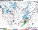
Latest rgem coming in with a stronger warm nose
Yeah it’s probably sketchy there on the southern edge with sleet etc, but mainly just watching trends and noting the moreso west to east running sliderI don't know how the snowfall algorithms work for that map and whether they're showing ZR / IP as snow, but taking the map at face value that's another 2-4"+ across nearly all over NC, which would be a very notable storm and not something you see much.
On another note, looks like it's time for me to repurchase a model subscription.
Bigedd09
Member
Never bet against the NAM when it comes to the warm nose.Latest rgem coming in with a stronger warm nose
OHnoSnow
Member
The trend is not your friend if you are in northern central Alabama
packfan98
Moderator
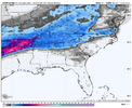
Here's the Kuchera. It looks better for the NW areas of NC
WolfpackHomer91
Member
As many have stated …. With this setup we’re gonna have to eat some WAA in order to increase QPF. Yes, that will sacrifice some on the extreme Southern/Eastern sections of the Board , but if we want decent QPF it has to happen. Jmo maybe I’m wrong
Sent from my iPhone using Tapatalk
Sent from my iPhone using Tapatalk
packfan98
Moderator
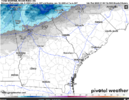
RGEM


Avalanche
Member
As far as NC goes, it would be better for a bigger jackpot than just some broad swath of a dusting to 2 inches. I’d sacrifice my snow to be able to drive west and see 6 plus. JmoAs many have stated …. With this setup we’re gonna have to eat some WAA in order to increase QPF. Yes, that will sacrifice some on the extreme Southern/Eastern sections of the Board , but if we want decent QPF it has to happen. Jmo maybe I’m wrong
Sent from my iPhone using Tapatalk
Webberweather53
Meteorologist
The favorable diurnal timing of the front end snow thump during the coldest part of the day gives a little additional help to Georgia, though sleet and ZR are inevitable here at some pt
I think this is absolute best case if everything went perfect for central nc. More than likely too far south with the mixing line.
Drizzle Snizzle
Member
I guess this means a major ice storm instead ?
Probably a different setup but I remember the Feb 2014 was going to be a big ICE storm for ATL east but it actually was more Snow/sleet instead of freezing rain. I could see this happening.The favorable diurnal timing of the front end snow thump during the coldest part of the day gives a little additional help to Georgia, though sleet and ZR are inevitable here at some pt
Quick note: I have added a snowfall forecast contest for this storm (thank you SD for the thread start).
I am putting up $50 for the winner. Contributions to the pot accepted.
The forecast cities are:
Memphis, TN (MEM)
Huntsville, AL (HSV)
Gainesville, GA (GNV)
Greenville, SC (GSP)
Asheville, NC (AVL)
Raleigh, NC (RDU)
Deadline for the forecasts is tomorrow (Thursday) at 10 PM EST
Link to the thread and more info: https://southernwx.com/community/threads/the-griteater-snowfall-contest.1364/
Drizzle Snizzle
Member
I've seen maps showing .50-1" of QPF, and only 1/2" of snow and 0.05" ice ? What's the rest of the precip ? Rain ?
Friday:
January 10, 2011: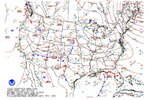
January 2011 we had a gulf low south of Pensacola and a big high pressure feeder down through the lakes region. We don’t have either of those with this one. Our low Friday is north of Pensacola and our high pressure has been replaced by a lakes low. The ONLY reason any of us have a chance here is due to the 50/50 low with strong blocking which is present Friday the same way it was 14 years ago to the day.

January 10, 2011:

January 2011 we had a gulf low south of Pensacola and a big high pressure feeder down through the lakes region. We don’t have either of those with this one. Our low Friday is north of Pensacola and our high pressure has been replaced by a lakes low. The ONLY reason any of us have a chance here is due to the 50/50 low with strong blocking which is present Friday the same way it was 14 years ago to the day.
Avalanche
Member
I think this is absolute best case if everything went perfect for central nc. More than likely too far south with the mixing line.
We must remember we lose some of this to low dew points. Virga has to virga.
ChattaVOL
Member

Sent from my iPhone using Tapatalk
ChattaVOL
Member
This is typically how it plays out—massive upward trends a few days ago, followed by a bit of a step back, just like I mentioned yesterday. It’s the usual back-and-forth we see in these situations.
We usually claw back up some…
Sent from my iPhone using Tapatalk
Need that low south of PCB. We 100% get warm nosed. Not a matter of if but when
This thing is locked in
18 run loop (4 days) of the Euro AIIt has been LOCKED in for DAYS. Hoping it is correct.

Gonna be fun Saturday evening, going back and looking how well these models have and haven't done. Need to score them on their LongRange, MidRange and Short Range perf.
The Euro AI has really caught my attn on the LR. All the AI's over the physics models.
See if the NAM still is the king of sniffing the warm nose. Its way diff than other guidance in sending the mixing all the way up to the VA/NC line.
I'm rooting for the Graphcast, RGEM and Euro AI.
The Euro AI has really caught my attn on the LR. All the AI's over the physics models.
See if the NAM still is the king of sniffing the warm nose. Its way diff than other guidance in sending the mixing all the way up to the VA/NC line.
I'm rooting for the Graphcast, RGEM and Euro AI.
From RAH (one paragraph from long-range discussion):
Precipitation Types and Amounts: With the cold air in place and
sufficient lift and saturation in the dendritic growth zone, latest
guidance suggests snow at the onset in most, if not all locations.
As the low approaches, a strengthening warm nose aloft should be
strong enough to melt the falling snow, resulting in an area of
sleet/freezing rain mixing with the snow. The biggest question is
how expansive that area will be and for how long it will persist in
a given location. As a result of this continued uncertainty,
snowfall and ice accumulation amounts remain low confidence. Best
chance for precip to remain all snow will be across the far NW and
north, where latest snowfall totals could be generally 1-3 inches.
Where sleet and freezing rain mix in, snowfall amounts will be a bit
less, but with a chance for a glaze of ice possible. Keeping the
uncertainty in mind, roughly speaking this area would generally be
from the I-85 to I-95 corridor. Across the south, expect generally
lower snowfall amounts, but potentially more significant ice accum
or perhaps even a quick transition from snow, to sleet/fzra to rain.
It remains too uncertain to say for sure.
beanskip
Member
I mean, it may have been super-consistently WRONG, but you have to admire the AI's stubbornness. If it's anywhere close to accurate, it will totally change how I approach model nerding.Gonna be fun Saturday evening, going back and looking how well these models have and haven't done. Need to score them on their LongRange, MidRange and Short Range perf.
The Euro AI has really caught my attn on the LR. All the AI's over the physics models.
See if the NAM still is the king of sniffing the warm nose. Its way diff than other guidance in sending the mixing all the way up to the VA/NC line.
I'm rooting for the Graphcast, RGEM and Euro AI.
NWMSGuy
Member
AFD from Memphis this afternoon. Going against the NAM sounds like:
The main headline for the forecast period is the expected winter
storm Friday. There is exceptional confidence in the progression
of the upper pattern into Friday at this range. A cutoff low over
the southwest CONUS will phase with a belt of strong upper flow to
its north tomorrow. These waves will then shear out, becoming an
amplified and positively tilted trough extending from Canada with
a base in northern Mexico. Flow on the lee side of the trough
will be strong (> 70 kt) and heavily diffluent and will aid in the
development of a surface low that will travel along the Gulf
Coast into this weekend. The high pressure currently sitting over
the Midsouth will hold cold air in place to the north of this
system. As the surface low approaches, moisture being drawn out
from over the gulf will isentropically lift over this cold air
mass and produce precipitation with support from the upper
diffluence starting Thursday night into Friday morning.
There still exists some ambiguity with respect to how
precipitation types will evolve during this event. The warm nose
has been consistently between 925 and 700 mb the past few days,
isothermal, and +/- 1 F around 32 F across much of the region.
Today, much of the guidance bifurcated with respect to the
strength and location of any frozen/liquid precipitation. Most
long-range guidance (ECMWF/GFS/GDPS) and HRRR/RAP/HREF keeps this
profile below freezing for much of the Friday as far south as
Clarksdale and Tupelo. However, NAM (12/3km respectively) bring
the rain/snow line up to the TN/MS border. As such, NBM brought a
mix up with the NAM as the higher resolution members don`t go out
as far. Opted to keep snow further south in line with medium/hi-
res guidance. Regardless, the depth of the near-surface cold
layer still appears to be shallow, which still allows for decent
confidence that this will be only a rain/snow event.
In terms of accumulations, the above uncertainties are reflected
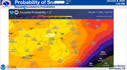
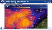
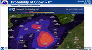
in LREF/NBM probabilities. LREF brings a large swath of > 60%
chance of seeing 4 or more inches from a line between Clarksdale
and Tupelo up to the TN/KY border. This is in line with a
HRRR/RAP-like solution. On the other hand, the NBM has the same
chances only from the TN/MS border to TN/KY. However, the
probability of seeing 2 or more inches jumps to > 60% to across
northern MS, lending enough confidence that we think the entire
CWA will experience warning criteria with a widespread area of 4-6
inches across a large portion of the Midsouth. Some convective
mesoscale banding could also provide locally higher snowfall
amounts. The timing for accumulation is expected to start between
00z and 06z Friday, lasting until 00z Saturday in the eastern
portions of the region.
The system leaves by Saturday morning with drying weather behind
it. The highs/lows should remain cold, especially in areas that
see lasting snowpack after the storm ends. The current forecast
calls for lows to drop below 20 for multiple days into next week
across northern portions of the region and in the 20s across
Mississippi. A few showers or flurries are possible Monday with a
cold front, but otherwise high pressure appears likely to keep the
remainder of the forecast dry.

