-
Hello, please take a minute to check out our awesome content, contributed by the wonderful members of our community. We hope you'll add your own thoughts and opinions by making a free account!
You are using an out of date browser. It may not display this or other websites correctly.
You should upgrade or use an alternative browser.
You should upgrade or use an alternative browser.
Wintry 1/9-12 Winter Potential Great Dane or Yorkie
- Thread starter SD
- Start date
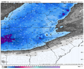
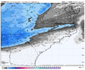
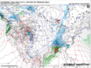
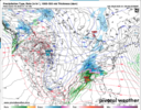
Closer GRAF look for nc folks
Not really all that reliable beyond 36hrs I understand
CNCsnwfan1210
Member
Yeah I’ll cash out on that
Sent from my iPhone using Tapatalk
Webberweather53
Meteorologist
If there’s any surprises we need a last minute boom over the Atlantic that could save north-eastern NC and south-eastern Virginia. Cold would be there for Elizabeth City and coastal areas. Better to root for someone vs no one
With an opened up contour at 850mb as it moves up gonna be tough to pull off I'm guessingIf there’s any surprises we need a last minute boom over the Atlantic that could save north-eastern NC and south-eastern Virginia. Cold would be there for Elizabeth City and coastal areas. Better to root for someone vs no one
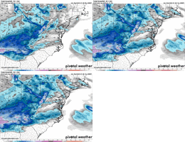
Seems like the absolute ultra best case scenario is 8-10 hours of snow for much of NC, maybe more like 12 if you're lucky. But mixing likely to be a little more prevalent than that GRAF run indicated. Honestly I think the RGEM looks ok if not a bit too bullish
ITUSETOSNOW
Member
Completely overcast in Atlanta,,,,28 degrees at noon.
SnowwxAtl
Member
I am noticing that the sfc low is trending alittle south on some runs this morning. Should help ATL with warm nose issues keeping it at bay somewhat. Interesting trend to me.
I have been burnt by this before but agreed temps profiles aren't verifying really at moment... The reported high was 37 today at but currently so far only at 29 in the surface tempCompletely overcast in Atlanta,,,,28 degrees at noon.
Mahomeless
Member
north winds blowing across a snowpack to the north with a blanket of clouds to insulate it....happens every time....however, it has no bearing on our upper levels verifyingI have been burnt by this before but agreed temps profiles aren't verifying really at moment... The reported high was 37 today at but currently so far only at 29 in the surface temp
Drizzle Snizzle
Member
its 34 and Partly Cloudy at the airportCompletely overcast in Atlanta,,,,28 degrees at noon.
mydoortotheworld
Member
Not for Atlanta it doesn’t, I don’t have access to soundings nor other maps atm but just straight glance tells me we still have issues with temps which has been the trend for the day unfortunately. But what’s new for ATL? NC, TN looks great
Makeitsnow
Member
Gfs has me at 46 in 50 minutes..but im only 39 under full sun. West ga should be in the upper 30s to low 40s. My area always warms the most on days like today so it's pretty decent bust by the models so far.north winds blowing across a snowpack to the north with a blanket of clouds to insulate it....happens every time....however, it has no bearing on our upper levels verifying
Snowflowxxl
Member
The temps today won’t impact Friday. Your better of monitoring the birds and squirrels in the yard.
ChattaVOL
Member

Sent from my iPhone using Tapatalk
Post of the day for all us away from computer. Thanks, this was much appreciatedJust a little recap for the most recent model runs:
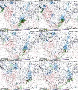
NAM/RGEM/FGV3: all fairly amped up. Would imply a warm nose switching most people from snow to sleet, but still a great winter storm, lots of liquid. RGEM least amped of the 3.
Hrrr/RAP/ICON/EURO/Euro/AI: all look relatively flat and don't seem to have the 700-750mb warm nose issues. They're also a little drier overall. More snow further south, and more people staying all snow... but less liquid for NC. Still a decent event there though.
It seems like the best compromise run right nowSeems like the absolute ultra best case scenario is 8-10 hours of snow for much of NC, maybe more like 12 if you're lucky. But mixing likely to be a little more prevalent than that GRAF run indicated. Honestly I think the RGEM looks ok if not a bit too bullish
Comparing setups is maybe useless when they are this different but Jan 2022 the RGEM had RDU with ~3" 72 hours out while NAM/HRRR had nothing. Is that comparison worth making since that was a last second NW/QPF trend and here we're talking thermals? Maybe not, but i think it should at least be kept in the back of one's mindIt seems like the best compromise run right now
Euro should be a tick colder
NWMSGuy
Member
Memphis AFD from this morning. Thinking the entire column will be at or below freezing:
The major attention grabber of this forecast period is the winter
storm incoming on Friday. A large Gulf Low is expected to
materialize along the southeast TX coast Thursday evening. The
surface low is expected to trek across southern and central MS/AL,
keeping the vast majority of our area on the cold, snowy side.
There`s already a very cold airmass in place so precip type is
less of a question mark than it was with the previous weekend`s
system. We`re looking at a very efficient band-like snowfall on
the back side of the surface low starting late Thursday night.
The heaviest snowfall is expected to occur between 6AM and noon on
Friday. Probabilistic guidance is still showing upticks on %
chance of exceeding 4 inches and we`re even seeing an uptick in
the % chance of exceeding 6 inches as well, especially just south
of the I-40 corridor. Digging into the ensemble space, there has
certainly been an upward trend in snow amounts with each
subsequent run since yesterday morning`s forecast. Both the LREF
ensemble mean and its individual components depict a swath of at
least 6" of snow in the Memphis metro along this I-40 corridor
between 12AM Friday and 12AM Saturday. As such, a Winter Storm
Watch has been hoisted for the entire area and will almost
certainly need to be upgraded to a Winter Storm Warning in a later
forecast.
The main uncertainty lies in a potential narrow corridor of a
changeover to liquid precip over north Mississippi on Friday
afternoon. Looking at forecast soundings for our southeastern
zones on Friday, there isn`t an obvious warm nose with a sudden
drop to below freezing at the surface that would make me think
freezing rain; almost the entire column is at or below freezing.
If any locations do see a mix of winter precip, it would likely be
a mix of rain and snow. In addition to the 2-4 inches of snow,
we`re generally not expecting any more than a light glaze of ice
in our Mississippi counties, if that.
Impacts from this system should not be taken lightly. The Winter
Storm Severity Index paints a large area of "major impacts" from
eastern Arkansas through the Memphis metro on Friday. This
entails considerable disruptions to daily life. Driving conditions
will be dangerous or at times, impossible. This is the kind of
heavy snow that can cause widespread closures and disruptions to
infrastructure. Even outside the locations of heaviest snow,
moderate impacts are expected, which still means driving
conditions will be quite hazardous.
After the storm moves out, another cold airmass will quickly slide
in behind it. This will be devastating for travel conditions as
we will barely rise above freezing for several days post heavy
snow, especially given a thick snowpack which usually causes
afternoon temperatures to drastically underperform. Any snow left
untreated on residential roads will further compact into an icy
mess for many days after the snowfall has ended. Start making
contingency plans for this weekend. If this snowfall lives up to
its potential (which it`s looking like it will), you will not want
to be out driving. Bitter cold overnight "feels like"
temperatures in the low 20s are expected through at least mid next
week. Little to no relief from the cold is in sight for the next 7
days.
That is one of the things that NWS KRDU mentioned in their last discussion. The fact that this contour is opened up is preventing this from being a classic Miller A system. Their discussion which I have not provided a link to is lengthy and very detailed. It would be worth reading if you live in or near the Triangle area.With an opened up contour at 850mb as it moves up gonna be tough to pull off I'm guessing
packfan98
Moderator
Euro is looking much better!
NBAcentel
Member
Downeastnc
Member
Need a strong closed 850 that tracks right along the coast with the SLP 100 miles SE of it to really see a decent NC snowstormThat is one of the things that NWS KRDU mentioned in their last discussion. The fact that this contour is opened up is preventing this from being a classic Miller A system. Their discussion which I have not provided a link to is lengthy and very detailed. It would be worth reading if you live in or near the Triangle area.
ForsythSnow
Moderator
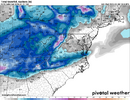
Can't see that far yet on free maps, is this looking a lot like the HRRR and RAP showing a colder press?We’re aliveView attachment 161347
NBAcentel
Member
RGEM did great with that one, but that was from a wave dropping in from the NW in clipper / manitoba mauler style. It tends to do pretty well with those in my experience. Different setup here of course so we'd have to factor it in with what the other models are saying as wellComparing setups is maybe useless when they are this different but Jan 2022 the RGEM had RDU with ~3" 72 hours out while NAM/HRRR had nothing. Is that comparison worth making since that was a last second NW/QPF trend and here we're talking thermals? Maybe not, but i think it should at least be kept in the back of one's mind
CNCsnwfan1210
Member
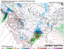
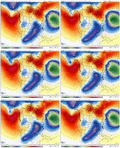
Notice that trend on the euro with the northern stream, every run has been headed the right direction, but it’s finally making a impact since it’s far enough south View attachment 161353
GEFS had a similar trend as well, we’ll take all the positive ticks we can get
Sent from my iPhone using Tapatalk
CNCsnwfan1210
Member
Anyone have a Euro ptype loop?
Sent from my iPhone using Tapatalk
Sent from my iPhone using Tapatalk
Winter storm watch language changes for FFC.
1-7” now south to north is their call!!!
1-7” now south to north is their call!!!
Yeah just thinking back to Ross's post and looking at this trend loop...if you're from Atlanta to Raleigh, you want that northern stream wave to drop farther south, but still have the trough be fairly positive tilt. If you're in Asheville to Richmond, you also want the wave dropping in more, but with not as much positive tilt overall with the troughNotice that trend on the euro with the northern stream, every run has been headed the right direction, but it’s finally making a impact since it’s far enough south View attachment 161353
rburrel2
Member
Yep. we get that and the 700-750mb warm nose is no longer a concern for us. Icon/Graf/Ukmet all looking the same with respect to the warm nose... gonna be interesting to see who wins, but i'm guessing the 5h height field getting mashed a little more in our direction from that great lakes lobe is what's driving it, and i'll trust the euro over the NAM at 60hrs out for that.Notice that trend on the euro with the northern stream, every run has been headed the right direction, but it’s finally making a impact since it’s far enough south View attachment 161353

