-
Hello, please take a minute to check out our awesome content, contributed by the wonderful members of our community. We hope you'll add your own thoughts and opinions by making a free account!
You are using an out of date browser. It may not display this or other websites correctly.
You should upgrade or use an alternative browser.
You should upgrade or use an alternative browser.
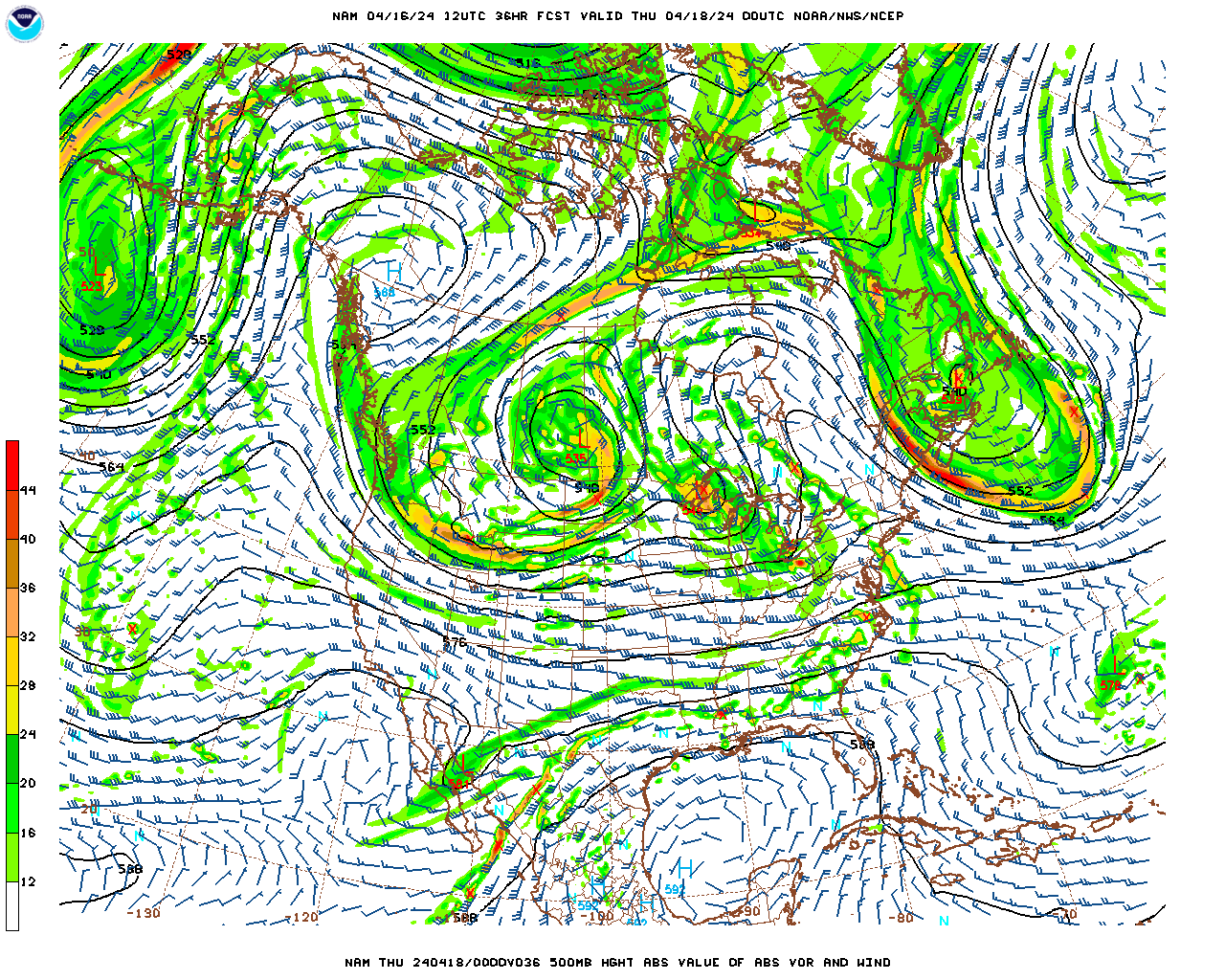
bouncycorn said:So there's more vorticity interaction but the system is further west & more separated. Could be a little slower this run.
Which would be good for the cold push i would assume
Xtreme weather said:Deltadog03 said:ATLWxFan said:Deltadog03 said:I wish the nam had a clue. Lol
I thought the NAM was more reliable at this range?
Sent from my iPhone using Tapatalk
It's getting there
You out of WY yet...been awhile lol
Oh ya. I'm in GA. Been hhere for almost 5 years now. Left WY back in March 2012
No snow for you said:I am getting concerned about I-85 and the cold not being able to make it over the mountains in time. Some of the models have hinted at this and since this is a Non CAD situation and the cold is coming from West to East, it normally takes longer for the cold to get to the CAD areas, if at all. Unless we see that High Pressure pop back up again in the NE, places like GSP could have some mixing issues or just a cold rain.
Ive been talking temps all along. Very concerned about cold rain being final outcome
Storm5 said:not surprised . we see vorts verify stronger all the time . Hopefully it's the trendbouncycorn said:And now it's interacting a little more but still stronger vort.
Sent from my SM-G900V using Tapatalk
Agreed. Looks a bit better and slower so far
SnowFlowXXL said:No snow for you said:I am getting concerned about I-85 and the cold not being able to make it over the mountains in time. Some of the models have hinted at this and since this is a Non CAD situation and the cold is coming from West to East, it normally takes longer for the cold to get to the CAD areas, if at all. Unless we see that High Pressure pop back up again in the NE, places like GSP could have some mixing issues or just a cold rain.
Ive been talking temps all along. Very concerned about cold rain being final outcome
I think ATL may have a better temp profile than GSP if the mountains get in the way. Remember, it is always tough for ATL to score any winter weather.
Live here 20 years, I know. Never seen more than 4 inches of snowNo snow for you said:SnowFlowXXL said:No snow for you said:I am getting concerned about I-85 and the cold not being able to make it over the mountains in time. Some of the models have hinted at this and since this is a Non CAD situation and the cold is coming from West to East, it normally takes longer for the cold to get to the CAD areas, if at all. Unless we see that High Pressure pop back up again in the NE, places like GSP could have some mixing issues or just a cold rain.
Ive been talking temps all along. Very concerned about cold rain being final outcome
I think ATL may have a better temp profile than GSP if the mountains get in the way. Remember, it is always tough for ATL to score any winter weather.
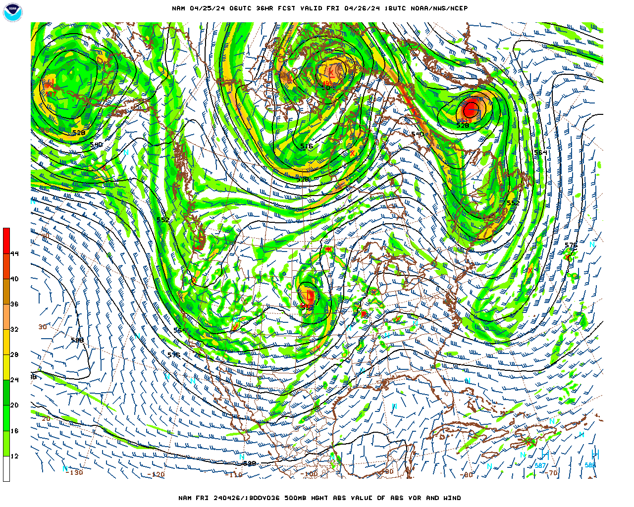
Deltadog03 said:by hr33 we are seeing a very nice trend away from interaction....PLUS the cold front is pushing south of I-40 in TN
please pass i 20 soon after that!
IF the idea of a central FL crossing were to turn out to be correct, climo of these tracks says that for ATL and vicinity it would be highly improbable that the bulk of any precip not be wintry meaning a cold rain dominating shouldn't occur. Now, if the low ends up further north and there's also not sufficient enough high pressure near the mid Atlantic coast, then cold rain becomes more of a possibility. One thing to note is that there is no -AO nor -NAO. The climo of central FL tracks says a -AO/-NAO is most likely to be associated with it. With those not forecasted to be there on 1/7 (~neutral at best) and with almost all other models being further north, a trend toward a further north track would seem likely. Otoh, the GFS has wavered very little for a number of runs, the 0Z GFS para was even further south (the extremely rare S FL track), and the 2/1973 great snowstorm low that crossed central FL was accompanied by a solid +AO/+NAO. So, it wouldn't be a big surprise if the central FL track were to hold. I'm leaning toward a north FL track as of this moment. Let's see what the 12Z consensus suggests.