Saddle up partners
-
Hello, please take a minute to check out our awesome content, contributed by the wonderful members of our community. We hope you'll add your own thoughts and opinions by making a free account!
You are using an out of date browser. It may not display this or other websites correctly.
You should upgrade or use an alternative browser.
You should upgrade or use an alternative browser.
Wintry 1/5-7 Winter Weather
- Thread starter SD
- Start date
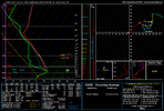
I still have the 12z GFS ice totals in my buffer. Here you go:

What's the reason for the change? Stronger high?


Good timing. Something it always takes/boils down to and we usually whiff on.What's the reason for the change? Stronger high?
Webberweather53
Meteorologist
I’m slowly but surely coming around to this system. I still have concerns.
The GFS is showing a winter wonderland for a good chunk of the mid-south and North Carolina. Let's see if the Euro gets on board with this look during its next run.
12z Canadian. Came south with LP track as well, not as much as GFS. Trends
.
.
12z UKMET still cuts hard. It has traded places with GFS from a couple days ago
Looks like the 2nd and 3rd wave stay suppressed on the GFS for now and goes out to sea.
iGRXY
Member


FRAM but honestly the western Carolinas probably accrue closer to the QPF estimate as temps were in the upper 20's.
Bigedd09
Member
Is there any support from the GEFS for this system?
Not out that far yetIs there any support from the GEFS for this system?
rburrel2
Member
Verbatim, it would have been mostly sleet for the Upstate I think. Short range models are gonna love this setup if we can get it in range.View attachment 158097
View attachment 158098
FRAM but honestly the western Carolinas probably accrue closer to the QPF estimate as temps were in the upper 20's.
Probably dumb question…but why is high pressure trending so favorably on GFS?I’m slowly but surely coming around to this system. I still have concerns.

GEFS starting to come in for the Monday to Tuesday storm.

iGRXY
Member
GFS actually has snow soundings but the Canadian is all ZR all the way at least for my location.Verbatim, it would have been mostly sleet for the Upstate I think. Short range models are gonna love this setup if we can get it in range.

Attachments
Gefs members so far with a big range in snow placement
Gefs will almost carbon copy op usually. When it doesnt, its a red flag
Last edited:
iGRXY
Member
 GEFS following it's OP. Faster S/W and more -NAO press further South.
NWMSGuy
Member
GEFS 12Z out to Hour 129:

It does have the higher snowfall mean up over central Virginia. Other models are showing this. Right now I would say central VA is the most favored with the upper south a close second. Two (three..) options right now.Gefs will almost carbon copy op usually. When it doesnt, its a red flag

Yep. Not really like the OP run at all. At least not for this 12zGefs will almost carbon copy op usually. When it doesnt, its a red flag
Because with the continued south trends of the shortwave it has detached itself from that piece of TPV sliding southward, allowing ridging and confluence aloft to stay over the top of it as it moves eastward.Probably dumb question…but why is high pressure trending so favorably on GFS?
View attachment 158101


Agrees with the CanadianIt does have the higher snowfall mean up over central Virginia. Other models are showing this. Right now I would say central VA is the most favored with the upper south a close second. Two (three..) options right now.
View attachment 158110

looks trapped at this pointBecause with the continued south trends of the shortwave it has detached itself from that piece of TPV sliding southward, allowing ridging and confluence aloft to stay over the top of it as it moves eastward.
View attachment 158114View attachment 158116
iGRXY
Member
GEFS looks almost exactly the same as it's OP lol?Yep. Not really like the OP run at all. At least not for this 12z

GoDuke
Member
 Navgem is locked in. Consistent with a southern track.
-NAO is doing work as others have said. Let's see if the Euro starts picking up on this.looks trapped at this point
Mahomeless
Member
- Joined
- Oct 17, 2023
- Messages
- 899
- Reaction score
- 2,157
Going to be an Ohio Valley special!
More snow for NC in operational? Ensembles seem to have more zrGEFS looks almost exactly the same as it's OP lol?
View attachment 158119
iGRXY
Member
Multiple members that are big on the Ice. Some still some snow also.
iGRXY
Member
Trying to figure out precip types this far out isn't smart. Just need to see that it has a storm signal and some kind of frozen showing up.More snow for NC in operational? Ensembles seem to have more zr
Same. Mount Rogers, Virginia and points north-east is what I’m thinking. Everything below looks like it’s teetering on mixing for NC mountains/foothills. Snow/sleet vs cold rain I don’t believe the ice maps at all. Still can be a good event esp in the CAD areas.I’m slowly but surely coming around to this system. I still have concerns.
Blue_Ridge_Escarpment
Member
I’m kind of the opposite. I think the highest probability is ice in the CAD regions. Even the models showing a cutter still have ice there.Same. Mount Rogers, Virginia and points north-east is what I’m thinking. Everything below looks like it’s teetering on mixing for NC mountains/foothills. Snow/sleet vs cold rain I don’t believe the ice maps at all. Still can be a good event esp in the CAD areas.
While we wait for an exciting Euro run - take a look at the updated member map! We've got about 125 folks added so far
SouthernWX Member Map
If you'd like to be added- feel free to fill out the quick form below
Form to get added to the map
SouthernWX Member Map
If you'd like to be added- feel free to fill out the quick form below
Form to get added to the map
The saving grace, is even if someone is mid 20s,gets all frzng rn, max they would get is 3/4 inch qpf. That will pop some limbs if it happened. But where you really get into major damage frzng rn, week + widespread power outages is north of .75 qpf.I’m kind of the opposite. I think the highest probability is ice in the CAD regions. Even the models showing a cutter still have ice there.
Best way to get major damage off .75 qpf frozen is a quick limb glazer, follwed by 6 inches wet snow on top, as it will catch everything
iGRXY
Member
