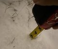
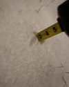
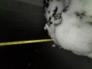
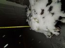
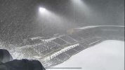
Holy crap; it’s dumping now!!I think I’m pushing 2” here rn
-
Hello, please take a minute to check out our awesome content, contributed by the wonderful members of our community. We hope you'll add your own thoughts and opinions by making a free account!
You are using an out of date browser. It may not display this or other websites correctly.
You should upgrade or use an alternative browser.
You should upgrade or use an alternative browser.
Wintry 1/20 - 1/23 Winter Storm
- Thread starter packfan98
- Start date
Just went out. Really dense small flakes. Intensity is greater than 30 minutes ago. Not far from 2".If this keeps up totals are going to jump quick. Many more flakes and they are much thicker now
Just a question of how long we can keep it up, flipped here in the last 5 mins, flake size will probably shrink on down but rates are really high, maybe .5-.75" a hr is doable for awhile but how long....figure we might have 4-5 hrs left but it almost always ends faster than we or the models think.
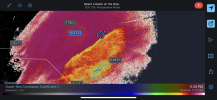
Will be out of here by 4am, tops, radar is encouraging for some rates approaching 1"hr and I think 3 maybe 4 is the upper end for us. NW Pitt & Edgecombe up towards the Albemarle Sound will max, status quo, maybe just a little east of the classic axis.
Downeastnc
Member
This is the HRRR snow depth change on the newest run on going.....this does give me a bit of hope and there certainly looks like some kind of band building in just SE of Wake....this is probably absolute best case but interesting....


I hear you measuring in the grass. That's what I'm talking about! I left that one off my list from earlier today too.Lol bruh, still some radar left to,
Gonna surpass 3.25” at this rate. At 2.75”
View attachment 109514View attachment 109515
Heelyes
Member
Whiteout
Parrothead
Member
Congrats @North/South Carolina on your snow!!
Looks like everyone from just west of Charlotte to Greensboro and points East are going to see snow. Now it’s time for west and middle tenn and the western parts of the mid and upper south to score one. No doubt the pattern looks good for North Carolina right now.Congrats to all getting a good snow and for parts of South Carolina in the Deep South for scoring their second good snow!
Has your chicken taken cover yet, that is the big questionWhiteout
Haha I’m a weenie I do weenie things, but in all seriousness the NWS counts 3 averaged out measurements in the grassI hear you measuring in the grass. That's what I'm talking about! I left that one off my list from earlier today too.
Walking to out front of my complex to try to get the death band in the car dealership lights!
brendan123
Member
About an inch here, but hard to tell due to the wind. Rates picking up and should snow until almost sunrise according to the HRRR, which says I get 4 inches. I bet it adds up to less than that bc of how small the flakes are, but still definitely the best snow since 2018. Roads are completely covered almost as much as grass and decks despite the county salting them.
Heelyes
Member
You want a new pic?Has your chicken taken cover yet, that is the big question
Only if it shows 2" on it's backYou want a new pic?
Latest METAR from RDU:
+SN FZFG
+SN FZFG

