If I scratch my scalp enough I’ll get some dandruff flakes to fall out. modernweenieI hallucinated a few flakes while driving does that count?
-
Hello, please take a minute to check out our awesome content, contributed by the wonderful members of our community. We hope you'll add your own thoughts and opinions by making a free account!
You are using an out of date browser. It may not display this or other websites correctly.
You should upgrade or use an alternative browser.
You should upgrade or use an alternative browser.
Wintry ❄The Christmas Miracle❄(12-24/12-25)
- Thread starter TheBatman
- Start date
NBAcentel
Member
Maybe, just maybe ? moving NE (tilt 2) 
Webberweather53
Meteorologist
When? I’d like to know when the nam consistently showed it or anything other than a random snow shower near sunrise in the north-central coastal plain because other than that it snowed nada & I had more than that here.Well the nam was showing a band of snow from charlotte south and east. I think the nam did a fine job
Sent from my Pixel 3 using Tapatalk
L
Logan Is An Idiot 02
Guest
It was never consistent with showing much. But for my area and areas near me the nam performed the bestWhen? I’d like to know when the nam consistently showed it or anything other than a random snow shower near sunrise in the north-central coastal plain
Sent from my Pixel 3 using Tapatalk
TN line on 26 has plenty. Must go north of AshevilleMy WNC folks...I am going to bring my son up to see some snow today. We are coming from Northern Greenville county and we are maybe 20 minutes from Flat rock and 30 from Hendersonville. Do you guys know if certain areas jackpotted more than others and where the best places to go would be? Thanks in advance!
Sent from my iPhone using Tapatalk
Webberweather53
Meteorologist
Ok so if it wasn’t then how did it do better than hrrr which showed that band on basically every single run for the past 2 days and actually depicted legitimate snow shower coverage east of the nc mountains which did in fact verify whereas the NAM showed none. Sorry but you’re wrong hereIt was never consistent with showing much. But for my area and areas near me the nam performed the best
Sent from my Pixel 3 using Tapatalk
NBAcentel
Member
Nam didn’t even even have a flake here, in fact it had no sort of response in my area with the Convective soundings, at least saw some flurries/snowflakes throughout the night/dayIt was never consistent with showing much. But for my area and areas near me the nam performed the best
Sent from my Pixel 3 using Tapatalk
L
Logan Is An Idiot 02
Guest
The nam was better for some areas and the HRRR was better for some areas. The HRRR screwed me and areas near me over twice in less than 24 hours. But I'm happy you got to see some snow!Ok so if it wasn’t then how did it do better than hrrr which showed that band on basically every single run for the past 2 days and actually depicted legitimate snow shower coverage east of the nc mountains which did in fact verify whereas the NAM showed none. Sorry but you’re wrong here
Sent from my Pixel 3 using Tapatalk
They got hammered so I’m sure you’ll have plenty. I’m jealous.Just left for pigeon forge hope there’s a little snow left on the ground
Sent from my iPhone using Tapatalk
our high here was 31.5 and it has dropped a degree since the clouds rolled back in.
Webberweather53
Meteorologist
So now you’re saying the nam didn’t nail this one then & didn’t perform better than the HRRR?The nam was better for some areas and the HRRR was better for some areas. The HRRR screwed me and areas near me over twice in less than 24 hours. But I'm happy you got to see some snow!
Sent from my Pixel 3 using Tapatalk
L
Logan Is An Idiot 02
Guest
IMO yes I saw a couple flakes but for my area the nam nailed it. I would say the HRRR was better for your area
Sent from my Pixel 3 using Tapatalk
Sent from my Pixel 3 using Tapatalk
L
Logan Is An Idiot 02
Guest
The HRRR showed hours of consistent flurries over me. I got flurries for 45 secondsSo now you’re saying the nam didn’t nail this one then & didn’t perform better than the HRRR?
Sent from my Pixel 3 using Tapatalk
Somebody got the Euro run? Thanks
South side of charlotte probably gets a quick hit later. Maybe beteen DT Charlotte and RockMaybe, just maybe ? moving NE (tilt 2) View attachment 60283
Hill. Meanwhile, I can’t even get a cloud overhead here.
Webberweather53
Meteorologist
Just to state the obvious here, because the NAM did well in your specific backyard doesn’t mean it did good overall. East of the mountains in nc, the coverage of snow showers was closer to the HRRR and not the NAM which had nothing overall, so saying things like “the nam nailed this one” just since it did okay in your backyard is nonsense.IMO yes I saw a couple flakes but for my area the nam nailed it. I would say the HRRR was better for your area
Sent from my Pixel 3 using Tapatalk
L
Logan Is An Idiot 02
Guest
I mean the HRRR also showed an expansive amount of snow over the triad for today and they haven't gotten any.Just to state the obvious here, because the NAM did well in your specific backyard doesn’t mean it did good overall. East of the mountains in nc, the coverage of snow showers was closer to the HRRR and not the NAM which had nothing overall, so saying things like “the nam nailed this one” just since it did okay in your backyard is nonsense.
Sent from my Pixel 3 using Tapatalk
NBAcentel
Member
If they do I’m chasing lol, not gonna miss another SC/NC special like this morningSouth side of charlotte probably gets a quick hit later. Maybe beteen DT Charlotte and Rock
Hill. Meanwhile, I can’t even get a cloud overhead here.
Webberweather53
Meteorologist
Scattered snow showers =/= widespread or expansive snow. Coverage overall was closer to the HRRR area-wide. Cherry picking a few locations to suit your fancy isn’t helping your case at all hereI mean the HRRR also showed an expansive amount of snow over the triad for today and they haven't gotten any.
Sent from my Pixel 3 using Tapatalk
NBAcentel
Member
Don’t know what this stuff will do but it’s breaking containment again 
L
Logan Is An Idiot 02
Guest
Hey I'm happy a saw some flakes. Just imo opinion I think the nam did a better job with this system for most areas. We are allowed to disagree and havee different opinionsScattered snow showers =/= widespread or expansive snow. Coverage overall was closer to the HRRR area-wide. Cherry picking a few locations to suit your fancy isn’t helping your case at all here
Sent from my Pixel 3 using Tapatalk
Webberweather53
Meteorologist
Well there are opinions and just being plain wrong, and the truth is the nam didn’t do better than the HRRR and you even said that just several minutes ago.Hey I'm happy a saw some flakes. Just imo opinion I think the nam did a better job with this system for most areas. We are allowed to disagree and havee different opinions
Sent from my Pixel 3 using Tapatalk
Maybe that’s where that Carolina boarder band comes from in a couple hours?Don’t know what this stuff will do but it’s breaking containment again View attachment 60284
Round Oak Weather
Member
NAM missed the snow I saw last night I’d post the picture if I could but idk how to make the image smallerNam didn’t even even have a flake here, in fact it had no sort of response in my area with the Convective soundings, at least saw some flurries/snowflakes throughout the night/day
Webb, he’s a troll just put him on ignoreWell there are opinions and just being plain wrong, and the truth is the nam didn’t do better than the HRRR and you even said that just several minutes ago.
D
Deleted member 609
Guest
Latest hrrr right over me. What can go wrong?

Its raining in Nova Scotia and snowing in the Carolinas
njbarrineau
Member
We went to Weaverville and I would say the place we were at had at least a solid 6”. Beautiful day but numbingly cold. My three year old had a blast.

Sent from my iPhone using Tapatalk

Sent from my iPhone using Tapatalk
Jessy89
Member
Asheville north there snow all over place
Sent from my iPhone using Tapatalk
Sent from my iPhone using Tapatalk
NAM missed the snow I saw last night I’d post the picture if I could but idk how to make the image smaller
Take a screenshot. That reduces the size. Do you have an iPhone?
"How to take a screenshot on iPhone models with Face ID. Press the Side Button and the Volume Up button at the same time. Quickly release both buttons. After you take a screenshot, a thumbnail temporarily appears in the lower-left corner of your screen. Tap the thumbnail to open it or swipe left ... "
I'm keeping a close eye on the Uptown Charlotte area, so I'll report any action. I saw 6-8 passing flakes about an hour ago, but nothing since.
- Joined
- Jan 2, 2017
- Messages
- 1,568
- Reaction score
- 4,283
Has gotten thick cloudy here...flurries watch!
drfranklin
Member
- Joined
- Dec 1, 2016
- Messages
- 511
- Reaction score
- 760
mostly cloudy here (most clouds the entire day) - temp is slowly falling, now 30.9Has gotten thick cloudy here...flurries watch!
Last edited:
Round Oak Weather
Member
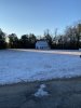
Hillsboro, Ga the band started coming through at about 11:20 and snowed till about 12:30 last night. I’d say they got between a .25-.5 they had more snow last night but you could tell the wind dried it out a bit by this morning.
Attachments
Ok just saw a few more flakes, but you have to be the utmost weenie to see. For example, looking towards the perfect dark backdrop, don't blink, stand real close to the window but not so close that you fog it up, and most of all patience.
NoSnowATL
Member
Never got above 31 today. Not too shabby with no snow on the ground.
accu35
Member
This is one of those times where you sit back and think before you post. Learn from the ones who actually been through college and knows weather.Hey I'm happy a saw some flakes. Just imo opinion I think the nam did a better job with this system for most areas. We are allowed to disagree and havee different opinions
Sent from my Pixel 3 using Tapatalk
SimeonNC
Member
I live a few miles north of uptown, and clouds are building upI'm keeping a close eye on the Uptown Charlotte area, so I'll report any action. I saw 6-8 passing flakes about an hour ago, but nothing since.
Sent from my Z983 using Tapatalk
29/4 in Chattanooga with back edge of the cloud deck quickly approaching - only thing keeping temps up tonight will be the wind. if those die off more than expected, we'll likely drop well below the forecast of 18.

NBAcentel
Member
Same here, especially to my westI live a few miles north of uptown, and clouds are building up
Sent from my Z983 using Tapatalk