Belle Lechat
Member
- Joined
- Aug 29, 2021
- Messages
- 1,672
- Reaction score
- 1,324







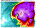
The variable of Wind Shear will be of major importance here, it's pretty assured there will be some but can't be sure just how much it will impact the growth of this storm yet and if it's on the lesser side or storm moves faster it could overperform.Overnight hurricane models were all pretty concerning imo HAFS A-B both dropped the idea of weakening as much leading into landfall and HWRF and HMON as well. All of these models drop pressure into upper 940s with minor weakening at landfall into lower to mid 950s.

View attachment 198520
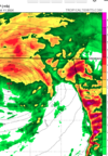
Way to early read of HWRF 00z run along with the hurricane itself that's some strong cells to west in East AL/West GA


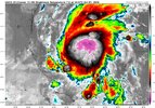



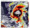
I fully expect the inbound flight to find at least 60 for winds with this. Just by the loop I can tell it's already decently organizedCertainly looks like a quickly organizing TS this morning
View attachment 198522View attachment 198523

Yep, that would be worst case scenario for the idea of a game occurring on Saturday night, but most other models do suggest faster.
We look as if we'd be well on our way to another high-end Gulf major under normal circumstances today.