• Hello, please take a minute to check out our awesome content, contributed by the wonderful members of our community. We hope you'll add your own thoughts and opinions by making a free account!

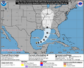
Tropical TD9

two_atl_2d0.png
 
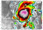
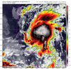
GOES19-CONUS-EXTENT3-625x375.gif


...FORECAST TO RAPIDLY STRENGTHEN OVER THE NEXT COUPLE OF DAYS...

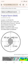
4:00 AM CDT Wed Oct 07
Location: 22.0°N 94.1°W
Moving: ENE at 8 mph
Min pressure: 1004 mb
Max sustained: 40 mph
 
1791364181443.png

from the Discussion

the NHC
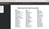
intensity forecast is being raised accordingly, now showing Isaias
reaching a peak intensity of 95 kt in 48 h while it is over the
central Gulf.
 
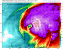
Overnight hurricane models were all pretty concerning imo HAFS A-B both dropped the idea of weakening as much leading into landfall and HWRF and HMON as well. All of these models drop pressure into upper 940s with minor weakening at landfall into lower to mid 950s.
The variable of Wind Shear will be of major importance here, it's pretty assured there will be some but can't be sure just how much it will impact the growth of this storm yet and if it's on the lesser side or storm moves faster it could overperform.
 
Could this be the one storm that meteorologist tag as “see, we told you, it only takes one named storm to….”

We’ve been fortunate with El Niño to squash any chances of an Atlantic hurricane. Now, could El Niño be the one thing that ventilates this storm enough to not tear it apart but rather help expand it?

Fascinating


Sent from my iPhone using Tapatalk
 
EuroAI is locked in on ~Gulf Shores. Euro AI Ensembles and the GFS are targeting Pensacola.

Gonna be a long weekend for me.
 
Last edited:
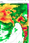
HWRF far stronger inland than its been. Yeah, no AL/GA game with that look.

View attachment 198521

Yep, that would be worst case scenario for the idea of a game occurring on Saturday night, but most other models do suggest faster.

We look as if we'd be well on our way to another high-end Gulf major under normal circumstances today.

 
Icon is weaker but would still cause a swath of 60-80mph gusts from Tuscaloosa to Carrolton, GA.
 
Yep, that would be worst case scenario for the idea of a game occurring on Saturday night, but most other models do suggest faster.

We look as if we'd be well on our way to another high-end Gulf major under normal circumstances today.

I don't think speed or timing means much anymore unless it slows down by a day. If we get widespread 60-80mph gusts, you are talking widespread tree damage and power outages. That alone will get the game postponed.
 
Back
Top