-
Hello, please take a minute to check out our awesome content, contributed by the wonderful members of our community. We hope you'll add your own thoughts and opinions by making a free account!
You are using an out of date browser. It may not display this or other websites correctly.
You should upgrade or use an alternative browser.
You should upgrade or use an alternative browser.
Wintry Machine Learning Mauler 1/30-2/1
- Thread starter SD
- Start date
Shaggy
Member
Anyone have the euro ens snow mean since it's qpf increased?
Stormsfury
Member
It is down, they were hoping to have it back up today.Any update on the the KCLX radar? It still seems to be down…
NWG_WX14
Member
18z NAM had it accumulating in wake county lol
Wondering if this makes it to Wake Forest or Youngsville
Sent from my iPhone using Tapatalk
chase223322
Member
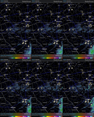
Happy for you Mitch! You deserve it more than anybody!Guys.. this is a now thing. Radar is lighting up in the Carolinas. WAY ahead of schedule. My buddy said it snowing in rock hill. Yall enjoy it. It’s a now thing. Bump the models. We rage
The Weather Channel has sent correspondents to Charlotte and Duck in North Carolina. I guess they believe in the dry slot over the Triangle, they didn't send here.
Last edited:
Crow
Member
Snowing at the Vance/Granville line at I85
Tokenfreak
Member
It is down, they were hoping to have it back up today.
So we most likely won’t have it in time for tomorrow it sounds like then. Bummer.
Sandbar
Member
So looking at this layout and it looks to my very untrained eye like the WRAL in house model that was shown earlier perhaps? Obviously just one of many options we are seeing.
38 degrees in Greenville!! That gonna get into the low 20s 20:1 ratios?? Or is this warmer than expected?
NWG_WX14
Member
Sent from my SM-S156V using Tapatalk
For the triangle that radar seems very similar to the Baron in house model WRAL posted.
View attachment 192075
For the few interested in the Coastal Empire, this is WTOCs GRAF latest totals. Probably best case scenario.
That 2.36” for SAV on this GRAF is higher than just about any run of any model that I’ve seen the last few days with the exception of maybe a run of the CMC. So, I agree that this is about the best case scenario, and one can see that it’s due to very narrow bands that happens to go over SAV without drying out too much as they move SE. That’s what any location needs to well exceed expectations. Notice that amounts drop off very sharply in every direction only 10-20 miles away. I’m guessing that the odds of actually 2-2.5” in any one location in this area are ~5% as long as other models don’t start upping their qpf. The much better bet is for 0.5-1.0”.
Baron model seemed bullish here too. Hope we reel this one inFor the triangle that radar seems very similar to the Baron in house model WRAL posted.
Sctvman
Member
rburrel2
Member
No. You trash the sref mean bc its highly inaccurate and antiquated, and when it shows something that disagrees with consensus it’s always wrong.that’s been proven yet again here. Unless you think central Virginia is getting a foot tomorrow.Yessir, if it doesn’t favor you, then trash it right?
It’s not my favorite model br any means, but doesn’t the NWS use it pretty heavily?I learned this lesson long ago, you probably knew too… but here’s another classic example of why you should give the sref mean 0% consideration in the future. It’s 100% trash and worthless.
Pulling for you and all the Savannah area posters!!That 2.36” for SAV on this GRAF is higher than just about any run of any model that I’ve seen the last few days with the exception of maybe a run of the CMC. So, I agree that this is about the best case scenario, and one can see that it’s due to very narrow bands that happens to go over SAV without drying out too much as they move SE. That’s what any location needs to well exceed expectations. Notice that amounts drop off very sharply in every direction only 10-20 miles away. I’m guessing that the odds of actually 2-2.5” in any one location in this area are ~5% as long as other models don’t start upping their qpf. The much better bet is for 0.5-1.0”.
Makeitsnow
Member
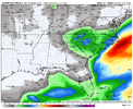
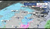
Persistent banding here and it only goes till tomorrow early afternoonI had to go look it up. Lol! It has snow coming into the Raleigh area around 1:45am. View attachment 192140
Lordhelmit
Member
TWC app's future radar has it showing up in Raleigh around that time too. I know I know it's TWC, but stillI had to go look it up. Lol! It has snow coming into the Raleigh area around 1:45am. View attachment 192140
Showmeyourtds
Member
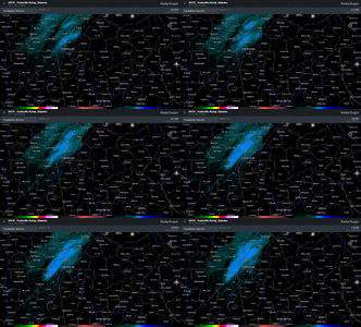
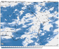
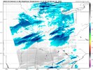
Full moon & stars are out heredefinitely a head start on moisture. hrrr shows a lot of breaks in cloud cover where there is returns on radar and cloud cover over north ga is ahead of schedule. View attachment 192139
View attachment 192138
At this point I'll take any good news...TWC app's future radar has it showing up in Raleigh around that time too. I know I know it's TWC, but still
iwantsouthernsnow123
Member
Hopefully you get some good snow over there. Hoping we get some here too, been a good while since either of us have gotten a good real snow.
I’m sitting here unable to focus on the show I’m watching because I keep having horrible visions of 6-10” 5 miles south of me.
Column is definitely saturated now. It’s a heavy snow now but flakes are small. Heavy dusting on all surfaces. Gonna be a hell of a snow in the mountains!
NBAcentel
Member
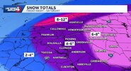
The cae nws video posted earlier really harped on how unbelievable this setup is, never seen before.This is just wild stuff View attachment 192144
Triplephase93
Member
Flakes flying in Hixson Tn at 33 degrees. Chattanooga finds away to flub even the little Precip we get


