Fountainguy97
Member
Yep It's going to continue forming this mesolow down here in upstate SC. This thing has a serious risk of overpreforming.You guys downstream of this ULL... it's hammering as forcing has picked up.
I'm supposed to get this for another 20 hours? Goodness.
View attachment 192088
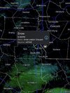
I can confirm that it's all verga right now. But the atmosphere is getting moist fast, wouldnt surprise me for flurries to start sooner than expected due to this.Big googly eyes..column crasher
View attachment 192089
WRAL in-house Baron Model
| Hrrr | 18z | 16hr | 0.32 | ||
| NAM | 18z | 16hr | 0.32 | ||
| NAM 3k | 18z | 16hr | 0.31 | ||
| ICON | 18z | 16hr | 0.28 | ||
| GFS | 18z | 16hr | 0.38 | ||
| rgem | 18z | 16hr | 0.23 | ||
| GFS AI | 18z | 16hr | 0.35 | ||
| Euro | 18z | 16hr | 0.4 | ||
| Euro AI | 18z | 16hr | 0.27 |

What’s the link for that as I’d be interested in checking different time periods? Thanks
Is this current? I am just north of baldwin and we havent seen anything so farBig googly eyes..column crasher
View attachment 192089
Euro has been going back and forth for the last two days at least.

Some of us between the Triad and Triangle are going to be sitting in the old Carolina split. Folks the East, West, South, and maybe North will be in the 8+ range. The question will be how much accumulation will be in the minimum areas. Euro has 3-4 in those areas. I can handle that much better than a trace to 2”.Yuck, good thing it's not in it's wheelhouse I guess.
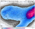
View attachment 192098
AI Euro stayed the same, at least (you can probably 1.5-2x these with ratios).Yuck, good thing it's not in it's wheelhouse I guess.
View attachment 192098

Yes..its virga mostly but helps saturate the columnIs this current? I am just north of baldwin and we havent seen anything so far
Been steady as heck in the upstate. Just moving the heavy bands around a littleEuro has been going back and forth for the last two days at least.
I agree. If I had to bet where the min will be, I’ll say Burlington. Coastal precip tends to verify a bit NW and the ULL is robust for MetrolinaSome of us between the Triad and Triangle are going to be sitting in the old Carolina split. Folks the East, West, South, and maybe North will be in the 8+ range. The question will be how much accumulation will be in the minimum areas. Euro has 3-4 in those areas. I can handle that much better than a trace to 2”.
I was glad to see that it held steady. I would say that the Op should be favored over the AI at this juncture with the better resolution, although I’m not exactly sure how the AI works with finer details.AI Euro stayed the same, at least (you can probably 1.5-2x these with ratios).
View attachment 192106
OG Euro has been bouncing back and forth with the precip in the Triangle every run.AI Euro stayed the same, at least (you can probably 1.5-2x these with ratios).
View attachment 192106
Reaching surface or verga?Getting a couple stray snowflakes under this right now View attachment 192108
Probably so, although the op Euro has honestly been all over the place over the last day or two, anyways, so I'm not sure how much credence it should even be given.I was glad to see that it held steady. I would say that the Op should be favored over the AI at this juncture with the better resolution, although I’m not exactly sure how the AI works with finer details.
