Brandon10
Member
Anyone have most recent GRAF?
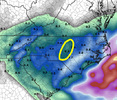
It's been a relentless, and pronounced, shift northward on the AIGFS all day today.
View attachment 192053

21z RAP doing the exact same thing as the HRR. At 7 pm Saturday, barely a dusting at RDU -- at the same time NAM had a foot. Absolutely crazy disparity.


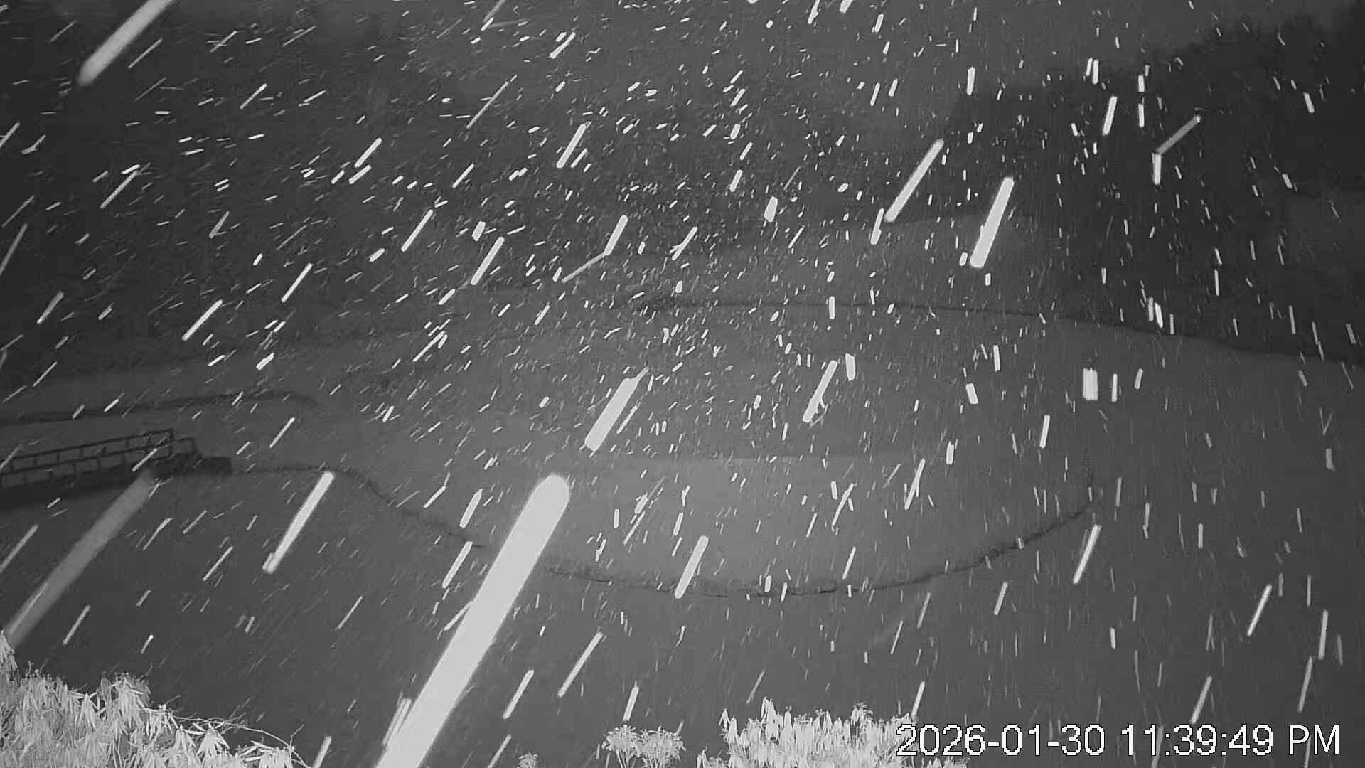
There are a few fat flakes flying on the cam@Parker need a ground report from OberView attachment 192026
 www.resortcams.com


18z UKMET looks to have filled in the dryslot a bit. Who has Pivotal access and can show the Kuchera? @RBR71

Folks at CAE are geeking out.
Rare stuff here. Somebody under that ULL band is gonna get a foot. Boatloads of lift, and steep mid level lapse rates right above the 500mb dry slot. Thundersnow potential here View attachment 192067View attachment 192068View attachment 192069View attachment 192071
What do you think about the mountains around cashiers?Yep I totally agree. Someone out near Charlotte is going to see a foot or more of snow
Folks at CAE are geeking out.

Ive lived in Walhalla and Seneca all my life and guarantee Cashiers and Highlands get over 10What do you think about the mountains around cashiers?
10.1 would be the 4th largest for CLT in my 49 years. February 2004, January 1988, and March 1983 are the top 3.I went with 10.1 inches for Charlotte earlier in the forecast contest. That would be the 7th biggest storm at CLT since 1930.
We'll see how it goes, but this is what I liked:
1. Strong upper wave bottoming out in the trough - that's when fireworks go off
2. Mid-level lows are closed and 'spinny' as they track across SC
3. Upstate mesolow formation and associated mid-level convergence
4. Highly anomalous soundings with very cold profiles, deep dendrite growth zone (DGZ), and mid-level frontogenesis co-located in the DGZ
The last holdout to me was the QPF inching up on the modeling, and I thought what we saw today was noteworthy. Good luck to all!
View attachment 192070
 www.ipcamlive.com
How’s it doing at hr1?


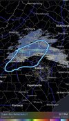
Rap looks spot on to what is hitting the groundView attachment 192078
View attachment 192079
Start of 21z Rap on top, current radar on bottom. Now granted i'm not sure how much of that if any of it at all is actually hitting the ground and sticking but Kat Campbell did say they had saw snowflakes on the Kerr Lake Skycam
View attachment 192078
View attachment 192079
Start of 21z Rap on top, current radar on bottom. Now granted i'm not sure how much of that if any of it at all is actually hitting the ground and sticking but Kat Campbell did say they had saw snowflakes on the Kerr Lake Skycam
Based on?Rough draw here but this is the most likely dryslot location imho. I think Wake may get more of the coastal
WRAL in-house Baron Model
WRAL in-house Baron Model
I think this discussion sums up the situation for KRDU and surrounding areas very well. This looks to be an almost all or nothing storm depending on where that dry slot sets up. Model runs show some of the most discrepancy I have ever seen before a winter weather event. On the edges of the dry slot there might be some very high totals. I'm hoping for the higher totals but I aware that there is a chance that this storm could be a comparative bust compared to other areas. Best of luck to everyone!More interesting discussion from RAH this afternoon on the setup (and the potential dry slot)...
Snow should really increase in coverage and intensity beginning
Saturday morning, with the event likely peaking in the afternoon and
evening as the mid/upper low interacts with the deepening coastal
low and a band of 850 mb frontogenesis sets up. With very cold
temperatures in place, the snow will be of the dry and fluffy
variety as snow to liquid ratios through the event generally range
from 12:1 to 20:1, lowest in the SE and initially, highest in the NW
and by Saturday evening/night. Liquid equivalent QPF for the event
is generally expected to range from a third to three quarters of an
inch, lowest N and highest SE. This generally translates to 4 to 8
inches across most of central NC, but a band of 8 to 12 inches is
likely to set up somewhere over the state with the best chance along
and east of I-95. There is also a scenario where many spots receive
lower amounts that will have to be monitored, which is explained
below.
Despite only being 24 hours from the event, there is still quite a
bit of discrepancy among the models on where exactly the band of
heavier snow will be, and it will depend on where exactly the
elevated frontal zone sets up, as well as how far south the
mid/upper low tracks. This is a complex setup and small shifts in
track and intensity can have a huge effect on how much snow falls.
If the mid/upper low tracks farther south, it will take longer to
interact with the coastal low, keeping the 8+ inch amounts to our
east, and potentially resulting in lower than expected snowfall
totals across a good portion of central NC. This is the scenario
depicted by the 12z NAMNest and 18z HRRR, which depict very light
amounts stretching from the northern Coastal Plain into the NE
Piedmont due to a gap in forcing between the mid/upper low to our
west and the coastal low to our east, a signal that has shown up on
some model runs since yesterday. This is a concerning trend that
will have to be monitored to see if it continues. But until there is
more consistency from run to run, it`s hard to take this one
scenario with too much weight. High-res models have been waffling
back and forth, with a notable shift east in the axis of heaviest
snow in some of the 12z and 18z runs compared to 06z. However, if
the mid/upper low and coastal low interact sooner, as depicted by
models like the 12z GFS and lower-resolution NAM, a larger area of
moderate to heavy snow will develop over central NC. Bust potential
is fairly high and this may be a nowcasting situation where we don`t
know exactly how far inland the heaviest snow will get. For now, a
Winter Storm Warning continues from this evening through Sunday
morning.

Looks about what I'm thinking tbh18z UKMET looks to have filled in the dryslot a bit. Who has Pivotal access and can show the Kuchera? @RBR71