-
Hello, please take a minute to check out our awesome content, contributed by the wonderful members of our community. We hope you'll add your own thoughts and opinions by making a free account!
You are using an out of date browser. It may not display this or other websites correctly.
You should upgrade or use an alternative browser.
You should upgrade or use an alternative browser.
Wintry Machine Learning Mauler 1/30-2/1
- Thread starter SD
- Start date
NCWeatherNow
Member
Is the ULL overperforming?
BrickTamland
Member
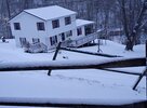
The last GFS run showed snow up there at this time.Snowing at Kerr Lake Country Club in Henderson, NC
Something I’ve always wondered and maybe one of the mets on here can answer. Does where bands of virga starting to pop up on radar give any indication to where the best forcing is setting up? I ask because there is band that just popped in the last hour south of me over Lancaster county stretch west over York and back over the upstate
rburrel2
Member
this is charlotte’s storm.

Same for here up in Eastern Rutherford CountyView attachment 192110That heaviest band is right over me.
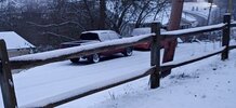
I'm a long time lurker, just figured I would share a pic. Hope this isn't banter. This is from Buchanan county VA, on the va/ky/WV border. Only calling for 3-5" of snow here, so I think you guys further east will have a nice treat. Good luck everyone!
Attachments
packfan98
Moderator
SREF is showing the Carolina Split for the first time. (The model has not finished running yet)

coldspringsfarm
Member
Its a bit too consistent and low resolution for this crowd me thinks.When this is said and done we will look back and see that the Weathernext more/less had it right for the last 5 days. Everything else is just noise and entertainment.
 .
.https://www.facebook.com/share/r/16gEEGdQaQ/ Snow falling already in Granville County in the Oxford area
NBAcentel
Member
It’s dry now, but it was the tiniest few flakes ever. hyped though hahaReaching surface or verga?
wow
Member
Radar is lighting up over W NC/SC

Gonna be flurries in GSP local buy 8 o’clock as this forms and expands!
Branch
Member
Anyone have the latest HRRR snow map for Georgia?
NBAcentel
Member
850mb warm air advection already doing some dirty work

rburrel2
Member
Been wondering why the gfs ai has shown a region wide .01 inch tonight and now I see why, lol.

- Joined
- Jan 2, 2017
- Messages
- 1,566
- Reaction score
- 4,279

Same. I haven’t seen anything eitherIs this current? I am just north of baldwin and we havent seen anything so far
packfan98
Moderator
Completed SREF run

rburrel2
Member
I learned this lesson long ago, you probably knew too… but here’s another classic example of why you should give the sref mean 0% consideration in the future. It’s 100% trash and worthless.SREF is showing the Carolina Split for the first time. (The model has not finished running yet)
View attachment 192116
NCWeatherNow
Member
Starting well ahead of schedule ^_^
Shifts the highest snows from central NC eastward.SREF is showing the Carolina Split for the first time. (The model has not finished running yet)
View attachment 192116
Final kuchera:

mx3gsr92
Member
Completed SREF run
View attachment 192122
NE NC jackpot
Appetizer for the main course later on perhaps?Yep Brad P even mentioned it seems early to have all this on radar, even with it not making it to ground yet
Sent from my A600DL using Tapatalk
Guys.. this is a now thing. Radar is lighting up in the Carolinas. WAY ahead of schedule. My buddy said it snowing in rock hill. Yall enjoy it. It’s a now thing. Bump the models. We rage
NWG_WX14
Member
That’s 10:1
Still ends well for the Triangle, but I did not like how it was showing the split. One of those rare times I wish I was in Wake and not Orange County, too, SMHCompleted SREF run
View attachment 192122
broken025
Member
Wait is any of this going to make it to ground? I wasn’t expecting anything until like 4am.
packfan98
Moderator
I think that’s the 10:1 map. I don’t believe SREF has Kuchera maps.
Yeah I think the closest you’re going to get to Kuchera is by looking at the SREF plumes for various sites. It appears the plumes do account for snowfall ratios.I think that’s the 10:1 map. I don’t believe SREF has Kuchera maps.
Tokenfreak
Member
Any update on the the KCLX radar? It still seems to be down…
But it is hitting the ground. Multiple people reporting. What’s the point of him speaking in absolutes when it’s literally happening.
wow
Member
RAP will strengthen and rotate that advection around CLT.. thus the jackpots around there being shown on the latest runs.850mb warm air advection already doing some dirty work View attachment 192119
I've seen a few videos of it too already in Northern NC and like u said Well ahead of scheduleBut it is hitting the ground. Multiple people reporting. What’s the point of him speaking in absolutes when it’s literally happening.
Sent from my A600DL using Tapatalk
Tsappfrog20
Member

Wondering if this makes it to Wake Forest or Youngsville
Sent from my iPhone using Tapatalk
wow
Member
"Seems a bit early" is all I need to hear, lolBut it is hitting the ground. Multiple people reporting. What’s the point of him speaking in absolutes when it’s literally happening.