-
Hello, please take a minute to check out our awesome content, contributed by the wonderful members of our community. We hope you'll add your own thoughts and opinions by making a free account!
You are using an out of date browser. It may not display this or other websites correctly.
You should upgrade or use an alternative browser.
You should upgrade or use an alternative browser.
Wintry Machine Learning Mauler 1/30-2/1
- Thread starter SD
- Start date
beanskip
Member
I've been meaning to ask a pro -- what is more "valuable" wrt to the ULL -- better tilt or deeper?12z GFS looks like it’s going to be pretty similar to prior runs, maybe a little less zesty?
^^ This ^^ I think it would also be a learning experience for a lot of us.Question / analysis:
So we should be close to "go time", how's the important features moving / developing at this time. Examples; is there current signs the coastal low will develop and then move closer to the coast, is the ULL separating more or stronger or south/north, and I any other features affecting the setup.
That stuff is out of my knowledge range..
Thrasher Fan
Member
FFC has certainly drawn the short stick in the SE region so far. The 2 nearly impossible winter weather scenarios for this area hit them on back to back weeks. Ice storm and ULL setups are the worst for NE Ga to forecast.That was a surprise after getting the WWA earlier now upgraded to WSW. Will be interested to see FFC video briefing today. But nobody is taking this one seriously around ATL. Probably a result of last weekend being so hyped and then not much for ATL. Really tough job being a winter forecaster in this area. FFC does a great job though! It’s up to the public whether they want to listen.
Gfs is terrible if you hate snow, 998 off the obx
NWG_WX14
Member
coastal is further west again on the GFS
packfan98
Moderator
Yeah, I think FFC is doing this not so much because a ton of snow is being forecast, but because they remember the crippling chaos in 2014. I seem to recall some commentary that they reserve the right to issue a WSW if the impact of the weather could be severe, even if the accumulations fall below typical criteria for a WSW. In this case, it's going to be really cold, and the snow is going to stick to the roads, hopefully not like 2014, but possibly.
Snowflowxxl
Member
Gfs looks awful 
packfan98
Moderator
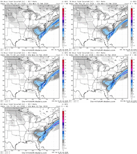
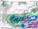
Because the AI’s are playing stubborn! But if they capitulateWhew! Why can’t this be right?
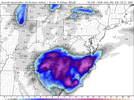
View attachment 191815
I only get about 8" here with that run lol...nice to see some of the recent models reversing the overnight trends with that ULL. I can't wait to see where the coastal starts forming. This could be a really special storm for a lot of people.
packfan98
Moderator
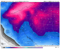
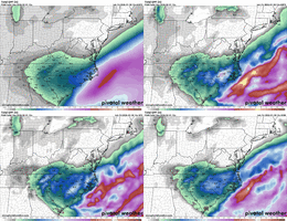
2 more model cycles to go. 2 more northern ticks you think?Nice to see the AI GFS coming in line with other globals...
View attachment 191816View attachment 191818
mydoortotheworld
Member
According to this map alone it seems that if NC wins GA loses and if GA wins NC loses. Every man for himselfNice to see the AI GFS coming in line with other globals...
View attachment 191816View attachment 191818
Will be a machine learning-lesson at its best.Because the AI’s are playing stubborn! But if they capitulate
Fills in the lesser amounts in the N Foothills.Not for everyone...
Tsappfrog20
Member
I only get about 8" here with that run lol...nice to see some of the recent models reversing the overnight trends with that ULL. I can't wait to see where the coastal starts forming. This could be a really special storm for a lot of people.
So I am still learning, but can you give me like an overview as to where the models are saying the low will be forming?
Sent from my iPhone using Tapatalk
bud006
Member
Braves Fest is cancelled
Had multiple fellow A-List members reach out to me yesterday, which gave me a chance to inform them and urge them to pay attention and prepare. I talked to my ticket rep and told him the way the forecast was trending, I wasn’t planning on attending. Hate it, but they had no choice but to cancel it.
LukeBarrette
im north of 90% of people on here so yeah
Meteorology Student
Member
2024 Supporter
2017-2023 Supporter
Its snowing light to moderately but the sun is trying to peak through, shows the first tongue of snowfall is mostly based in the lower to mid levelsCan’t lie it’s coming down way harder than I thought it would, roads starting to get slick again.
2 more model cycles to go. 2 more northern ticks you think?
I hope...but I can't tell you how annoying that 50/50 has been...the one time in our lifetimes it's just refuses to lift out just a little. Could have made all the difference....
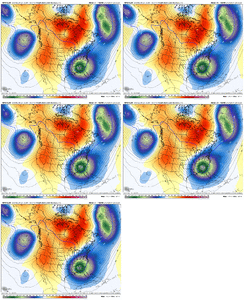
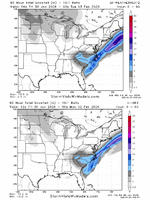
AI-GFS/Google - now on top of each other. A broad swath of 3-6" across the Carolinas is coming...now who jackpots and gets 8-10" is still debatable. But my money is on the CLT area and the Greenville, NC area. And of course...who dryslots...some small area is going to get 1-2" between I-77 and I-95 with the dryslot/precip min.
ForsythSnow
Moderator
FFC's warning here now is 3 to 5 inches, up from 2 to 4 this morning.
foothillscrewzone
Member
Looks like the AIGFS just shifted that way, too!Because the AI’s are playing stubborn! But if they capitulate
That’d be Concord in the dry slot. I promise!! You can all relax now..I hope...but I can't tell you how annoying that 50/50 has been...the one time in our lifetimes it's just refuses to lift out just a little. Could have made all the difference....
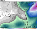
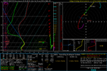
View attachment 191822
AI-GFS/Google - now on top of each other. A broad swath of 3-6" across the Carolinas is coming...now who jackpots and gets 8-10" is still debatable. But my money is on the CLT area and the Greenville, NC area. And of course...who dryslots...some small area is going to get 1-2" between I-77 and I-95 with the dryslot/precip min.
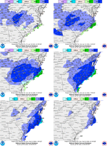
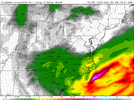
View attachment 191823
x
No model is showing a dryslot in Concord...thats one thing you don't have to worry about. If I could be anywhere in this even it would be PGV first and then CLT metro 2nd. CLT metro might not jackpot but it will be 4-6" easy.That’d be Concord in the dry slot. I promise!! You can all relax now..
iGRXY
Member
broken025
Member
Not to get ahead of the storm, but we’ve ticked down our forecast low Monday morning all the way to 6 degrees. Not record territory but some of the traditional cold sinks in eastern NC and SC might have a shot at the big goose egg. Last 0 reading in these parts was 2018 on an unofficial station.
Stormsfury
Member
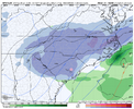
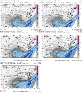
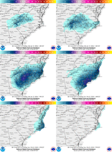
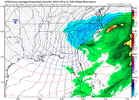
So far, the ICON was the furthest north with the ULL vs the other physics/AIGFS. Starting to get a good consensus average and a better idea where generalized QPF expectations should be.The 4 12z OPs, so far, roughly inline...AI-GFS/GFS/ICON/CMC
All show that PGV jackpot zone...they are best chance to get 10"+. If you wanted to chase....
View attachment 191832
- Joined
- Jan 23, 2021
- Messages
- 4,596
- Reaction score
- 15,184
- Location
- Lebanon Township, Durham County NC
I personally never believed a column like this and antecedent conditions were ever possible hereI know everybody is bust-conscious -- but don't forget that there is big upside to this one as well.
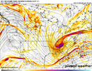
And as I type that, the 12 GFS closes off the upper low over Tennessee at 24 hours.
i'm not really trusting or caring about any dry slot location. they will exist, but it's luck of the draw. it may happen to you. adjust your expectations accordingly.
NBAcentel
Member
iGRXY
Member
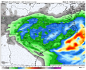
Add the RAP now to an absolute smoking of the upstate and CLT metro

