NBAcentel
Member
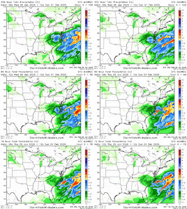
Funny to me that the windshield wiper effect with precip is happening more the closer we get!GFS is looking good for western NC so far.
View attachment 191221
GFS is looking good for western NC so far.
View attachment 191221

Clear trend under the hood hereView attachment 191222
Drier?Clear trend under the hood hereView attachment 191222
I will take that and run like I stole it. Check please!GFS is looking good for western NC so far.
View attachment 191221
Starting to feel like 2/12/2010. We will see if those trends continue.Clear trend under the hood hereView attachment 191222
Very minor changes in the strength, location, and tilt of that upper low have significant implications. Models are still all over the place with it.RGEM and OPs still don’t agree on the degree of tilt around 60 hours. Until that resolves we are going to bounce
I've mentioned this in my videos a couple of times. Right now, I'm not buying the Bahama low scenario. I think closer to the GS is the way to go. Still got a lot to figure out though.I already posted on this, but the Gulf Stream is anomalously warm right now. How we don't see abundant convection and a low form along that is beyond me. Of course, I don't have a met tag or anything.
View attachment 191151
That's a sweet temperature gradient.
View attachment 191152
prolly just gfs being gfs but who knowsNot sure why but all the models set up a really decent FGEN region over N GA but few actually drop heavy precip. GFS shows the lower 900 mb being slightly too dry. I'm wondering if it'll come in as a surprise or if there's some reason it's showing up like this. I'd think the NW winds against the mountains would stop the dry air when it's that low given the upper level tropical moisture inflow
Looks like Raleigh is getting completely blanked again here. Oh, wait.GFS is looking good for western NC so far.
View attachment 191221
There’s gonna be a streamer that drops 2-5 somewhere in WGA that I will probably account for in my next mapNot sure why but all the models set up a really decent FGEN region over N GA but few actually drop heavy precip. GFS shows the lower 900 mb being slightly too dry. I'm wondering if it'll come in as a surprise or if there's some reason it's showing up like this. I'd think the NW winds against the mountains would stop the dry air when it's that low given the upper level tropical moisture inflow
Why?At this very moment, the only area I would feel safe about my forecast is the upstate of SC back to Charlotte and maybe the mountains, (hence my earlier post a little bit ago). Outside of that? Yeah I honestly don’t know
The whole state is covered by a minimum of 5 inches. Sheesh.If you love snow in Central North Carolina, please avert your eyes when the latest GFS accumulation maps are shown. If you live in the Southern coastal communities, you are going to love them.
And if the snow ratios are higher then 10:1 it's probably gonna be more than 5 so I'm not worriedThe whole state is covered by a minimum of 5 inches. Sheesh.
rufus is what happens when the low bombs in the area you'd expect it to bomb given the synoptics lol
The Synoptics behind the ULL is rather extreme and top notch for the area, this isn’t a regular run of the mill ULL. While yes it will be winners and losers with banding, a few people are gonna get nuked under that band with perhaps a double digit total. The column is quite anomalous as well with high ratios and deep dendritic growth zones. Just where does it setup ?I feel like the whole storm is getting messed up due to that secondary/primary low fight on all the models in the Atlantic. It seems like with such a strong ULL, the real surface low should tuck right along the coast. It seems like that's what the WPC is counting on as well. I really wish the models would just all go to that, but I don't know. I think the big totals being shown are really dependent on that low bombing and throwing moisture west and not getting the main low sent to Bermuda.
I agree with this. If the low doesn't bomb and we don't get under the deformation band, I have doubts that the ULL precip is going to be all that impressive in the southern piedmont. It'll be very bandy, and spotty with winners/losers right next to each other as discussed. With pixie dust snow, not sure it would accumulate very deep from a measuring perspective (not to mention, the trend is pushing everything south this morning). No gulf moisture fetch to get big totals like we're accustomed to. Could be totally wrong, but it just doesn't feel like a big winner here to me except for the awesome temps.
Overall, this storm is very anomalous (weird) to me with the last second ULL drop, and primary/secondary low fight in the Atlantic. I'll just wait and see what happens.
Yep, been showing up on several diff models for days now. Somewhere between Athens and the Savannah River valley might get a nice surprise.There’s gonna be a streamer that drops 2-5 somewhere in WGA that I will probably account for in my next map
GRAF gave Charlotte a foot ….. hmmm sure
Sent from my iPhone using Tapatalk
Hmm kinda looks like the WXnext
