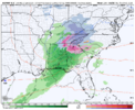
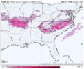
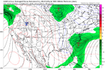
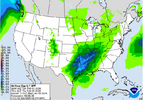
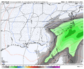
Congrats PaducahBest I got. What's the SDNext model saying?
-
Hello, please take a minute to check out our awesome content, contributed by the wonderful members of our community. We hope you'll add your own thoughts and opinions by making a free account!
You are using an out of date browser. It may not display this or other websites correctly.
You should upgrade or use an alternative browser.
You should upgrade or use an alternative browser.
Pattern Fab Feb
- Thread starter SD
- Start date
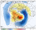
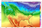
hmmm...my wall to wall cold might have some possibilitiesFeels kind of slimy to post anything GFS these days with the way it's performing, but here we are for Feb 10-17
View attachment 189291
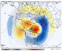
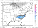
Euro Weeklies - same timeframe
View attachment 189292
wow
Member
I forgot how a cold winter works... All the things are.working for us?
I also wonder if we can kick in the STJ while in that time frame and make it an amazing FEB for many.
NBAcentel
Member
lexxnchloe
Member
WEATHERBOYROY
Member
Looking a little bit flatter at 72 on gfs...heights in the east are higher and lower in the west....maybe Lp in gulf gets a little stronger in the gulf earlier? At 90 more moisture into Miss!
packfan98
Moderator
Wrong threadLooking a little bit flatter at 72 on gfs...heights in the east are higher and lower in the west....maybe Lp in gulf gets a little stronger in the gulf earlier?
Something else I thought of earlier. The lowest I've ever seen water temps in the shelf waters off Myrtle Beach/Wilmington area has been 40F. With this LONG stretch of very cold weather we have a legit shot to see a sub-40F reading at one of the official reporting stations.
21/8, either side of 10 seems doable tonight
Oh hell na! Not again. No ma’am. I need to speak to your supervisor! This is unacceptable!
Good thing I was just looking back at the 423 saved model images and just saw the euro was putting out a butt ton of snow for this past weekend. At about this range. So I’d say… not panicking. Yet.
Edit: I cannot stress enough how grateful I am for your posts. Seriously, all the thank yous!
Last edited:
bdake
Member
I'd love for this month to actually drop some Winter Weather on points north of BHM instead of cold rain. My 3yo keeps asking if it's a snow day, lol.
Sent from my iPhone using Tapatalk
Sent from my iPhone using Tapatalk
- Joined
- Jan 23, 2021
- Messages
- 4,596
- Reaction score
- 15,184
- Location
- Lebanon Township, Durham County NC
Ah yes. Finally. Rain/snow line making its way back north where it belongs
Lord Have Mercy at the latest CFS throughout February. I mean , I've never seen a Feb, wall to wall look so good. We are just getting started, if this verifies
You made me go look. Yeah, if something like that panned out, many of us would be really hoping for spring.Lord Have Mercy at the latest CFS throughout February. I mean , I've never seen a Feb, wall to wall look so good. We are just getting started, if this verifies
LukeBarrette
im north of 90% of people on here so yeah
Meteorology Student
Member
2024 Supporter
2017-2023 Supporter
Bigedd09
Member
LukeBarrette
im north of 90% of people on here so yeah
Meteorology Student
Member
2024 Supporter
2017-2023 Supporter
Man just be happy there is another possible threat showing up...Surface temps are meh
Sent from my iPhone using Tapatalk
Bigedd09
Member
Man just be happy there is another possible threat showing up...
Oh I am haha. I just want to be able to get some sleep before instantly tracking something else

Sent from my iPhone using Tapatalk
Another durn threat that skips bama and GA.Man just be happy there is another possible threat showing up...
I’ll be exited for yall SC, NC, and VA folks this storm. But salty and denied will take its toll if yet another one skips us again.
Tarheelwx
Member
Looks like yesterday's run.
disassociated_vort
Member
The model consensus is progging ~-5 for the 1/28 AO. If it gets there, it would join a select few Jans with a day or more of a sub -5 AO:
2010: ATL very cold but nothing historic
1985: ATL -8 one day later
1977: snow/freeze to Miami 2 days later
1966: ATL -3 2 days later
1963: ATL -3 3 days later
The preliminary AO for 1/28 fell just barely short of -5 as it was -4.9. When it’s finalized, that could go sub -5. Regardless, this is the most -AO day in Jan since 2016. Extreme SE cold, sometimes accompanied by wintry precip very far to the south, have some tendency to follow these very strong -AOs as per the list in the quoted post though those were all sub -5.
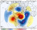
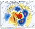
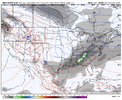
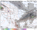
After next weekend, it looks like we may do the Greenland Block > Retrograde thing again. This time, we may retrograde the pattern some across the U.S. too, so maybe more of a full conus flat trough instead of the steep E U.S. trough.....we'll see. Good things can happen though if the block goes big and retrogrades.
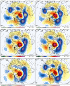
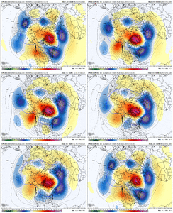
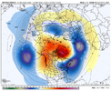
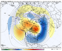
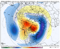
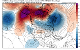
Euro Weeklies trying to push closer toward an SSW here around Valentine's Day
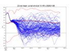
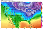
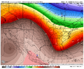
Remember the Trapper Keeper Notebook? See E Canada


Euro Weeklies trying to push closer toward an SSW here around Valentine's Day

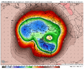
Remember the Trapper Keeper Notebook? See E Canada

wow
Member
I lived through 95-96 .. piece of cakeGFS loading up a monster for somebody. Also shows NC VA snow around 150hr. Pattern looks strong for the foreseeable View attachment 191016
NBAcentel
Member
NBAcentel
Member
60s is gonna feel like a torchy Memorial Day after this stretchhelp is otw. We’ll sleep again soon. Just not now. Or tomorrow or the next day or the next week after that. But we willView attachment 191021
I'm tired too. Tired of Alabama and Georgia getting skipped over!
Stormsfury
Member
Its like every weekend, new threat pops up within 7 to 9 days.Euro with more snow late next week. Think ima wave the white flag and sit that one out
Y’all know that’s a lie
View attachment 191056
We’re getting the “good” El Niño a year earlyIts like every weekend, new threat pops up within 7 to 9 days.
I’m ok with this. lol. Why? It might give me a chance to see snow in Tahoe. HaAfter next weekend, it looks like we may do the Greenland Block > Retrograde thing again. This time, we may retrograde the pattern some across the U.S. too, so maybe more of a full conus flat trough instead of the steep E U.S. trough.....we'll see. Good things can happen though if the block goes big and retrogrades.
View attachment 190983
View attachment 190984
Euro Weeklies trying to push closer toward an SSW here around Valentine's Day
View attachment 190986
Remember the Trapper Keeper Notebook? See E Canada
View attachment 190988

