Cbmatt2408
Member
If this continues to trend south and west it will catch a lot of people in West Central Georgia and East Alabama off guard. They have all seen higher temps on the forecast and moved on.
So they're a little behind at the moment. They'll catch up and they'll have a reasonable forecast for this event. They're not going to just neglect thisMakes sense.
View attachment 187635
We did. The Euro was out to lunch. Doesn't mean we're going to get snow, but it wouldn't surprise me at all if it continued to trend colder and even provide a better front end thump before turning over to sleet. Areas that do not see the bulk of the precipitation fall as sleet are going to be in big, big trouble. Power will be out for days and with the cold behind the storm, roads may be impassable for days. I don't know how people will get medical help who might need it. If people do not have ample food and water stored up, they will be in trouble. The elderly are going to be in trouble. And if 4 inches of sleet falls along with freezing rain, nobody is going anywhere. Temps will barely get above freezing during the day and plummet into perhaps the single digits at night for several days. And then the next system will be coming in. I'm not trying to sound alarmist, but this isn't a 1% chance kind of thing. We are setting the stage for real disaster, the likes of which many haven't seen.Dare I say that the Euro looks a lot closer to what the RGEM has...
These are the changes we should of expected when you have such cold air to the north.
There is no excuse to be behind. We have all the data in the world right in front of us.So they're a little behind at the moment. They'll catch up and they'll have a reasonable forecast for this event. They're not going to just neglect this
As @Webberweather53 mentioned somewhere lighter precip will only help CAD stay locked in as well as accrue freezing rain more efficiently. Hopefully it trends dry enough that icing impacts are reduced but I still think most of the CAD zones are going to see steady freezing drizzle at most times for this event.
At least before tonight. Perhaps an ice storm warning.You would think that would tip the scale to put WSW up for Atlanta and Columbia SC
Sent from my iPhone using Tapatalk
It appears models have convection in the northwestern gulf and that’s what’s robbing moisture transport to the Midwest and ultimately giving us more liquid. The ai models aren’t picking up on this.
Who’s correct? No idea.
WSW got extended to include Calhoun, and Cleburne.If this continues to trend south and west it will catch a lot of people in West Central Georgia and East Alabama off guard. They have all seen higher temps on the forecast and moved on.
There is no excuse to be behind. We have all the data in the world right in front of us.
the euro trailblazed the north shift and was the first model to show myself as mix by a cycle or two. every model then immediately followed it. even with this current shift, i'm going to be fighting for my life to keep power where two days ago i looked safely all snow. that model definitely got high on its own supply the last few runs but i don't mind the met logic of hitching you wagon to the model that everyone is catching up to. if it keeps shifting south then fair to begin having a different convoIt seems a lot of offices and pros di** ride the euro til the wheels fall off. Now they are forced to play catch up.
Was bad NE of town. Not whole city. Think 2000 might have been the last big one to cover such a large area.Could be wrong but I want to say 2014
Dare I say it's ingesting the new data?i think it comes down to many followed the euro verbatim. Now we'll see where it goes. I bet it's not done.
As someone who lives in these areas, unfortunantly, many people have seen the 40s in the Weather Channel forecast and have started to write this one off. Our infrastructure around here is not exactly "prepared" for this type of event. We will see how it plays out when the time comes, however I am worried for many folks around here.If this continues to trend south and west it will catch a lot of people in West Central Georgia and East Alabama off guard. They have all seen higher temps on the forecast and moved on.
This is where we are better in today's standard of information vs 20, 30 years ago.There is no excuse to be behind. We have all the data in the world right in front of us.
No clue. They are taking people off their guard.CAE in their discussion DECREASED confidence in freezing rain. Man do what??
Another interesting point i need to bring up.It appears models have convection in the northwestern gulf and that’s what’s robbing moisture transport to the Midwest and ultimately giving us more liquid. The ai models aren’t picking up on this.
Who’s correct? No idea.
Particularly with how dangerous this storm may become to so many. Need to be more proactive.There is no excuse to be behind. We have all the data in the world right in front of us.
Oh man. Euro is going to come in much colder in the CAD regions. Oh my goodness
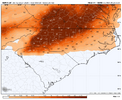
FEMA disasterWhat appears to be an official, not automated first call ice accum map from GSP:
View attachment 187638


Far western upstate, NE GA, southern upstate. problems. Think that GEM map Webb posted above may not be too off although probably aggressive on totals. At my house in particular we may sleet just enough to be not as bad but still not great. We've made the prep we need toFEMA disaster
That would require divine intervention I'm afraid.What if everything comes back to 4-5 days ago?
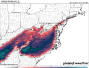
Good lord this is FRAM? Good lordThe general footprints of sleet and freezing rain and overall storm evolution on the 12z CMC look pretty reasonable to me and are in agreement with my forecast from earlier this morning, tho I will inevitably need to tweak it.
The CMC tends to have a cold bias on most normal days, but when it comes to cad oth, it is usually the only global model that I put much stock in once we get to about day 3-3.5 ish.
View attachment 187640
View attachment 187641
This is historical if it checks outThe general footprints of sleet and freezing rain and overall storm evolution on the 12z CMC look pretty reasonable to me and are in agreement with my forecast from earlier this morning, tho I will inevitably need to tweak it.
The CMC tends to have a cold bias on most normal days, but when it comes to cad oth, it is usually the only global model that I put much stock in once we get to about day 3-3.5 ish.
View attachment 187640
View attachment 187641
I know you're NC primary, but do you think the strength of both the CAD to the East and Midwest High bullying it's way South are going to press the Low a bit further to the South in AL, or is the WAA more likely to win out over extreme N. AL. Seems like a very fine line up here at the moment and respect your thoughts.Lol surprise surprise, the euro sucks with cad.
There is no excuse to be behind. We have all the data in the world right in front of us.
Deeper cad (shallower nose) at 850s? For a bit at least?

