LittleMountain
Member
Where do you think is “sitting pretty” right now? I-40 in NC? Or further south?
Second round stays south and gets Florida and the Carolina beaches in on it. Wild run.View attachment 186331
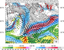
Would that juice up the moisture too?You can clearly see the influence of this atmospheric river here with convective heating in it pumping the mid to upper ridge ahead of the Baja low, which slows it down. Global models have a bad habit of underestimating this latent heat release >> mass response process or potential vorticity redistribution.
That ultimately favors things to go more south downstream.
View attachment 186352
View attachment 186353
Nc/Va border region in my opinion. Further south shifts occur then central NCWhere do you think is “sitting pretty” right now? I-40 in NC? Or further south?
The shear width of that upper level divergence is amazeballsYou can clearly see the influence of this atmospheric river here with convective heating in it pumping the mid to upper ridge ahead of the Baja low, which slows it down. Global models have a bad habit of underestimating this latent heat release >> mass response process or potential vorticity redistribution.
That ultimately favors things to go more south downstream.
View attachment 186352
View attachment 186353

if you love sleet!UK Met Looks pretty good???
View attachment 186361
You have the soundings? I don't have access to them.if you love sleet!
initially i'd think no w/o extra forcing from baja low, but if downstream ridge gets strengthened i'd imagine jet and associated right entrance region strengthens in response. fun dynamics exam questionWould that juice up the moisture too?
6z Euro AIFS. Colder, snowier, and further south.
View attachment 186205
looking at the mid level temp maps.. NW NC looks ok but the rest will defintely change over earlier.You have the soundings? I don't have access to them.
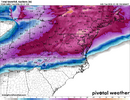
Lot of ice, probably ton of ipCloser Up view of UKMET. Who has the Pivotal Kuchera?
View attachment 186362

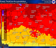
I thought it looked a little low... wowVery early ice forecasts from FFC on the winter weather page for north Georgia, definitely going to change
View attachment 186363

Im not Webb but for all snow definitely the I40 crowd. But the best rates and possibly highest totals are going to be right above that transition line. Northwest of 85 in SC gets a ton of lift here and makes out on precip. Sure we are going to have sleet mix in but we generally out perform in qpf. The highest qpf totals are likely inand above Atlanta where they battle mixing. Oconee and Pickens are typically colder through the column and get close to the same qpf being the direct Lee side. Webb or Grit or Rburrel can Def explain it better.Where do you think is “sitting pretty” right now? I-40 in NC? Or further south?
Looks like less amped and further south but still plenty of precip.
By that would it be heavy enough for snow instead?
No High pressure to be seen, so low just barrels its way through the middle of the stormView attachment 186366
Well for starters sleet line to my house in Blacksburg is not happening. Not in this setup
AIFS ticking slower with the Baja:
View attachment 186372
When you hang the Baja low back further, you don't inject quite as much moisture/energy into the already rather stout overrunning boundary along the Arctic front. More Baja invovlement (i.e. faster, gets wrapped up in everything quicker) is going to inject more moisture and "amp" the system north, shoving the p-type corridors north with them. Higher ice risk for many that are thinking they have mainly sleet/snow coming.Can you explain what being slower does?
Sent from my iPhone using Tapatalk
Blocking looks different in Canada, can you explain the changes there?
Again. Id be surprised if the snow and transition line does not set up between Us264 and HWY70 In Eastern NC based on if these trends continue.
Agree, typically the model gets confused with back to back systems, and as opposed to a steady fetch, there tends to be lulls.personally, i do not buy the gfs solution. and that is not because it gives me less snow, which to be clear, it does big time. my take is that i do not think the "long fetch/conveyor belt" solutions pan out very often. typically models will settle on a shortwave or a different feature that eventually becomes dominant over the course of an event. given this event is just throwing a subtropical jet against a broad imposing mega cold trough, i guess it could happen, but i favor models settling on a more defined storm eventually
That might be counting some ice in totals based on the precip output, but this is the way. Everybody eats (though a better axis would let GA in the game, so still need a little something to truly let everybody in)UK Met Looks pretty good???
View attachment 186361
Agree. I think we will see a good snow hit that runs 70 to the north and then as the coastal low pops the warm air change over to about Belhaven, New Bern. Just based on climo.I think Hwy 17 east might be mixing a lot and maybe 20-30 miles inland from the immediate coast but the cold air is stout...but sleet mixing in is almost guaranteed around here at some point if the coastal low pops to close....
We want it to slow down some but not completely get left behind right?Going to be another tick slower with the Baja and further pressed southward on the TPV. Minor difference so far though
