Ah well there you go, could be something there. Hope it works outIn this case we get the benefit of that low level convergence zone.
View attachment 184736View attachment 184737
Ah well there you go, could be something there. Hope it works outIn this case we get the benefit of that low level convergence zone.
View attachment 184736View attachment 184737
I reached 53.4 and I'm currently at 50 with a dewpoint of 40. I just don't see how this is going to work out for N. GA. Maybe central GA can score?I reached 51 over here as well, but I believe we were forecast 55. The lower dew points are starting to filter in, not that it matters until they get to central Georgia.
Dewpoints in the teens and twenties in central Tennessee are headed our way, it should make the difference in central Georgia by the early morning hours.
View attachment 184740
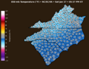
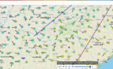
It is NOT sleeting in Greenville GA.. I was in Hogansville just a few miles to the northwest and I came through a light rain at 50 degrees. Medium sized drops.. SW to NE orientation.MPing report of sleet in Greenville, GA
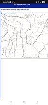
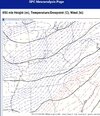
I agree with your statement. Didn’t check the mesoanalysis yet. With the onset sleet event in late Nov in TN, the freezing line was as high as 700mb, but the air was very very dry. Judging by the fact that there is drizzle and rain, it probably would be impossible to get a sleet pellet down now as there is nowhere near as much dry air.Plus, 850's are still north of town.
Right- it most certainly is possible. But I looked at the SPC upper air analysis at the time I read the original report and was like no way in hell. Cold enough air to support that at the upper levels ain't even into N GA yet.
Pretty sure they flew early this morning around 3am or so - no point in them going back up this lateNot that it really matters at this point, but curious when/if that hurricane hunters flight data gets injested… still 00z runs?
Pretty sure they flew early this morning around 3am or so - no point in them going back up this late
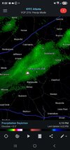
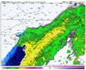
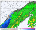
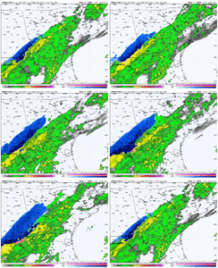
That backedge literally is over my backyard while the front lawn is dry.Man the HRRR is such a tease: continuing to trend northward and slightly NW with the second precip shield, and this time soundings support a small enough dry layer for actual snow to reach the surface in places close to Athens GA and GSPView attachment 184742
It will dry back out as the front pushes through….need as much precip as you can get after midnight.Light precipitation reaching the ground in Athens GA. Good to see that the column is already saturated here!
No.


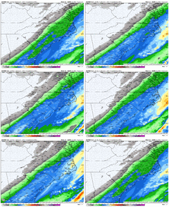
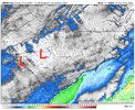
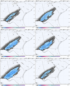
Pretty cool that you can actually see mesolows developing over the upstate of SC on some of the CAMs tomorrow as the low-level flow interacts with the mountains, generating some lee side eddies.
I highlighted a pair of these on the HRRR forecast
View attachment 184771
This actually helps back-build the precip westward in spite of the downsloping and allows the cold advection catch up more with the precip, increasing the chances for snow around GSP up to CLT
View attachment 184767
View attachment 184768
Yeah, I noticed that on most of the 18z runs. I didn’t really dig into the vort maps to
Pretty cool that you can actually see mesolows developing over the upstate of SC on some of the CAMs tomorrow as the low-level flow interacts with the mountains, generating some lee side eddies.
I highlighted a pair of these on the HRRR forecast
View attachment 184771
This actually helps back-build the precip westward in spite of the downsloping and allows the cold advection catch up more with the precip, increasing the chances for snow around GSP up to CLT
View attachment 184767
View attachment 184768

Easy. Low pressure Transferrence....how did we mess this upView attachment 184720
I noted yesterday to someone answering about the warm bubble over SC, and immediately thought of the mesolow chances. Seen this happen before in a setup I believe 2011 days before the Jan 10th-11th. 2011 winter storm. Mesolow locally shot temps up here from 36 to 43 in one hour. Killed any novelty chances then l.Pretty cool that you can actually see mesolows developing over the upstate of SC on some of the CAMs tomorrow as the low-level flow interacts with the mountains, generating some lee side eddies.
I highlighted a pair of these on the HRRR forecast
View attachment 184771
This actually helps back-build the precip westward in spite of the downsloping and allows the cold advection catch up more with the precip, increasing the chances for snow around GSP up to CLT
View attachment 184767
View attachment 184768
Probs one of your coolest posts. I consider myself an educated hobbyist. I know the ins and outs of general set-ups, but this one..showing microclimate and the perturbations and ripples and how it effects the downstream microclimate is pretty damn cool. Selfishly in CLT I would love it, but regardless...good post!Pretty cool that you can actually see mesolows developing over the upstate of SC on some of the CAMs tomorrow as the low-level flow interacts with the mountains, generating some lee side eddies.
I highlighted a pair of these on the HRRR forecast
View attachment 184771
This actually helps back-build the precip westward in spite of the downsloping and allows the cold advection catch up more with the precip, increasing the chances for snow around GSP up to CLT
View attachment 184767
View attachment 184768
Yea im taking one for the team in Oconee...geezPretty cool that you can actually see mesolows developing over the upstate of SC on some of the CAMs tomorrow as the low-level flow interacts with the mountains, generating some lee side eddies.
I highlighted a pair of these on the HRRR forecast
View attachment 184771
This actually helps back-build the precip westward in spite of the downsloping and allows the cold advection catch up more with the precip, increasing the chances for snow around GSP up to CLT
View attachment 184767
View attachment 184768
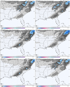
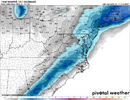
Biggest ensemble mean yet in the upstateNW trend continues. Hopefully you folks in the upstate into the Piedmont can get something.
View attachment 184775
Globals should be fairly steady now. All eyes turn to the short-range models. Will be watching the mesoscales from here on out.NW trend continues. Hopefully you folks in the upstate into the Piedmont can get something.
View attachment 184775