• Hello, please take a minute to check out our awesome content, contributed by the wonderful members of our community. We hope you'll add your own thoughts and opinions by making a free account!

Jan. 17-18, 2026 SE Winter Weather Threat

this happens with basically every storm. 12 seed that's down by 12 with two minutes lefts gets scrappy and cuts the deficit to 5. my heuristic going forward is to use ai tools to formally gauge the "ceiling" of the storm's potential and then allow for about 10-20% improvement once consensus exist between all models like we got by about the 12z cycle today.
Does this tick NW until go time at this point? Idk... That would be a comeback. Maybe the GFS did sniff it out first?... We await King Euro
 
It did delay itself a little bit, hence the higher totals/QPF in the southern half of the state.

Yeah, there's beefier snow totals in south GA here and if you're a weenie like me and use 10:1 ratios, snow flying gets probably about 30 miles to the west of the previous run.

If another tick doesn't get to me...gosh we're getting to the point where I may actually pull the trigger on trying to map out a way to get to Screven County actually, which is backroads, but I'm not too concerned.
 
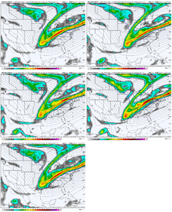
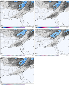
Before we all get too excited, I will caution that most of that NW precipitation on the GFS is falling into extremely dry air at 850mb and most likely is not reaching the ground, however the NW trend is a very positive sign as with a few more ticks maybe the mid level moisture content would be improved somewhat. Also, it is a global model trying to handle smaller scale features, so wouldn't worry about that yet.
 
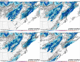
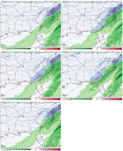
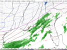
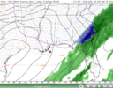
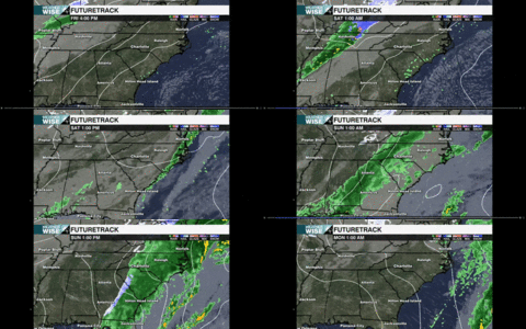
As for the 21Z rap and likely 00Z HRRR, initial finger of precipitation is much further north than 12/15Z but struggles with cold temps which are actively moving in from the west. As the system progresses Sunday AM, the RAP which still keeps most moisture by now further east gets a band of heavy wet snow through southeastern GA over to Savannah, much like the RRFS from 18z but displaced to the south and east as the tilt is still not great. Might be workable though with all of these NW trends on various different models if a slightly better cold air supply can happen. 1768601584442.png1768601600701.png
 
18z Icon with a 20-30 mile shift northwest with the initial finger band. Starting to think the very northwest edge of the shield will be where the best accumulations are.

Very concerned that band is going to wind up like 10 miles to my southeast though, lol.
The very NW edge is the only place that might be accumulations unless something changes. Remember, this is cold air chasing moisture.
 
I have a very hard time taking the graf seriously. Didn’t it just have it WAY off the coast yesterday


Sent from my iPhone using Tapatalk
Who knows with these models? I do remember the GRAF was the first to show snow IMBY for last year's Gulf Coast Blizzard.


Shot way NW. it’s just to warm. Man… if the temps were a little cooler this would be an awesome snowstorm.


2026-01-16 17-21-01(1).gif

Tweet was deleted, here is the GIF saved of the 18z GRAF run.

It looks straight up like either A. Dry into the 1km layer or B. GRAF did not handle the precipitative cooling well at all.
 
View attachment 184333

Tweet was deleted, here is the GIF saved of the 18z GRAF run.

It looks straight up like either A. Dry into the 1km layer or B. GRAF did not handle the precipitative cooling well at all.
That is an insane shift. Not sure I’ve ever seen the GRAF do that over two runs
 
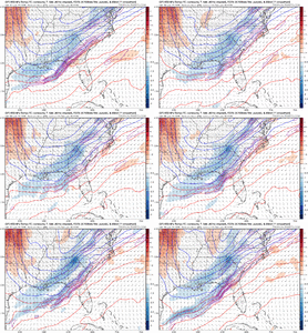
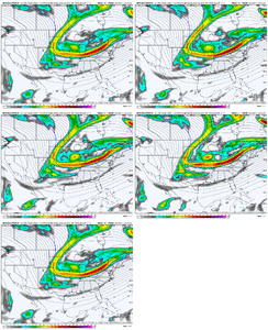
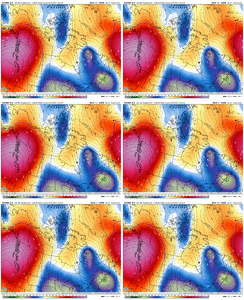
That forcing up over north central GA is trending stronger. Let’s add another contour or two then 🧨 View attachment 184324
No way that comes back and blows up snow here but I'd be surprised if this somehow happens. Need that tilt and slowdown and maybe we somehow get some flakes.
 
Here's the way it goes every storm potential. See it 10 days out, call it a "clown map!" It disappears, but then reappears within 7 days. Everybody starts to pay attention and gets excited if it shows snow for their area. It disappears again, 2-3 days out, and everyone pisses and moans about how this or that model is good or bad or the king or whatever and how they will never follow said model(s). Finally, the models converge on a solution and the chips fall where they do...usually in disappointment, with a few lucky souls.

That's winter and winter storm potential in the SE. It's soooo rare to have a storm modelled from the beginning to come to fruition.

We aren't done with winter and potential by any means and I really believe next weekend and beyond is going to be glorious for many on this board.

Good luck and happy model chasing

Sent from my Pixel 10 Pro XL using Tapatalk
 
Honestly sucks we have to deal with the literal antithesis of what you want for a Winter Storm in the Carolinas. Get temps in the 20s the nights before and a cold pattern will it keep? nah let’s just be 60 degrees beforehand. Oh and then let’s be pipe bursting cold 8 hours after the storm. Dealing with low QPF or crappy temperatures for the past few years and now both? It’s such an odd thing to see but it begs the question of it’s the new norm down here. FL sees heavy snow and maybe we whiff a little but it gives hope the south can get a big snow some winter ahead-Nah next winter they’ll see snow while you’re too warm in NC/SC. Wild
 
Honestly sucks we have to deal with the literal antithesis of what you want for a Winter Storm in the Carolinas. Get temps in the 20s the nights before and a cold pattern will it keep? nah let’s just be 60 degrees beforehand. Oh and then let’s be pipe bursting cold 8 hours after the storm. Dealing with low QPF or crappy temperatures for the past few years and now both? It’s such an odd thing to see but it begs the question of it’s the new norm down here. FL sees heavy snow and maybe we whiff a little but it gives hope the south can get a big snow some winter ahead-Nah next winter they’ll see snow while you’re too warm in NC/SC. Wild
To be fair, I’ve seen many a storm here have 50-60 degree temperatures the day before or even day of the storm. Off the top of my head, January 30, 2010 and February 25, 2015 come to mind. Certainly isn’t how I would draw it up, though!
 
That cutoff snow line is legit like 10 miles from my house need more NW
Im just east of you....we are either going to be just inside or outside of it. I do think we will see flakes but for accumulations we still need some westward adjustments. Dont be surprised if that line is Greensboro to Washington knowing our luck
 
To be fair, I’ve seen many a storm here have 50-60 degree temperatures the day before or even day of the storm. Off the top of my head, January 30, 2010 and February 25, 2015 come to mind. Certainly isn’t how I would draw it up, though!
Good point, some of the best events have happened with marginal temps but it all depends on location and setup. This really could be one of those maybe it’s a further east DEC 2017 repeat. But it feels like 2022 was the last real winter we had. Storms back to back, no wild shifts on modeling and losing storms. Everybody had QPF and some cold.
 
Back
Top