CNCsnwfan1210
Member

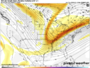
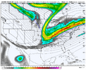
NAM 12km trend, 12z run has quite finished yet for the Thursday system. Very thin strip of snow on the western side of the band of precip.
Sent from my iPhone using Tapatalk

Yo.. Good LAWWWWDView attachment 182882
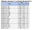
I remember driving to work that Tuesday morning in shock. I think there may have been talk about the possibility on Amwx but it really was a last minute deal. That was only about 36 hours out from a storm that was supposed to be a much bigger deal for the Charlotte area, but that one ended up a heartbreaker for those of us on the southern fringes.View attachment 182897
I had to look it up, but the way these short range models are starting to hint for some areas on Thursday kinda reminds me of this one. This event completely started popping up in the last 48 hours and in fact some local mets here in CLT didn’t even forecast it within 12 hours
I talk about this one all the time for Northeast Tennessee and literally no one remembers it.View attachment 182897
I had to look it up, but the way these short range models are starting to hint for some areas on Thursday kinda reminds me of this one. This event completely started popping up in the last 48 hours and in fact some local mets here in CLT didn’t even forecast it within 12 hours
Furthermore what was great about that week in NE TN was having 4-6” of snow on the ground and a new Winter Storm Watch issued for the storm coming 36 hours later that dumped another 4-8”.I talk about this one all the time for Northeast Tennessee and literally no one remembers it.
Many local mets went with globals and lowballed the forecast for the 24 hours prior with a dusting to an inch. Short range was showing several inches.
I remember Robert Gamble at WxSouth saying to look out.
That night NWS MRX issued a Winter Weather Advisory in the middle of the night for 2-4” which is bordering WSW criteria here. Mountains got WSW with 3-6”
Woke up the next morning and we were getting 1-2” per hour rates with temperatures in the 20s. Piled up to 4-6” most places in the 2-4” advisory area.
So majority of people woke up that morning expecting a dusting and there was 4-6” of snow. You can imagine the apologies local mets had to make on that one. Twas a horrific day for credibility.
That storm was awesome.
Yeah they probably are overselling. It’s time to pay attention to that weekend deal, the NAM is slowing down/further west with the energy out of Canada as well. We might have something going our way, finallyThe hrrr and rap are trash out past 24hrs. For entertainment only, don’t get your hopes up.

call me i weenie but i don't think they're too off kilter. aggressive for sure but its not like we're dealing with 2009 era dgex. i think these runs demonstrate the ceiling- possible but things have to break right (i see the hwrf the same way in hurricane season for aggressive runs). these are the models you'd *expect* to be first to the party for a qpf increaseThe hrrr and rap are trash out past 24hrs. For entertainment only, don’t get your hopes up.
We shouldn’t get too bogged down at this point on what models are showing at the surface. The models are probably going to have to reach a “sweet spot” with the digging for the surface to start improving. Even though we are only 5-6 days out on system #2, we have to be looking for good trends. It seems like most of the trends have been good so far this morning.

Icon has gone from St. Louis to central Oklahoma in 4 runs. I just think the upper level trends are a lot more useful at this range with this type of setup than surface depiction. It might reverse course at 12z and start moving the other way, but we’ve seen these things trend more amped in the 11th hour so many times before and we’re nowhere near the 11th hour yet.So, what's the sweet spot that we should be looking for? Or in other words, how far SW is this going to have to dig to tap a nice swath of moisture from the gulf? Northern, Central, or Southern TX? I'm thinking central TX would be good, but we've got a way to go. Not sure how far we can get it based on how east the ridge is.
View attachment 182905

Ha! Beat me to it.This looks like a hour 180 model fight View attachment 182909View attachment 182910
This looks like a hour 180 model fight View attachment 182909View attachment 182910

Big ol’ El Niño Precip fingerBruh. The GFS man.. lolView attachment 182919
