WolfpackHomer91
Member
man the vibes are better this morning
You should be a State and Panthers fan …. Just trust me, this is the only vibe I’m having go good this AM
Sent from my iPhone using Tapatalk
man the vibes are better this morning
I wonder what will be a “fair question” in the State postgame presser.You should be a State and Panthers fan …. Just trust me, this is the only vibe I’m having go good this AM
Sent from my iPhone using Tapatalk
I wonder what will be a “fair question” in the State postgame presser.
This model has to be trashed. The NAM is even better.
As usualEuro has it but it’s just way to slow with the cutoff

We are beaten and battered around here. Gonna need some legit fantasy runs to bring us back to life.Gonna need yall to pick up the energy in here. Yall acting like it's Saturday afternoon & have better things to do.
Afternoon ensemble guidance from the reliables looking great!! View attachment 181001View attachment 181002View attachment 181003View attachment 181004
Love the enthusiasm, Mitch.Gonna need yall to pick up the energy in here. Yall acting like it's Saturday afternoon & have better things to do.
Afternoon ensemble guidance from the reliables looking great!! View attachment 181001View attachment 181002View attachment 181003View attachment 181004
I get it. but we ain't no time to wollar around & cry about it. We got to bully the atmosphere & make it stop being an idiot. Got work to do.We are beaten
We are beaten and battered around here. Gonna need some legit fantasy runs to bring us back to life.

I get it. but we ain't no time to wollar around & cry about it. We got to bully the atmosphere & make it stop being an idiot. Got work to do.
OKAY TURN ME UP WEATHER CHANNELView attachment 181006
Weather channel must be thinking second half of month looks good now after saying January would be a torch.
We know the first part of jan is going to be well above, we need just the second half tempsView attachment 181006
Weather channel must be thinking second half of month looks good now after saying January would be a torch.
Remind us again what the numbers represent. I’m a little confused. Thanks.Coldest post Jan 6th at Chicago on GFS/GEFS thru today’s 12Z:
1/2 12Z +30/+25
1/3 0Z +29/+25
6Z +21/+21
12Z +22/+19
Same for Euro/EPS:
1/2 12Z +22/+22
1/3 0Z -15/+16
1/3 12Z +7/+17
Remind us again what the numbers represent. I’m a little confused. Thanks.
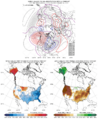
Their analogs are colder than their forecast. I think pattern analogs are best used in a general sense. Sometimes useful, and sometimes they moreso highlight extreme scenarios. They've changed their analog maps and correlations over the past year, and it looks like they are just taking analogs back to 1990. But analogs seen here are from Jan 2009, Jan 2025, and Jan 2022, all which were chilly with wintry opportunities. Possible this Jan too, but this is evolving of course and reasons it could break either way for us IMO (good or bad)

Thanks. For clarification what does this mean?The coldest lows on the runs at Chicago after Jan 6th. This is important because the air from Arctic outbreaks that gets into the SE typically travels over the Midwest first. If Chicago is staying mild, it’s going to be very hard for the SE to get that cold, especially for a sustained period. The coldest low at, say RDU, is almost always going to be a fair bit warmer than the coldest low at Chicago due to moderation as the air comes further SE.
I started posting these yesterday at 12Z because they were so mild for Chicago and thus was saying they’d need to evolve sig. colder to give the SE a better chance for a sustained cold period by 1/20. Compared to then, they’ve generally trended colder. We’ll see whether or not this trend continues. Ensemble means are much more important than the ops that far out obviously. I could just stick to those if I wanted to.
They don’t use the better performing/verifying ai means yet? That’s interestingTheir analogs are colder than their forecast. I think pattern analogs are best used in a general sense. Sometimes useful, and sometimes they moreso highlight extreme scenarios. They've changed their analog maps and correlations over the past year, and it looks like they are just taking analogs back to 1990. But analogs seen here are from Jan 2009, Jan 2025, and Jan 2022, all which were chilly with wintry opportunities. Possible this Jan too, but this is evolving of course and reasons it could break either way for us IMO (good or bad)
For their forecast, they used:
The official 8-14 day 500-hPa height blend consists of: 35% of Today's 0z GFS
Ensemble Mean centered on Day 11, 35% of Today's 0z European Ensemble Mean
centered on Day 11, and 30% of Today's 0z Canadian Ensemble Mean centered on
Day 11
View attachment 181011
Didn’t think about that - but yeah, not mentioned in there at least for todayThey don’t use the better performing/verifying ai means yet? That’s interesting
