• Hello, please take a minute to check out our awesome content, contributed by the wonderful members of our community. We hope you'll add your own thoughts and opinions by making a free account!

Pattern January Joke

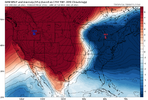
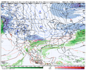
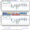
i think I’ve asked this Q already, but again: do we think we can trust these as more of “vibes based” guidance? As in, treated the same as any other ensemble but with perhaps less credence to the actual numbers on there. Lots of members showing snow still indicative of good signal. I am not sure if the oddities it shows with snow way out of place affect these charts significantly enough to inflate them beyond trust
That’s above my pay grade. I’m using it for vibes and trends. Looking at potential outcomes and opportunities.
 
That’s above my pay grade. I’m using it for vibes and trends. Looking at potential outcomes and opportunities.
I tend to think it can be utilized for feeling out if something is trending nicely for us / finding windows for potential wintry events. But that may be it
 
So far though GFS looks fine to me in a general sense, it’s AI cousin oth isn’t great

AIGFS is real close
1ddfb1e3de5417b78484f5878ddb5f1d.jpg


Sent from my iPhone using Tapatalk
 
Euro was ready to cook at the end there.

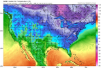
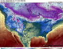
00z euro overall stayed with the two troughs next week, although a smidge more progressive. Nothing jarring in terms of changes in that regard tho. Trended colder and more active the rest of the run with that fantasy storm loading up at the end.
 

Attachments

  • 50963672-C80A-4034-B65E-921A0111F6B8.png
    50963672-C80A-4034-B65E-921A0111F6B8.png
    191.7 KB · Views: 82
077ca15278df6f4288c1e440555e4463.gif

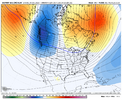
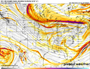
-NAO block keeps getting reinforced for the foreseeable future. Occasional shots of cold air from one of the coldest sources centered over Canada/Yukon territories. Can’t help but think of wintry weather down the road with this persistent -NAO.


Sent from my iPhone using Tapatalk
 
Good trends stopped overnight. This tends to happen when you have such an aggressive trend one way, things tend to balance out. 06z GFS follows the 00z by losing the second trough more. Seemed like this happened with our Arctic blast early last week. We had super aggressive runs then it trended away then it trended back South & we had record breaking lows.
 
Good trends stopped overnight. This tends to happen when you have such an aggressive trend one way, things tend to balance out. 06z GFS follows the 00z by losing the second trough more. Seemed like this happened with our Arctic blast early last week. We had super aggressive runs then it trended away then it trended back South & we had record breaking lows.
Agreed. Overall the theme remains the same we’ve seen the last couple days.
 
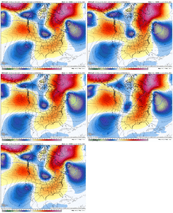
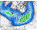
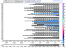
+EAMT showing up AI GEFS


Sent from my iPhone using Tapatalk
If we don’t go absolutely nuclear with the pacific jet we should see some change for the better, would be hilarious though if we went from Aleutian ridge to all out pacific jet furnace, but on the AIFS for ex you can see see signs of a PT regime
 
If we don’t go absolutely nuclear with the pacific jet we should see some change for the better, would be hilarious though if we went from Aleutian ridge to all out pacific jet furnace, but on the AIFS for ex you can see see signs of a PT regime

I’m hoping the end result will be more of a -EPO/+PNA /-NAO combo if we play our cards right. Hopefully the weeklies have a good handle on the January pattern coming up. The CFS pretty much mimicked the Euro ext FWIW.


Sent from my iPhone using Tapatalk
 
Based on the overall 0Z/6Z model consensus being not as cold in the E US as the 12Z/18Z model consensus, which had lead to ~15% gain by late evening (best of all of 2025 so far), natural gas has not surprisingly had a good amount of selling, including profit taking, which has NG down over 4%. But that level is still 10-11% higher than the close of Monday.

Let’s see whether or not the 12Z will bounce back colder. This market will likely tell us the answer without having to actually look at the models, themselves.
 
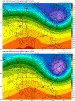
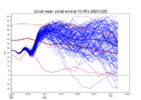
Some top-down strengthening starting to commence with the polar vortex as it begins to recover from the stratospheric warming event in late November.

We probably won’t notice anything in the troposphere until maybe late January or early February at the earliest.

A weak early winter polar vortex and strong late winter-early spring (Feb-March) polar vortex fits with the classic eQBO/high solar winter progression. It’s also pretty typical to see in the lead-up to El Niño, with many El Niño onset years often having a strong polar vortex during the late winter and springtime

ps2png-worker-commands-7899bdc75-zp6df-6fe5cac1a363ec1525f54343b6cc9fd8-rn10fszr.png
 
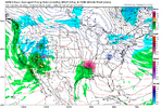
GFS trying to sneak in a marginal event around 1/6, another VA bread winner


Sent from my iPhone using Tapatalk
 
Some top-down strengthening starting to commence with the polar vortex as it begins to recover from the stratospheric warming event in late November.

We probably won’t notice anything in the troposphere until maybe late January or early February at the earliest.

A weak early winter polar vortex and strong late winter-early spring (Feb-March) polar vortex fits with the classic eQBO/high solar winter progression. It’s also pretty typical to see in the lead-up to El Niño, with many El Niño onset years often having a strong polar vortex during the late winter and springtime

View attachment 179793

Eric, doesn’t the earlier warming events that occur late fall/early winter like this one have longer lasting effects/lag time than the later SSWE’s?


Sent from my iPhone using Tapatalk
 
Back
Top