-
Hello, please take a minute to check out our awesome content, contributed by the wonderful members of our community. We hope you'll add your own thoughts and opinions by making a free account!
You are using an out of date browser. It may not display this or other websites correctly.
You should upgrade or use an alternative browser.
You should upgrade or use an alternative browser.
Pattern January Joke
- Thread starter SD
- Start date
rburrel2
Member
CNCsnwfan1210
Member
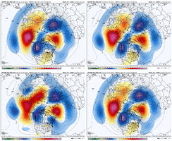
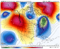
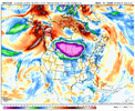
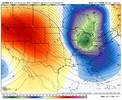
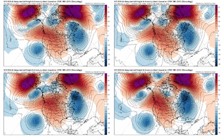
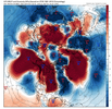
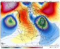
Nice global H5 retrogression trend. It’s almost as if the central US ridge just disappeared on the latest run.
Sent from my iPhone using Tapatalk
CNCsnwfan1210
Member
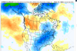
EPS continues to cool down the central and eastern US, warming taking place over western Canada and western US out to Jan 4
Sent from my iPhone using Tapatalk
NBAcentel
Member
That is a western ridge away from a butt freezing, apocalypse.
Natural gas is now up a whopping 10% due to the models’ much colder late Dec and now early Jan vs what last week’s models showed! If this holds, it would easily be the strongest single day for NG since at least August. Keep in mind that NG’s strongest days are usually when the E US two week forecast is looking colder than the prior day:


iGRXY
Member
imo the MJO and EAMT are likely cancelling eachother out in the pacific. What’s keep us from spiking a ridge or just flooding the continent with mild pacific air is the big -NAO. It’s really the saving grace in shifting everything south and west. The flow is slowing considerably and we are quickly deepening the trough over the northeast and northern Atlantic. At worst we will be cold, but there’s already a signal of some kind of CAD ice potential (which is what I’d lean to without the pacific being the best)
wow
Member
Vodka cold with a side of Pam Anderson
lexxnchloe
Member
packfan98
Moderator
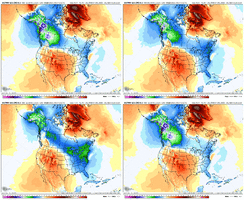
Looks like the new Euro Weeklies is much colder overall than past runs. I eagerly await the full breakdown from @GaWx …
Absolutely! Unfortunately I have to post them via screenshots, which makes this post a bit jumbled, because this site won’t let me download them:
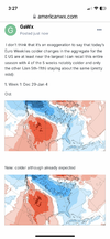
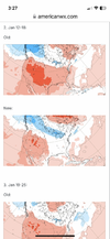
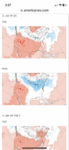
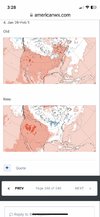
Absolutely! Unfortunately I have to post them via screenshots, which makes this post a bit jumbled, because this site won’t let me download them:
View attachment 179709View attachment 179710
View attachment 179711View attachment 179712

CNCsnwfan1210
Member
Absolutely! Unfortunately I have to post them via screenshots, which makes this post a bit jumbled, because this site won’t let me download them:
View attachment 179709View attachment 179710
View attachment 179711View attachment 179712
Thanks @GaWx for this…it looks like the cold signal just gets better as we head toward mid and late January. Also, do we keep the continued trend going of colder trends from the long to medium range forecast period? You can clearly see the change in week 1 how it trended colder.
Sent from my iPhone using Tapatalk
SnowNiner
Member
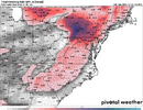
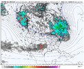
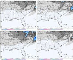
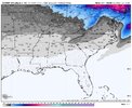
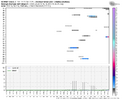
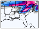
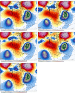
this EPS run starting to show something here storm wise, the trough around SE Canada vortex is trending stronger as well, with a batch of energy traversing the central U.S., some ice events but a noticeable increase on the snow mean. Something to watch hereView attachment 179694View attachment 179695View attachment 179696View attachment 179698
Happy to see the trough get squeezed west and blocking set up starting sooner. That's a relief and signs that we may be still in the game.
I notice the -NAO is little east based I think though, so the flow to me looks just like the first week or two of December, cold coming north through the great lakes into the NE and bleeding south; with the trough not far enough west for anything to dig. Didn't work for us then, but like you say, maybe the southern stream can spit some energy our way, and it'll be colder this time since it's January.
- Joined
- Jan 2, 2017
- Messages
- 1,566
- Reaction score
- 4,279
Very refreshing trends the last couple of days. Ill be back at work and golfers out by then so let's rage!
Happy hour is rolling
Mods like when you announce that in the main thread

Mods like when you announce that in the main thread
Let’s place bets on whether or not we see any fantasy runs this round. I’m gonna go with 0.Happy hour is rolling
Mods like when you announce that in the main thread

We are getting a BIG fantasy run.Let’s place bets on whether or not we see any fantasy runs this round. I’m gonna go with 0.
Webberweather53
Meteorologist
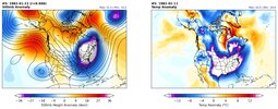
what happened? I was negative 2 lol....the snow jam '82 right?Lol the 1981-1982 analog showing up yet again.
We all know what happened in Jan 1982
View attachment 179719
View attachment 179720
It never lets me download the temperature maps despite not being large. But it always lets me download the 10 mb zonal wind maps. Weird!
NBAcentel
Member
Jonathan Wall seems very intrigued and has been all over this for a few days
Webberweather53
Meteorologist
What is the errorIt never lets me download the temperature maps despite not being large. But it always lets me download the 10 mb zonal wind maps. Weird!
NBAcentel
Member
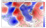
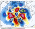
Damn, it might actually do that lolI’d say one more less likely but possible scenario on the pacific side is rolling over the Aleutian ridge temporarily and cutting off in the pacific for a short duration ridge bridge, been seeing this look show up on basically almost every deterministic time to timeView attachment 178941
rburrel2
Member
Webberweather53
Meteorologist
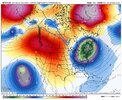
This is definitely one of the weirdest looking planetary wave patterns I’ve ever seen.
The wavelengths are just crazy short for late Dec
The wavelengths are just crazy short for late Dec
Is she breaking loose?
wow
Member
Aleutian ridge is rolling over and TADA! a serious cross polar hook up. LET IT GO! LET IT GO!

