• Hello, please take a minute to check out our awesome content, contributed by the wonderful members of our community. We hope you'll add your own thoughts and opinions by making a free account!

Pattern December Doldrums 2025 🎄 ❄️

Thank you!
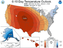
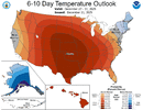
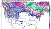
1. Sig. colder 12/29-1/5 vs yesterday but we already knew that. Two days ago, they had solidly AN in the SE. Todays has NN to a little BN for that week! Tomorrow’s may be even colder.

2. The rest of the weeks are still mainly AN but not really torchy. However, with them recently struggling with 12/29-1/5, I suspect that colder changes will occur as we get closer to each week. That’s especially the case if the Jan 2022 analog and other analogs with a +PNA Jan following a -PNA Dec during -ENSO end up being a good guide and a switch to a +PNA ends up occuring. That’s also considering the likelihood of a -WPO in Jan due to the strong Dec -WPO.
Thanks. That’s what I was seeing too, but I hadn’t dove into the data or been following them closely like you have been. Encouraging trends.
 
Last edited:
Yep, that’s a notable colder signal than the prior outlook for the SE and NE! No surprise. It’s likely going to cool more tomorrow.

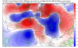
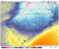
To show how much it changed, this is from just yesterday:

View attachment 179571
Well I guess today's 6-10 day outlook is cooler because December 27 is no longer included, and December 27 is going to be very warm.
 
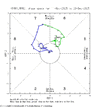
The MJO’s 3rd phase 8 period of the month ended on 12/20, when it went into phase 7.

So far this month there have been three phase 8 periods:

- Dec 3-7
- Dec 15
- Dec 17-19

Will there be more?
 

Attachments

  • IMG_6428.gif
    IMG_6428.gif
    14.3 KB · Views: 27
The MJO’s 3rd phase 8 period of the month ended on 12/20, when it went into phase 7.

So far this month there have been three phase 8 periods:

- Dec 3-7
- Dec 15
- Dec 17-19

Will there be more?
The fact that we’ve had this much phase 8 and no real reward in the upper south is criminal and I’ll never not be mad about it
 
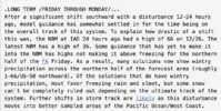
FRIDAY: The Wudge is real....Maryland style. To point out how much the models have shifted SOUTH (While here for XMAS) with the wedge. Northwest Baltimore by 1 hour) forecast has gone from upper 60's to ice storm potential. Crazy.
 

Attachments

  • Screenshot 2025-12-23 at 9.56.45 AM.png
    Screenshot 2025-12-23 at 9.56.45 AM.png
    162.2 KB · Views: 26
I mean... I drove 45 minutes to see a dusting 3 weeks ago

I can't really say anything
I took a page out of your book and went to the Breckenridge area a couple of weeks ago. Luckily, they got over a foot of snow the day before I arrived or otherwise, I would have seen nothing. The Rockies need more snow, badly in CO. Will be trekking to Jackson hole in late January. They have been doing okay in the higher elevations there.
 
I took a page out of your book and went to the Breckenridge area a couple of weeks ago. Luckily, they got over a foot of snow the day before I arrived or otherwise, I would have seen nothing. The Rockies need more snow, badly in CO. Will be trekking to Jackson hole in late January. They have been doing okay in the higher elevations there.

Yeah someone here went to Utah where he's apparently gone for 30 years and he was appalled at the lack of snow. Like he couldn't believe it.

I'm trying hard to not go anywhere else this winter lol
 
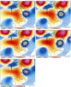
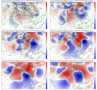
What a crazy trend the last few days. One wave starts digging for gold and then it quickly turns into a gold rush, with all of them digging for gold


View attachment 179657

Man what a trend with that PNA, big change there. If we can get that cutoff low off the CA coast to eject some energy into one of these cold shots…or some energy diving down on the front side of the ridge. A couple of ways to work something in if you ask me.


Sent from my iPhone using Tapatalk
 
Eric,
Are you having second thoughts about your recent pessimistic warmth for January? I’m sensing a tone change in your most recent posts.

I'd definitely say so, especially early on. Taking a gigantic L on the big warm-up late December, thanks to this huge -NAO trend in the medium range. Some of those takes I've had are aging as badly as the egg nog you accidentally left in the back of your fridge from last Christmas.

It'll take something pretty flukey to get a storm to pan out in early January, but I think it can work if we time things up correctly.
 
I'm old enough to remember a time when the models forecast a big cold shot beyond 5-days, you could count on it being overdone if it occurred at all. So far, this winter is turning that observation on its head with weeks-long heat waves turning into a few warm days while the next Arctic shot loads up.

The NW trend has become the SW trend. :D
 
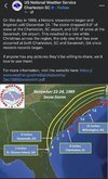
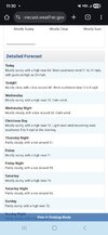
I hope this colder weather verifies next week but in the meantime this is likely the warmest Christmas week I have ever seen. I mean this would be warm for Halloween or St Patrick's day week.... but Christmas...
 

Attachments

  • Screenshot_20251223_113011_Chrome.jpg
    Screenshot_20251223_113011_Chrome.jpg
    436.1 KB · Views: 30
I hope this colder weather verifies next week but in the meantime this is likely the warmest Christmas week I have ever seen. I mean this would be warm for Halloween or St Patrick's day week.... but Christmas...
MBY got 76 in 2015 so I don’t think it’ll get there
 
My 50/60 degreee Christmas has fallen by the wayside! A lot of crushed hot weenie dreams around here! The local Mets were hyping record warm Christmas, for the last 2 weeks! Whooopss! IMG_4084.png
 
Back
Top